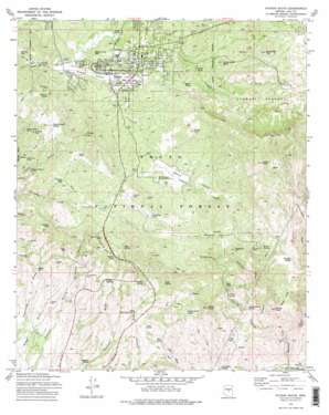
Payson South Topo Map Arizona
To zoom in, hover over the map of Payson South
USGS Topo Quad 34111b3 - 1:24,000 scale
| Topo Map Name: | Payson South |
| USGS Topo Quad ID: | 34111b3 |
| Print Size: | ca. 21 1/4" wide x 27" high |
| Southeast Coordinates: | 34.125° N latitude / 111.25° W longitude |
| Map Center Coordinates: | 34.1875° N latitude / 111.3125° W longitude |
| U.S. State: | AZ |
| Filename: | o34111b3.jpg |
| Download Map JPG Image: | Payson South topo map 1:24,000 scale |
| Map Type: | Topographic |
| Topo Series: | 7.5´ |
| Map Scale: | 1:24,000 |
| Source of Map Images: | United States Geological Survey (USGS) |
| Alternate Map Versions: |
Payson South AZ 1973, updated 1975 Download PDF Buy paper map Payson South AZ 1973, updated 1975 Download PDF Buy paper map Payson South AZ 2004, updated 2006 Download PDF Buy paper map Payson South AZ 2011 Download PDF Buy paper map Payson South AZ 2014 Download PDF Buy paper map |
| FStopo: | US Forest Service topo Payson South is available: Download FStopo PDF Download FStopo TIF |
1:24,000 Topo Quads surrounding Payson South
> Back to 34111a1 at 1:100,000 scale
> Back to 34110a1 at 1:250,000 scale
> Back to U.S. Topo Maps home
Payson South topo map: Gazetteer
Payson South: Airports
Lacy Airport elevation 1491m 4891′Payson South: Basins
Hole in the Ground elevation 1248m 4094′Stewart Pocket elevation 1448m 4750′
Payson South: Flats
Weymouth Flat elevation 1429m 4688′Payson South: Gaps
The Narrows elevation 904m 2965′Payson South: Mines
Delaware Mine elevation 1385m 4543′Golden Wonder Mine elevation 1494m 4901′
Harris Tank elevation 1189m 3900′
Midget Mine elevation 1311m 4301′
Neal Tank elevation 1135m 3723′
Oxbow Mine elevation 1374m 4507′
Pay Rock Mine elevation 1454m 4770′
Rocky Ford Mine elevation 1375m 4511′
Royal Flush Mine elevation 1368m 4488′
Silver King Mine elevation 1478m 4849′
Single Standard Mine elevation 1327m 4353′
Thompson Mine elevation 1231m 4038′
Payson South: Parks
Payson Rodeo Grounds elevation 1506m 4940′Rumsey Park elevation 1512m 4960′
Payson South: Populated Places
Fort McDonald elevation 1513m 4963′Oxbow Estates elevation 1412m 4632′
Payson elevation 1500m 4921′
Payson South: Post Offices
Payson Post Office elevation 1487m 4878′Payson South: Reservoirs
American Tank elevation 1519m 4983′Beeline Tank elevation 1402m 4599′
Big Tank elevation 1133m 3717′
Bishop Knoll Tank elevation 1256m 4120′
Cal Tank elevation 1350m 4429′
Elephant Head Tank elevation 1500m 4921′
Hill Cabin Tank elevation 1484m 4868′
Jackson Tank elevation 1475m 4839′
Joe Tank elevation 1440m 4724′
Lousy Tank elevation 1439m 4721′
Munro Reservoir elevation 1499m 4917′
North Tank elevation 1398m 4586′
Orchard Tank elevation 1451m 4760′
Oxbow Tank elevation 1426m 4678′
Peace Tank elevation 1182m 3877′
Saint Johns Tank elevation 1432m 4698′
Stewart Tank elevation 1529m 5016′
Trezise Tank elevation 1201m 3940′
Payson South: Springs
Blue Spring elevation 1435m 4708′Brushy Basin Spring elevation 1133m 3717′
Calvin Spring elevation 1447m 4747′
Gibson Spring elevation 1463m 4799′
Gilmore Spring elevation 1284m 4212′
Grape Spring elevation 1329m 4360′
Grapevine Spring elevation 1292m 4238′
Martin Spring elevation 1304m 4278′
Mud Spring elevation 1502m 4927′
Neal Spring elevation 1125m 3690′
Peach Orchard Spring elevation 1414m 4639′
Red Mountain Spring elevation 1308m 4291′
Sand Wash Spring elevation 989m 3244′
Sand Wash Spring Number Two elevation 1101m 3612′
Sycamore Spring elevation 1035m 3395′
Table Spring elevation 1341m 4399′
Turkey Spring elevation 1500m 4921′
Upper Hog Canyon Spring elevation 1195m 3920′
Willow Spring elevation 1255m 4117′
Payson South: Streams
Gibson Creek elevation 1050m 3444′Houston Creek elevation 899m 2949′
Payson South: Summits
Bishop Knoll elevation 1456m 4776′Bishop Nose elevation 1333m 4373′
Gibson Peak elevation 1782m 5846′
Monument Peak elevation 1535m 5036′
Oxbow Hill elevation 1487m 4878′
Red Hills elevation 1244m 4081′
Sorghum Hill elevation 1479m 4852′
Table Top elevation 1583m 5193′
Yerba Senta Butte elevation 1562m 5124′
Payson South: Valleys
Green Valley elevation 1459m 4786′Rattlesnake Canyon elevation 1133m 3717′
Round Valley elevation 1400m 4593′
Sorghum Canyon elevation 1141m 3743′
Willow Spring Canyon elevation 934m 3064′
Payson South: Wells
Harris Well elevation 1113m 3651′Hitching Rack Well elevation 1272m 4173′
Payson South digital topo map on disk
Buy this Payson South topo map showing relief, roads, GPS coordinates and other geographical features, as a high-resolution digital map file on DVD:


