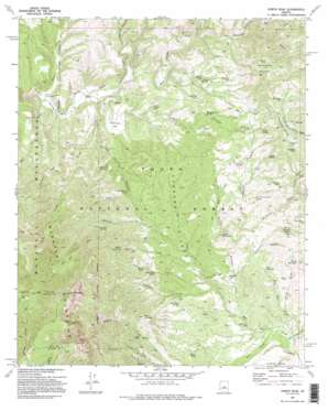
North Peak Topo Map Arizona
To zoom in, hover over the map of North Peak
USGS Topo Quad 34111b4 - 1:24,000 scale
| Topo Map Name: | North Peak |
| USGS Topo Quad ID: | 34111b4 |
| Print Size: | ca. 21 1/4" wide x 27" high |
| Southeast Coordinates: | 34.125° N latitude / 111.375° W longitude |
| Map Center Coordinates: | 34.1875° N latitude / 111.4375° W longitude |
| U.S. State: | AZ |
| Filename: | o34111b4.jpg |
| Download Map JPG Image: | North Peak topo map 1:24,000 scale |
| Map Type: | Topographic |
| Topo Series: | 7.5´ |
| Map Scale: | 1:24,000 |
| Source of Map Images: | United States Geological Survey (USGS) |
| Alternate Map Versions: |
North Peak AZ 1973, updated 1975 Download PDF Buy paper map North Peak AZ 1973, updated 1986 Download PDF Buy paper map North Peak AZ 1973, updated 1995 Download PDF Buy paper map North Peak AZ 2004, updated 2007 Download PDF Buy paper map North Peak AZ 2011 Download PDF Buy paper map North Peak AZ 2014 Download PDF Buy paper map |
| FStopo: | US Forest Service topo North Peak is available: Download FStopo PDF Download FStopo TIF |
1:24,000 Topo Quads surrounding North Peak
> Back to 34111a1 at 1:100,000 scale
> Back to 34110a1 at 1:250,000 scale
> Back to U.S. Topo Maps home
North Peak topo map: Gazetteer
North Peak: Flats
Simonton Flat elevation 1084m 3556′The Park elevation 1799m 5902′
North Peak: Mines
Callahan Mine elevation 1401m 4596′Collom Mine elevation 1248m 4094′
Excursion Mine elevation 1282m 4206′
Gold Hill Mine elevation 1147m 3763′
House Mine elevation 1231m 4038′
Little Green Mine elevation 1207m 3959′
Little Maud Mine elevation 1352m 4435′
Maggie Mine elevation 1402m 4599′
Waif Mine elevation 1335m 4379′
Zulu Mine elevation 1132m 3713′
North Peak: Reservoirs
Arrastre Tank elevation 1303m 4274′Browse Tank elevation 1145m 3756′
Callahan Tank elevation 1387m 4550′
Gold Hill Tank elevation 1104m 3622′
Goldfish Tank elevation 1283m 4209′
Hill Tank elevation 1417m 4648′
Pasture Tank elevation 1542m 5059′
Rye Creek Tank elevation 1042m 3418′
Saddle Tank elevation 1375m 4511′
Snowstorm Tank elevation 1439m 4721′
Zulu Tank elevation 1162m 3812′
Zulu Tank Number Two elevation 1110m 3641′
North Peak: Springs
Barnett Spring elevation 1181m 3874′Booth Spring elevation 1110m 3641′
Boyd Mountain Spring elevation 1149m 3769′
Collom Spring elevation 1241m 4071′
Dennis Spring elevation 1331m 4366′
Gould Springs elevation 1234m 4048′
Grapevine Spring elevation 1305m 4281′
Grimes Spring elevation 1343m 4406′
Hanging Rock Spring elevation 1207m 3959′
Hidden Spring elevation 1328m 4356′
House Place Spring elevation 1191m 3907′
Larsen Spring elevation 1208m 3963′
Mantkin Spring elevation 1256m 4120′
Mineral Spring elevation 1358m 4455′
Pig Spring elevation 1184m 3884′
Pole Hollow Spring elevation 1172m 3845′
Sedge Spring elevation 1037m 3402′
Surprise Spring elevation 1061m 3480′
North Peak: Streams
Callahan Creek elevation 1073m 3520′City Creek elevation 1037m 3402′
Delaware Wash elevation 1079m 3540′
Dennis Creek elevation 1097m 3599′
Hill Creek elevation 1170m 3838′
House Creek elevation 1082m 3549′
Mineral Creek elevation 1110m 3641′
Moore Wash elevation 1048m 3438′
Pine Creek elevation 1012m 3320′
Rock Creek elevation 1021m 3349′
Saint Johns Creek elevation 1036m 3398′
Zulu Wash elevation 1012m 3320′
North Peak: Summits
Boyd Mountain elevation 1434m 4704′Gold Hill elevation 1154m 3786′
Marysville Hill elevation 1488m 4881′
Moore Mountain elevation 1355m 4445′
North Peak elevation 2273m 7457′
Snowstorm Mountain elevation 1565m 5134′
Table Mountain elevation 1258m 4127′
North Peak: Trails
Mazatzal Divide Trail elevation 1603m 5259′North Peak Trail elevation 1760m 5774′
North Peak: Valleys
American Gulch elevation 1178m 3864′Arrastre Gulch elevation 1136m 3727′
Brushy Hollow elevation 1267m 4156′
Flume Hollow elevation 1047m 3435′
Hells Hole elevation 1407m 4616′
Limestone Canyon elevation 1112m 3648′
Lousy Gulch elevation 1258m 4127′
Pole Hollow Canyon elevation 1059m 3474′
Summit Canyon elevation 1226m 4022′
Table Mountain Canyon elevation 1121m 3677′
Thompson Draw elevation 1013m 3323′
Wonder Gulch elevation 1248m 4094′
North Peak: Wells
City Creek Well elevation 1037m 3402′Headquarters Well elevation 1047m 3435′
North Peak: Woods
Cypress Thicket elevation 1146m 3759′North Peak digital topo map on disk
Buy this North Peak topo map showing relief, roads, GPS coordinates and other geographical features, as a high-resolution digital map file on DVD:


