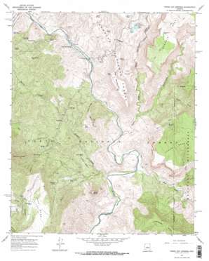
Verde Hot Springs Topo Map Arizona
To zoom in, hover over the map of Verde Hot Springs
USGS Topo Quad 34111c6 - 1:24,000 scale
| Topo Map Name: | Verde Hot Springs |
| USGS Topo Quad ID: | 34111c6 |
| Print Size: | ca. 21 1/4" wide x 27" high |
| Southeast Coordinates: | 34.25° N latitude / 111.625° W longitude |
| Map Center Coordinates: | 34.3125° N latitude / 111.6875° W longitude |
| U.S. State: | AZ |
| Filename: | o34111c6.jpg |
| Download Map JPG Image: | Verde Hot Springs topo map 1:24,000 scale |
| Map Type: | Topographic |
| Topo Series: | 7.5´ |
| Map Scale: | 1:24,000 |
| Source of Map Images: | United States Geological Survey (USGS) |
| Alternate Map Versions: |
Verde Hot Springs AZ 1967, updated 1968 Download PDF Buy paper map Verde Hot Springs AZ 1967, updated 1968 Download PDF Buy paper map Verde Hot Springs AZ 2004, updated 2006 Download PDF Buy paper map Verde Hot Springs AZ 2012 Download PDF Buy paper map Verde Hot Springs AZ 2014 Download PDF Buy paper map |
| FStopo: | US Forest Service topo Verde Hot Springs is available: Download FStopo PDF Download FStopo TIF |
1:24,000 Topo Quads surrounding Verde Hot Springs
> Back to 34111a1 at 1:100,000 scale
> Back to 34110a1 at 1:250,000 scale
> Back to U.S. Topo Maps home
Verde Hot Springs topo map: Gazetteer
Verde Hot Springs: Basins
Cedar Basin elevation 853m 2798′The Pocket elevation 1061m 3480′
Verde Hot Springs: Dams
Stehr Lake Dam elevation 1134m 3720′Verde Hot Springs: Gaps
Ike Saddle elevation 1219m 3999′Verde Hot Springs: Parks
Verde Wild River Area elevation 790m 2591′Verde Hot Springs: Populated Places
Lancaster elevation 890m 2919′Verde Hot Springs: Rapids
Baby Snaggletooth elevation 790m 2591′Childs Rapid elevation 795m 2608′
Red Wall Rapid elevation 735m 2411′
Verde Hot Springs: Reservoirs
Beck Tank elevation 1022m 3353′Bee Tree Tanks elevation 1191m 3907′
Cedar Basin Tank elevation 841m 2759′
Childs Powerplant Tank elevation 888m 2913′
Coldwater Tank Number One elevation 994m 3261′
Deadman Tank elevation 1364m 4475′
Deer Tank elevation 1267m 4156′
Headquarter Tank elevation 943m 3093′
Ikes Tank elevation 1230m 4035′
Long Mesa Tank elevation 1324m 4343′
Quail Tank elevation 1145m 3756′
Rock Spring Tank elevation 1061m 3480′
Sinkhole Tank elevation 1147m 3763′
Squaw Creek Tank elevation 973m 3192′
Stehr Lake elevation 1135m 3723′
Stehr Tank elevation 1262m 4140′
Tanko Caliente elevation 1268m 4160′
Verde Hot Springs: Ridges
Black Ridge elevation 1156m 3792′Ikes Backbone elevation 1275m 4183′
Verde Hot Springs: Springs
Mud Spring elevation 1083m 3553′Quail Spring elevation 1208m 3963′
Roadside Spring elevation 1119m 3671′
Rock Spring elevation 904m 2965′
Verde Hot Springs elevation 825m 2706′
Warm Spring elevation 743m 2437′
Verde Hot Springs: Streams
East Verde River elevation 753m 2470′Fossil Creek elevation 775m 2542′
Hardscrabble Creek elevation 826m 2709′
Houston Creek elevation 748m 2454′
Pigeon Creek elevation 826m 2709′
Squaw Creek elevation 769m 2522′
Verde Hot Springs: Summits
Long Mesa elevation 1346m 4416′Squaw Butte elevation 1315m 4314′
Verde Hot Springs: Trails
Mountain Ranch Trail Number Ten elevation 1153m 3782′Verde Hot Springs: Valleys
Hardscrabble Canyon elevation 810m 2657′Hells Hole elevation 865m 2837′
Horse Camp Canyon elevation 1172m 3845′
Verde Hot Springs digital topo map on disk
Buy this Verde Hot Springs topo map showing relief, roads, GPS coordinates and other geographical features, as a high-resolution digital map file on DVD:


