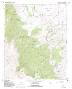
Horner Mountain Topo Map Arizona
To zoom in, hover over the map of Horner Mountain
USGS Topo Quad 34111d7 - 1:24,000 scale
| Topo Map Name: | Horner Mountain |
| USGS Topo Quad ID: | 34111d7 |
| Print Size: | ca. 21 1/4" wide x 27" high |
| Southeast Coordinates: | 34.375° N latitude / 111.75° W longitude |
| Map Center Coordinates: | 34.4375° N latitude / 111.8125° W longitude |
| U.S. State: | AZ |
| Filename: | o34111d7.jpg |
| Download Map JPG Image: | Horner Mountain topo map 1:24,000 scale |
| Map Type: | Topographic |
| Topo Series: | 7.5´ |
| Map Scale: | 1:24,000 |
| Source of Map Images: | United States Geological Survey (USGS) |
| Alternate Map Versions: |
Horner Mtn. AZ 1967, updated 1968 Download PDF Buy paper map Horner Mtn AZ 1967, updated 1992 Download PDF Buy paper map Horner Mountain AZ 2012 Download PDF Buy paper map Horner Mountain AZ 2014 Download PDF Buy paper map |
| FStopo: | US Forest Service topo Horner Mountain is available: Download FStopo PDF Download FStopo TIF |
1:24,000 Topo Quads surrounding Horner Mountain
> Back to 34111a1 at 1:100,000 scale
> Back to 34110a1 at 1:250,000 scale
> Back to U.S. Topo Maps home
Horner Mountain topo map: Gazetteer
Horner Mountain: Basins
Cottonwood Basin elevation 974m 3195′Horner Mountain: Benches
Cedar Bench elevation 1669m 5475′Horner Mountain: Falls
The Falls elevation 884m 2900′Horner Mountain: Flats
Beasley Flat elevation 907m 2975′Rodeo Flat elevation 1075m 3526′
Horner Mountain: Islands
Punk Rock elevation 860m 2821′Horner Mountain: Mines
Squaw Peak Mine elevation 1269m 4163′Horner Mountain: Rapids
Bull Run Rapid elevation 863m 2831′Bushman Rapid elevation 849m 2785′
Off-the-Wall Rapid elevation 899m 2949′
Pre-Falls Rapid elevation 891m 2923′
Turkey Gobbler Rapid elevation 860m 2821′
White Flash Rapid elevation 838m 2749′
Horner Mountain: Reservoirs
Bear Grass Tank elevation 1151m 3776′Bear Grass Tank Number Two elevation 1287m 4222′
Billy Tank elevation 1286m 4219′
Bootleg Tank elevation 1536m 5039′
Boulder Tank elevation 1037m 3402′
Cedar Bench Tank elevation 1673m 5488′
Chalk Tank elevation 1528m 5013′
Horner Mountain Tank elevation 1585m 5200′
Jims Tank elevation 1032m 3385′
Laddens Tank elevation 953m 3126′
Ladder Tank elevation 976m 3202′
Lower Cedar Bench Tank elevation 1341m 4399′
Mesa Tank elevation 987m 3238′
Monkey Tank elevation 1006m 3300′
Oxbow Tank elevation 1688m 5538′
Road Tank elevation 1067m 3500′
Rodeo Flat Tank elevation 1060m 3477′
South Pasture Tank elevation 1122m 3681′
Sycamore Tank elevation 964m 3162′
Table Mountain Tank elevation 1192m 3910′
Verde Tank elevation 957m 3139′
Horner Mountain: Springs
Amerone Spring Number One elevation 1133m 3717′Amerone Spring Number Two elevation 1142m 3746′
Bear Spring elevation 1078m 3536′
Brown Springs elevation 968m 3175′
Cedar Spring elevation 1789m 5869′
Cottonwood Spring elevation 952m 3123′
Dripping Spring elevation 939m 3080′
Esperanza Spring elevation 998m 3274′
Goat Camp Spring elevation 1414m 4639′
Government Spring elevation 1426m 4678′
Lithograph Spring elevation 1609m 5278′
Lower Mine Spring elevation 1046m 3431′
Mesquite Spring elevation 1034m 3392′
Mesquite Spring elevation 952m 3123′
Mine Spring elevation 1128m 3700′
Mud Spring elevation 1227m 4025′
North Mine Spring elevation 1128m 3700′
Red Basin Spring elevation 1418m 4652′
Red Blow Spring elevation 1474m 4835′
Red Bluff Spring elevation 1516m 4973′
Rodeo Flat Spring elevation 1035m 3395′
Table Mountain Spring elevation 1094m 3589′
Walnut Spring elevation 1541m 5055′
Horner Mountain: Streams
Bull Run Creek elevation 863m 2831′Chasm Creek elevation 878m 2880′
Cold Water Creek elevation 831m 2726′
Cottonwood Creek elevation 891m 2923′
Gap Creek elevation 854m 2801′
Towel Creek elevation 854m 2801′
Horner Mountain: Summits
Horner Mountain elevation 1793m 5882′Table Mountain elevation 1552m 5091′
Wingfield Mesa elevation 1024m 3359′
Horner Mountain: Trails
Cold Water Trail elevation 1360m 4461′Cold Water Trail Number Twenty Seven elevation 1342m 4402′
Ox Bow Trail Number One Hundred Sixty Three elevation 1569m 5147′
Horner Mountain: Valleys
Gospel Hollow elevation 840m 2755′Sycamore Canyon elevation 878m 2880′
Horner Mountain digital topo map on disk
Buy this Horner Mountain topo map showing relief, roads, GPS coordinates and other geographical features, as a high-resolution digital map file on DVD:


