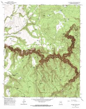
Calloway Butte Topo Map Arizona
To zoom in, hover over the map of Calloway Butte
USGS Topo Quad 34111e4 - 1:24,000 scale
| Topo Map Name: | Calloway Butte |
| USGS Topo Quad ID: | 34111e4 |
| Print Size: | ca. 21 1/4" wide x 27" high |
| Southeast Coordinates: | 34.5° N latitude / 111.375° W longitude |
| Map Center Coordinates: | 34.5625° N latitude / 111.4375° W longitude |
| U.S. State: | AZ |
| Filename: | o34111e4.jpg |
| Download Map JPG Image: | Calloway Butte topo map 1:24,000 scale |
| Map Type: | Topographic |
| Topo Series: | 7.5´ |
| Map Scale: | 1:24,000 |
| Source of Map Images: | United States Geological Survey (USGS) |
| Alternate Map Versions: |
Calloway Butte AZ 1965, updated 1967 Download PDF Buy paper map Calloway Butte AZ 1965, updated 1972 Download PDF Buy paper map Calloway Butte AZ 1965, updated 1972 Download PDF Buy paper map Calloway Butte AZ 2011 Download PDF Buy paper map Calloway Butte AZ 2014 Download PDF Buy paper map |
| FStopo: | US Forest Service topo Calloway Butte is available: Download FStopo PDF Download FStopo TIF |
1:24,000 Topo Quads surrounding Calloway Butte
> Back to 34111e1 at 1:100,000 scale
> Back to 34110a1 at 1:250,000 scale
> Back to U.S. Topo Maps home
Calloway Butte topo map: Gazetteer
Calloway Butte: Flats
Bow Ribbon Park elevation 2074m 6804′Harris Park elevation 2061m 6761′
Maxwell Park elevation 2066m 6778′
Calloway Butte: Lakes
Calloway Lake elevation 2048m 6719′Twentyseven Mile Lake elevation 2121m 6958′
Calloway Butte: Reservoirs
Back Tank elevation 2096m 6876′Bear Tank elevation 2129m 6984′
Between Tank elevation 2082m 6830′
Bow Ribbon Tanks elevation 2074m 6804′
Bueno Tank elevation 1940m 6364′
Calloway Tank elevation 2071m 6794′
Cave Draw Tank elevation 1794m 5885′
Cherry Tree Tank elevation 1856m 6089′
Corral Tank elevation 2025m 6643′
Coyote Tank elevation 2026m 6646′
Dead Horse Tank elevation 2022m 6633′
Dirty Name Tank elevation 1984m 6509′
Ditch Tank elevation 2078m 6817′
Dozer Tank elevation 2061m 6761′
Dukey Tank elevation 2032m 6666′
Flatrock Tank elevation 2065m 6774′
Good Enough Tank elevation 2043m 6702′
Harris Tank elevation 2064m 6771′
Horse Knoll Tank elevation 1897m 6223′
Horse Tank elevation 2078m 6817′
Idas Tank elevation 2084m 6837′
Island Tank elevation 1896m 6220′
Island Tank elevation 2067m 6781′
Jack Pine Tank elevation 1946m 6384′
Juniper Tank elevation 1996m 6548′
Link Dart Tank elevation 2076m 6811′
Maxwell Tank elevation 2057m 6748′
Meadow Tank elevation 2064m 6771′
Neilson Tank elevation 2003m 6571′
New Tank elevation 2027m 6650′
Oak Grove Tank elevation 1855m 6085′
Orchard Grass Tank elevation 2065m 6774′
Pecks Point Tank Number 3 elevation 2077m 6814′
Pecks Point Tank Number One elevation 2037m 6683′
Pecks Point Tank Number Three elevation 2076m 6811′
Point Tank elevation 2036m 6679′
Poor Tank elevation 2070m 6791′
Pothole Tank elevation 2067m 6781′
Pothole Tank elevation 2088m 6850′
Road Tank elevation 1905m 6250′
Rock Tank elevation 1835m 6020′
Sams Butte Tank elevation 2070m 6791′
Sandy Tank elevation 2062m 6765′
Scotts Tank elevation 2061m 6761′
Snake Ridge Tank elevation 1893m 6210′
Snake Tank elevation 1956m 6417′
Soldier Mesa Tank elevation 2055m 6742′
Toilet Paper Tank elevation 1998m 6555′
Toms Tank elevation 2074m 6804′
Tramway Tank elevation 2055m 6742′
Tule Tank elevation 1905m 6250′
Turkey Draw Tank elevation 2096m 6876′
Upper Tank elevation 1919m 6295′
Walker Tank elevation 2049m 6722′
West Tank elevation 2066m 6778′
Wilbur Tank Number One elevation 2041m 6696′
Wilbur Tank Number Two elevation 2041m 6696′
Calloway Butte: Ridges
Good Enough Ridge elevation 2038m 6686′Snake Ridge elevation 2007m 6584′
Calloway Butte: Streams
Clover Creek elevation 1843m 6046′Toms Creek elevation 1916m 6286′
Calloway Butte: Summits
Calloway Butte elevation 2088m 6850′Sams Butte elevation 2155m 7070′
Soldier Mesa elevation 2061m 6761′
Calloway Butte: Valleys
Bear Canyon elevation 1799m 5902′Clover Canyon elevation 1843m 6046′
Hicks and Duncan Canyon elevation 2029m 6656′
Pivot Rock Canyon elevation 2050m 6725′
Turkey Draw elevation 1859m 6099′
Wilbur Canyon elevation 1775m 5823′
Willow Valley elevation 1839m 6033′
Calloway Butte digital topo map on disk
Buy this Calloway Butte topo map showing relief, roads, GPS coordinates and other geographical features, as a high-resolution digital map file on DVD:


