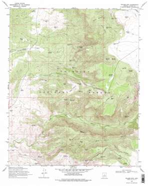
Walker Mountain Topo Map Arizona
To zoom in, hover over the map of Walker Mountain
USGS Topo Quad 34111e6 - 1:24,000 scale
| Topo Map Name: | Walker Mountain |
| USGS Topo Quad ID: | 34111e6 |
| Print Size: | ca. 21 1/4" wide x 27" high |
| Southeast Coordinates: | 34.5° N latitude / 111.625° W longitude |
| Map Center Coordinates: | 34.5625° N latitude / 111.6875° W longitude |
| U.S. State: | AZ |
| Filename: | o34111e6.jpg |
| Download Map JPG Image: | Walker Mountain topo map 1:24,000 scale |
| Map Type: | Topographic |
| Topo Series: | 7.5´ |
| Map Scale: | 1:24,000 |
| Source of Map Images: | United States Geological Survey (USGS) |
| Alternate Map Versions: |
Walker Mtn. AZ 1969, updated 1971 Download PDF Buy paper map Walker Mtn. AZ 1969, updated 1978 Download PDF Buy paper map Walker Mtn. AZ 1969, updated 1978 Download PDF Buy paper map Walker Mtn. AZ 1969, updated 1978 Download PDF Buy paper map Walker Mountain AZ 2011 Download PDF Buy paper map Walker Mountain AZ 2014 Download PDF Buy paper map |
| FStopo: | US Forest Service topo Walker Mountain is available: Download FStopo PDF Download FStopo TIF |
1:24,000 Topo Quads surrounding Walker Mountain
> Back to 34111e1 at 1:100,000 scale
> Back to 34110a1 at 1:250,000 scale
> Back to U.S. Topo Maps home
Walker Mountain topo map: Gazetteer
Walker Mountain: Basins
Blodgett Basin elevation 1606m 5269′Walker Basin elevation 1632m 5354′
Walker Mountain: Benches
Cedar Bench elevation 1532m 5026′Walker Mountain: Reservoirs
Bald Hill Tank Number Five elevation 1599m 5246′Bald Hill Tank Number Four elevation 1681m 5515′
Bald Hill Tank Number Three elevation 1745m 5725′
Bald Hill Tank Number Two elevation 1755m 5757′
Black Mountain Tank elevation 1508m 4947′
Blodgett Basin Tank elevation 1586m 5203′
Blodgett Tank elevation 1611m 5285′
Boulder Tank elevation 1733m 5685′
Brockett Tank elevation 1741m 5711′
Bull Tank elevation 1190m 3904′
Cedar Bench Tank Number One elevation 1388m 4553′
Cedar Bench Tank Number Two elevation 1423m 4668′
Cedar Mountain Tank elevation 1471m 4826′
Devils Jawbone Tank elevation 1338m 4389′
Diamond M Tank elevation 1245m 4084′
Elmore Tank Number Two elevation 1176m 3858′
F S Tank elevation 1346m 4416′
Goswick Lake Tank elevation 1333m 4373′
Hance Tank elevation 1411m 4629′
Hilltop Tank elevation 1204m 3950′
Hollingshead Point Tank elevation 1599m 5246′
Hollingshead Tank elevation 1293m 4242′
Hunting Tank elevation 1683m 5521′
Last Tank elevation 1303m 4274′
Mulcarie Tank elevation 1330m 4363′
Ninemile Tank elevation 1171m 3841′
Parsons Tank elevation 1431m 4694′
Pesthouse Tank elevation 1270m 4166′
Petes Tank elevation 1612m 5288′
Quail Trick Tank elevation 1105m 3625′
Red Tank elevation 1464m 4803′
Runner Tank elevation 1365m 4478′
Sawlog Tank Number One elevation 1772m 5813′
Sawlog Tank Number Two elevation 1744m 5721′
Section Corner Tank elevation 1272m 4173′
Strip Tank elevation 1177m 3861′
Thirteenmile Tank elevation 1544m 5065′
Tommies Tank elevation 1556m 5104′
Trail Tank elevation 1257m 4124′
Vernon Tank elevation 1297m 4255′
Walker Basin Tank elevation 1615m 5298′
Walker Creek Tank elevation 1562m 5124′
Walker Rim Tank elevation 1780m 5839′
Wickiup Tank Number One elevation 1249m 4097′
Wickiup Tank Number Two elevation 1208m 3963′
Walker Mountain: Springs
Chalk Point Spring elevation 1431m 4694′Clear Creek Number One Spring elevation 1198m 3930′
Clear Creek Number Two Spring elevation 1202m 3943′
Hance Spring elevation 1122m 3681′
Thirteen Mile Spring elevation 1532m 5026′
Walker Mountain: Summits
Bald Hill elevation 1877m 6158′Black Mountain elevation 1640m 5380′
Cactus Mountain elevation 1297m 4255′
Cedar Mountain elevation 1653m 5423′
Hollingshead Point elevation 1612m 5288′
Thirteenmile Rock Butte elevation 1672m 5485′
Walker Mountain elevation 1807m 5928′
Walker Mountain: Trails
Buckhorn Trail elevation 1598m 5242′Walker Basin Trail elevation 1735m 5692′
Walker Mountain: Valleys
Black Mountain Canyon elevation 1037m 3402′Devils Windpipe elevation 1470m 4822′
Walker Mountain digital topo map on disk
Buy this Walker Mountain topo map showing relief, roads, GPS coordinates and other geographical features, as a high-resolution digital map file on DVD:


