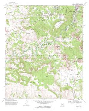
Sedona Topo Map Arizona
To zoom in, hover over the map of Sedona
USGS Topo Quad 34111g7 - 1:24,000 scale
| Topo Map Name: | Sedona |
| USGS Topo Quad ID: | 34111g7 |
| Print Size: | ca. 21 1/4" wide x 27" high |
| Southeast Coordinates: | 34.75° N latitude / 111.75° W longitude |
| Map Center Coordinates: | 34.8125° N latitude / 111.8125° W longitude |
| U.S. State: | AZ |
| Filename: | o34111g7.jpg |
| Download Map JPG Image: | Sedona topo map 1:24,000 scale |
| Map Type: | Topographic |
| Topo Series: | 7.5´ |
| Map Scale: | 1:24,000 |
| Source of Map Images: | United States Geological Survey (USGS) |
| Alternate Map Versions: |
Sedona AZ 1969, updated 1971 Download PDF Buy paper map Sedona AZ 1969, updated 1972 Download PDF Buy paper map Sedona AZ 2011 Download PDF Buy paper map Sedona AZ 2014 Download PDF Buy paper map |
| FStopo: | US Forest Service topo Sedona is available: Download FStopo PDF Download FStopo TIF |
1:24,000 Topo Quads surrounding Sedona
> Back to 34111e1 at 1:100,000 scale
> Back to 34110a1 at 1:250,000 scale
> Back to U.S. Topo Maps home
Sedona topo map: Gazetteer
Sedona: Airports
Sedona Airport elevation 1468m 4816′Sedona: Areas
Devils Dining Room elevation 1341m 4399′Sedona: Arroyos
Mortgage Draw elevation 1260m 4133′Sedona: Flats
Big Park elevation 1251m 4104′Grasshopper Flat elevation 1342m 4402′
Little Horse Park elevation 1319m 4327′
Little Park elevation 1239m 4064′
Sedona: Forests
Sedona Ranger District elevation 1245m 4084′Sedona: Populated Places
Baldwins Crossing elevation 1216m 3989′Big Park elevation 1242m 4074′
Oak Creek elevation 1238m 4061′
Red Rock elevation 1212m 3976′
Sedona elevation 1326m 4350′
West Sedona elevation 1354m 4442′
Sedona: Reservoirs
Bell Canyon Tank elevation 1268m 4160′Bug Tank elevation 1304m 4278′
Bums Tank elevation 1489m 4885′
Corner Tank elevation 1421m 4662′
Corral Tank elevation 1378m 4520′
Corral Tank elevation 1241m 4071′
D A Tank Number One elevation 1319m 4327′
Division Tank elevation 1377m 4517′
Dumas Tank elevation 1232m 4041′
Ed Loy Tank elevation 1408m 4619′
Ed Loy Tank elevation 1341m 4399′
Fuller Tank elevation 1213m 3979′
Girdner Tank elevation 1355m 4445′
Grasshopper Flat Tank elevation 1352m 4435′
Greasy Spoon Tank elevation 1329m 4360′
Hidden Tank elevation 1332m 4370′
Horse Mountain Trick Tank elevation 1328m 4356′
House Mountain Tank elevation 1449m 4753′
Indian Tank elevation 1412m 4632′
John Lee Tank elevation 1483m 4865′
John Lee Tank elevation 1490m 4888′
Old Seventynine Tank elevation 1233m 4045′
Petes Water Haul elevation 1307m 4288′
Plub Tank elevation 1315m 4314′
Ring Tank elevation 1305m 4281′
Turkey Creek Tank elevation 1220m 4002′
Wildhorse Tank elevation 1291m 4235′
Sedona: Springs
Bell Rock Spring elevation 1305m 4281′Sedona: Streams
Soldier Wash elevation 1281m 4202′Turkey Creek elevation 1156m 3792′
Sedona: Summits
Bell Rock elevation 1468m 4816′Cathedral Rock elevation 1500m 4921′
Courthouse Butte elevation 1658m 5439′
House Mountain elevation 1562m 5124′
Scheurman Mountain elevation 1491m 4891′
Scheurman Mountain Tank elevation 1409m 4622′
Table Top Mountain elevation 1471m 4826′
Sedona: Valleys
Bear Wallow Canyon elevation 1292m 4238′Bell Canyon elevation 1234m 4048′
Carroll Canyon elevation 1207m 3959′
Margs Draw elevation 1281m 4202′
Mormon Canyon elevation 1308m 4291′
Sedona digital topo map on disk
Buy this Sedona topo map showing relief, roads, GPS coordinates and other geographical features, as a high-resolution digital map file on DVD:


