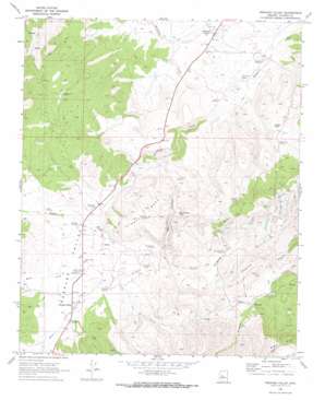
Peeples Valley Topo Map Arizona
To zoom in, hover over the map of Peeples Valley
USGS Topo Quad 34112c6 - 1:24,000 scale
| Topo Map Name: | Peeples Valley |
| USGS Topo Quad ID: | 34112c6 |
| Print Size: | ca. 21 1/4" wide x 27" high |
| Southeast Coordinates: | 34.25° N latitude / 112.625° W longitude |
| Map Center Coordinates: | 34.3125° N latitude / 112.6875° W longitude |
| U.S. State: | AZ |
| Filename: | o34112c6.jpg |
| Download Map JPG Image: | Peeples Valley topo map 1:24,000 scale |
| Map Type: | Topographic |
| Topo Series: | 7.5´ |
| Map Scale: | 1:24,000 |
| Source of Map Images: | United States Geological Survey (USGS) |
| Alternate Map Versions: |
Peeples Valley AZ 1969, updated 1972 Download PDF Buy paper map Peeples Valley AZ 2011 Download PDF Buy paper map Peeples Valley AZ 2014 Download PDF Buy paper map |
| FStopo: | US Forest Service topo Peeples Valley is available: Download FStopo PDF Download FStopo TIF |
1:24,000 Topo Quads surrounding Peeples Valley
> Back to 34112a1 at 1:100,000 scale
> Back to 34112a1 at 1:250,000 scale
> Back to U.S. Topo Maps home
Peeples Valley topo map: Gazetteer
Peeples Valley: Flats
Sourgrass Flat elevation 1452m 4763′Peeples Valley: Mines
Zonia Mine elevation 1414m 4639′Peeples Valley: Populated Places
Ferguson Place Windmill elevation 1361m 4465′Kirkland Junction elevation 1251m 4104′
Peeples Valley elevation 1367m 4484′
Peeples Valley: Reservoirs
Box Canyon Tank elevation 1313m 4307′Condon Tank elevation 1348m 4422′
Tin Can Tank elevation 1258m 4127′
Peeples Valley: Springs
Genung Spring elevation 1346m 4416′Peeples Valley: Streams
Miller Creek elevation 1342m 4402′Model Creek elevation 1342m 4402′
Poplar Wash elevation 1325m 4347′
Sheppard Wash elevation 1244m 4081′
Peeples Valley: Summits
Parker Mesa elevation 1479m 4852′Peeples Valley: Valleys
Box Canyon elevation 1305m 4281′Peeples Valley elevation 1340m 4396′
Peeples Valley digital topo map on disk
Buy this Peeples Valley topo map showing relief, roads, GPS coordinates and other geographical features, as a high-resolution digital map file on DVD:


