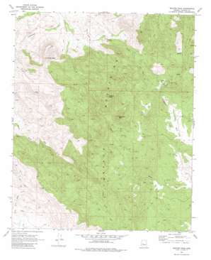
Weaver Peak Topo Map Arizona
To zoom in, hover over the map of Weaver Peak
USGS Topo Quad 34112c7 - 1:24,000 scale
| Topo Map Name: | Weaver Peak |
| USGS Topo Quad ID: | 34112c7 |
| Print Size: | ca. 21 1/4" wide x 27" high |
| Southeast Coordinates: | 34.25° N latitude / 112.75° W longitude |
| Map Center Coordinates: | 34.3125° N latitude / 112.8125° W longitude |
| U.S. State: | AZ |
| Filename: | o34112c7.jpg |
| Download Map JPG Image: | Weaver Peak topo map 1:24,000 scale |
| Map Type: | Topographic |
| Topo Series: | 7.5´ |
| Map Scale: | 1:24,000 |
| Source of Map Images: | United States Geological Survey (USGS) |
| Alternate Map Versions: |
Weaver Peak AZ 1969, updated 1972 Download PDF Buy paper map Weaver Peak AZ 1969, updated 1980 Download PDF Buy paper map Weaver Peak AZ 2011 Download PDF Buy paper map Weaver Peak AZ 2014 Download PDF Buy paper map |
1:24,000 Topo Quads surrounding Weaver Peak
> Back to 34112a1 at 1:100,000 scale
> Back to 34112a1 at 1:250,000 scale
> Back to U.S. Topo Maps home
Weaver Peak topo map: Gazetteer
Weaver Peak: Mines
Buckhorn Mine elevation 1558m 5111′Cuba Mine elevation 1549m 5082′
Monte Cristo Mine elevation 1540m 5052′
Weaver Peak: Parks
Lounce Lookout elevation 1716m 5629′Weaver Peak: Summits
Ritter Peak elevation 1716m 5629′Rocky Boy Peak elevation 1879m 6164′
Weaver Peak elevation 1977m 6486′
Weaver Peak: Wells
Childers Well elevation 1070m 3510′Weaver Peak digital topo map on disk
Buy this Weaver Peak topo map showing relief, roads, GPS coordinates and other geographical features, as a high-resolution digital map file on DVD:


