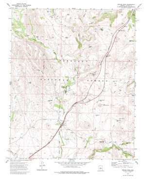
Estler Peak Topo Map Arizona
To zoom in, hover over the map of Estler Peak
USGS Topo Quad 34112d1 - 1:24,000 scale
| Topo Map Name: | Estler Peak |
| USGS Topo Quad ID: | 34112d1 |
| Print Size: | ca. 21 1/4" wide x 27" high |
| Southeast Coordinates: | 34.375° N latitude / 112° W longitude |
| Map Center Coordinates: | 34.4375° N latitude / 112.0625° W longitude |
| U.S. State: | AZ |
| Filename: | o34112d1.jpg |
| Download Map JPG Image: | Estler Peak topo map 1:24,000 scale |
| Map Type: | Topographic |
| Topo Series: | 7.5´ |
| Map Scale: | 1:24,000 |
| Source of Map Images: | United States Geological Survey (USGS) |
| Alternate Map Versions: |
Estler Peak AZ 1974, updated 1977 Download PDF Buy paper map Estler Peak AZ 1974, updated 1987 Download PDF Buy paper map Estler Peak AZ 2012 Download PDF Buy paper map Estler Peak AZ 2014 Download PDF Buy paper map |
| FStopo: | US Forest Service topo Estler Peak is available: Download FStopo PDF Download FStopo TIF |
1:24,000 Topo Quads surrounding Estler Peak
> Back to 34112a1 at 1:100,000 scale
> Back to 34112a1 at 1:250,000 scale
> Back to U.S. Topo Maps home
Estler Peak topo map: Gazetteer
Estler Peak: Airports
Orme School Airport elevation 1192m 3910′Estler Peak: Crossings
Dugas Interchange elevation 1153m 3782′Estler Peak: Reservoirs
Antelope Tank elevation 1249m 4097′Black Butte Tank elevation 1254m 4114′
Burro Tank elevation 1317m 4320′
Cedar Tank elevation 1284m 4212′
Cienega Tank elevation 1250m 4101′
Cienega Tank elevation 1256m 4120′
East Pasture Tank elevation 1226m 4022′
Fence Tank elevation 1265m 4150′
Hance Mesa Tank elevation 1360m 4461′
Hooker Tank elevation 1288m 4225′
Long Ridge Tank elevation 1201m 3940′
Metate Tank elevation 1259m 4130′
Old East Side Tank elevation 1228m 4028′
Severty Nine Tank elevation 1194m 3917′
Sterling Tank elevation 1268m 4160′
Upper Government Tank elevation 1340m 4396′
V Bar Tank elevation 1258m 4127′
Wingfield Tank elevation 1381m 4530′
Estler Peak: Springs
Brown Spring elevation 1200m 3937′Cedar Spring elevation 1358m 4455′
Government Spring elevation 1297m 4255′
Osborne Spring elevation 1287m 4222′
Sheep Spring elevation 1312m 4304′
Estler Peak: Streams
Cienega Creek elevation 1228m 4028′Hackberry Wash elevation 1281m 4202′
Johnson Wash elevation 1285m 4215′
Osborne Spring Wash elevation 1177m 3861′
Racetrack Wash elevation 1255m 4117′
Yellow Jacket Creek elevation 1185m 3887′
Estler Peak: Summits
Estler Peak elevation 1296m 4251′Estler Peak: Valleys
Government Spring Gulch elevation 1184m 3884′Horner Gulch elevation 1189m 3900′
Long Draw elevation 1164m 3818′
Yellow Jacket Gulch elevation 1191m 3907′
Estler Peak: Wells
Ash Creek Well elevation 1268m 4160′Black Canyon Well elevation 1261m 4137′
Cattleguard Well elevation 1206m 3956′
Heifer Pasture Well elevation 1261m 4137′
Long Draw Well elevation 1245m 4084′
Osborne Well elevation 1281m 4202′
Osborne Well Number Two elevation 1234m 4048′
Estler Peak digital topo map on disk
Buy this Estler Peak topo map showing relief, roads, GPS coordinates and other geographical features, as a high-resolution digital map file on DVD:


