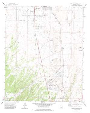
Chino Valley South Topo Map Arizona
To zoom in, hover over the map of Chino Valley South
USGS Topo Quad 34112f4 - 1:24,000 scale
| Topo Map Name: | Chino Valley South |
| USGS Topo Quad ID: | 34112f4 |
| Print Size: | ca. 21 1/4" wide x 27" high |
| Southeast Coordinates: | 34.625° N latitude / 112.375° W longitude |
| Map Center Coordinates: | 34.6875° N latitude / 112.4375° W longitude |
| U.S. State: | AZ |
| Filename: | o34112f4.jpg |
| Download Map JPG Image: | Chino Valley South topo map 1:24,000 scale |
| Map Type: | Topographic |
| Topo Series: | 7.5´ |
| Map Scale: | 1:24,000 |
| Source of Map Images: | United States Geological Survey (USGS) |
| Alternate Map Versions: |
Chino Valley South AZ 1973, updated 1977 Download PDF Buy paper map Chino Valley South AZ 1973, updated 1984 Download PDF Buy paper map Chino Valley South AZ 2011 Download PDF Buy paper map Chino Valley South AZ 2014 Download PDF Buy paper map |
| FStopo: | US Forest Service topo Chino Valley South is available: Download FStopo PDF Download FStopo TIF |
1:24,000 Topo Quads surrounding Chino Valley South
> Back to 34112e1 at 1:100,000 scale
> Back to 34112a1 at 1:250,000 scale
> Back to U.S. Topo Maps home
Chino Valley South topo map: Gazetteer
Chino Valley South: Airports
Cooper Farm Landing Strip elevation 1454m 4770′Ernest A Love Field elevation 1524m 5000′
Robin Stolport elevation 1438m 4717′
Chino Valley South: Canals
Chino Valley Irrigation Ditch elevation 1500m 4921′Chino Valley South: Dams
Bottleneck Wash Dam elevation 1507m 4944′Chino Valley South: Populated Places
Granite Siding elevation 1493m 4898′Tutt elevation 1511m 4957′
Chino Valley South: Reservoirs
Little Black Hill Tank elevation 1501m 4924′Chino Valley South: Streams
Bottleneck Wash elevation 1508m 4947′Chino Valley South: Summits
Black Hill elevation 1532m 5026′Chino Valley South digital topo map on disk
Buy this Chino Valley South topo map showing relief, roads, GPS coordinates and other geographical features, as a high-resolution digital map file on DVD:


