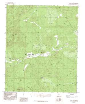
Indian Peak Topo Map Arizona
To zoom in, hover over the map of Indian Peak
USGS Topo Quad 34112h7 - 1:24,000 scale
| Topo Map Name: | Indian Peak |
| USGS Topo Quad ID: | 34112h7 |
| Print Size: | ca. 21 1/4" wide x 27" high |
| Southeast Coordinates: | 34.875° N latitude / 112.75° W longitude |
| Map Center Coordinates: | 34.9375° N latitude / 112.8125° W longitude |
| U.S. State: | AZ |
| Filename: | o34112h7.jpg |
| Download Map JPG Image: | Indian Peak topo map 1:24,000 scale |
| Map Type: | Topographic |
| Topo Series: | 7.5´ |
| Map Scale: | 1:24,000 |
| Source of Map Images: | United States Geological Survey (USGS) |
| Alternate Map Versions: |
Indian Peak AZ 1986, updated 1986 Download PDF Buy paper map Indian Peak AZ 2012 Download PDF Buy paper map Indian Peak AZ 2014 Download PDF Buy paper map |
| FStopo: | US Forest Service topo Indian Peak is available: Download FStopo PDF Download FStopo TIF |
1:24,000 Topo Quads surrounding Indian Peak
> Back to 34112e1 at 1:100,000 scale
> Back to 34112a1 at 1:250,000 scale
> Back to U.S. Topo Maps home
Indian Peak topo map: Gazetteer
Indian Peak: Forests
Chino Valley Ranger District elevation 1652m 5419′Indian Peak: Reservoirs
Brush Tank elevation 1629m 5344′Cement Tank elevation 1602m 5255′
Chucks Tank elevation 1523m 4996′
Flood Dam Tank elevation 1634m 5360′
Fritche Tank elevation 1576m 5170′
Hunt Tank elevation 1620m 5314′
Section Twentyfive Tank elevation 1722m 5649′
South Tank elevation 1621m 5318′
Spur Tank elevation 1646m 5400′
Triangle U Tank elevation 1643m 5390′
Trick Tank elevation 1523m 4996′
Windshield Tank elevation 1593m 5226′
Indian Peak: Springs
Ash Spring elevation 1711m 5613′Bald Mountain Spring elevation 1659m 5442′
Indian Spring Number Three elevation 1560m 5118′
Indian Springs elevation 1545m 5068′
Juniper Spring elevation 1868m 6128′
Indian Peak: Streams
Apache Creek elevation 1580m 5183′Graver Wash elevation 1563m 5127′
Indian Peak: Summits
Bald Mountain elevation 1796m 5892′Indian Hill elevation 1762m 5780′
Indian Peak elevation 1668m 5472′
Indian Peak digital topo map on disk
Buy this Indian Peak topo map showing relief, roads, GPS coordinates and other geographical features, as a high-resolution digital map file on DVD:


