Reid Valley Topo Map Arizona
To zoom in, hover over the map of Reid Valley
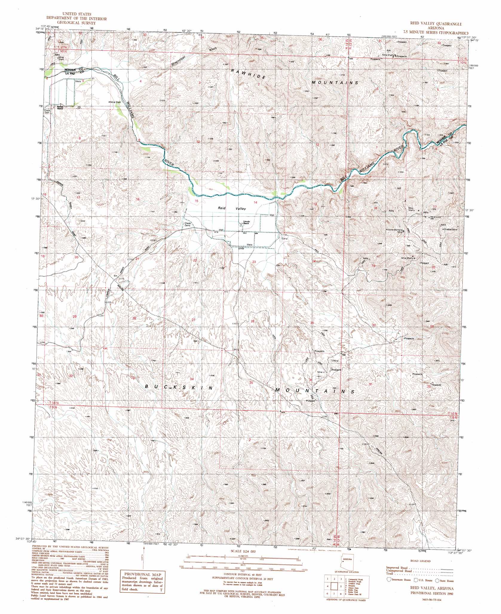
USGS Topo Quad 34113b6 - 1:24,000 scale
| Topo Map Name: | Reid Valley |
| USGS Topo Quad ID: | 34113b6 |
| Print Size: | ca. 21 1/4" wide x 27" high |
| Southeast Coordinates: | 34.125° N latitude / 113.625° W longitude |
| Map Center Coordinates: | 34.1875° N latitude / 113.6875° W longitude |
| U.S. State: | AZ |
| Filename: | o34113b6.jpg |
| Download Map JPG Image: | Reid Valley topo map 1:24,000 scale |
| Map Type: | Topographic |
| Topo Series: | 7.5´ |
| Map Scale: | 1:24,000 |
| Source of Map Images: | United States Geological Survey (USGS) |
| Alternate Map Versions: |
Reid Valley AZ 1990, updated 1990 Download PDF Buy paper map Reid Valley AZ 2011 Download PDF Buy paper map Reid Valley AZ 2014 Download PDF Buy paper map |
1:24,000 Topo Quads surrounding Reid Valley
Castaneda Hills |
Mccracken Peak |
Signal |
Signal Mountain |
Arrastra Mountain |
Castaneda Hills Sw |
Centennial Wash |
Rawhide Wash |
Artillery Peak |
Palmerita Ranch |
Planet |
Swansea |
Reid Valley |
Alamo Dam |
Smith Peak Nw |
Powerline Well |
Butler Pass |
Butler Well |
Alamo Dam Se |
E C P Peak |
Bouse Hills West |
Bouse Hills East |
Harcuvar Peak |
Cunningham Pass |
Webber Canyon |
> Back to 34113a1 at 1:100,000 scale
> Back to 34112a1 at 1:250,000 scale
> Back to U.S. Topo Maps home
Reid Valley topo map: Gazetteer
Reid Valley: Mines
Arizona Montana Mine elevation 559m 1833′Bernarde Mine elevation 502m 1646′
Bluebell Mine elevation 553m 1814′
Santa Maria Mine elevation 539m 1768′
Reid Valley: Streams
Mississippi Wash elevation 250m 820′Reid Valley: Valleys
Reid Valley elevation 269m 882′Reid Valley digital topo map on disk
Buy this Reid Valley topo map showing relief, roads, GPS coordinates and other geographical features, as a high-resolution digital map file on DVD: