Planet Topo Map Arizona
To zoom in, hover over the map of Planet
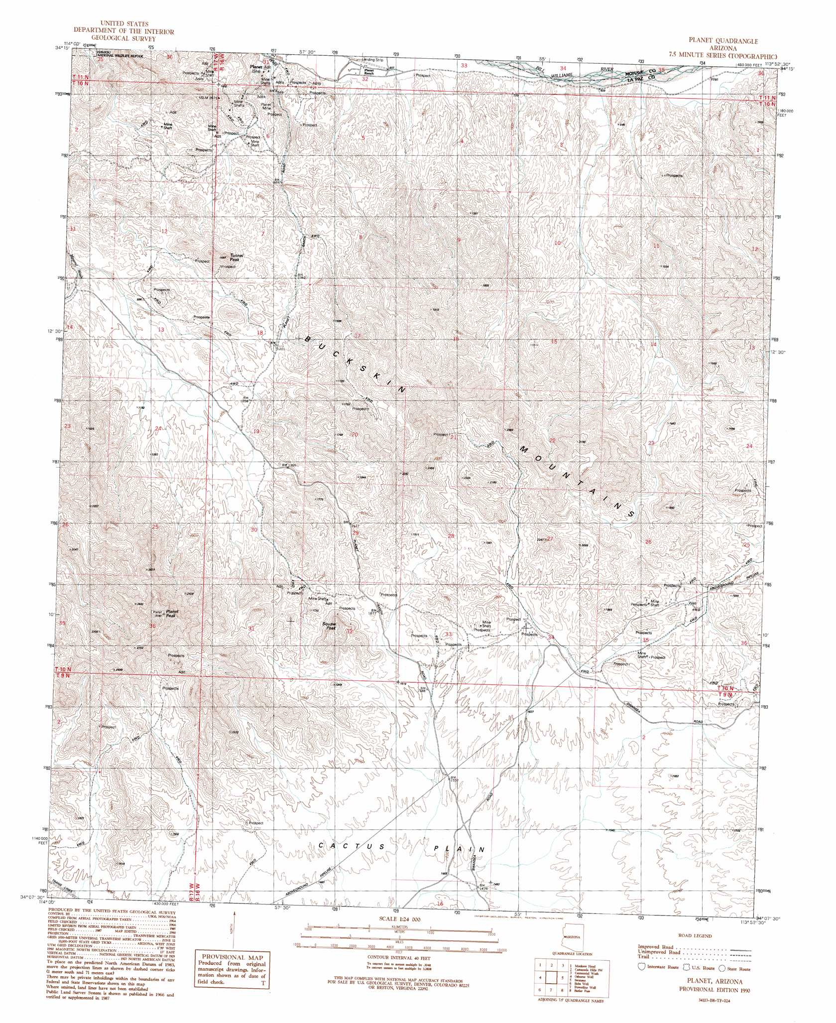
USGS Topo Quad 34113b8 - 1:24,000 scale
| Topo Map Name: | Planet |
| USGS Topo Quad ID: | 34113b8 |
| Print Size: | ca. 21 1/4" wide x 27" high |
| Southeast Coordinates: | 34.125° N latitude / 113.875° W longitude |
| Map Center Coordinates: | 34.1875° N latitude / 113.9375° W longitude |
| U.S. State: | AZ |
| Filename: | o34113b8.jpg |
| Download Map JPG Image: | Planet topo map 1:24,000 scale |
| Map Type: | Topographic |
| Topo Series: | 7.5´ |
| Map Scale: | 1:24,000 |
| Source of Map Images: | United States Geological Survey (USGS) |
| Alternate Map Versions: |
Planet AZ 1990, updated 1990 Download PDF Buy paper map Planet AZ 2011 Download PDF Buy paper map Planet AZ 2014 Download PDF Buy paper map |
1:24,000 Topo Quads surrounding Planet
Standard Wash |
Mohave Springs |
Castaneda Hills |
Mccracken Peak |
Signal |
Gene Wash |
Monkeys Head |
Castaneda Hills Sw |
Centennial Wash |
Rawhide Wash |
Cross Roads |
Osborne Well |
Planet |
Swansea |
Reid Valley |
Black Peak |
Bobs Well |
Powerline Well |
Butler Pass |
Butler Well |
Bouse Nw |
Bouse |
Bouse Hills West |
Bouse Hills East |
Harcuvar Peak |
> Back to 34113a1 at 1:100,000 scale
> Back to 34112a1 at 1:250,000 scale
> Back to U.S. Topo Maps home
Planet topo map: Gazetteer
Planet: Basins
Retort Oven elevation 602m 1975′Planet: Mines
Planet Mine elevation 250m 820′Planet: Populated Places
Planet elevation 191m 626′Planet: Summits
Planet Peak elevation 951m 3120′Squaw Peak elevation 686m 2250′
Tunnel Peak elevation 490m 1607′
Planet digital topo map on disk
Buy this Planet topo map showing relief, roads, GPS coordinates and other geographical features, as a high-resolution digital map file on DVD: