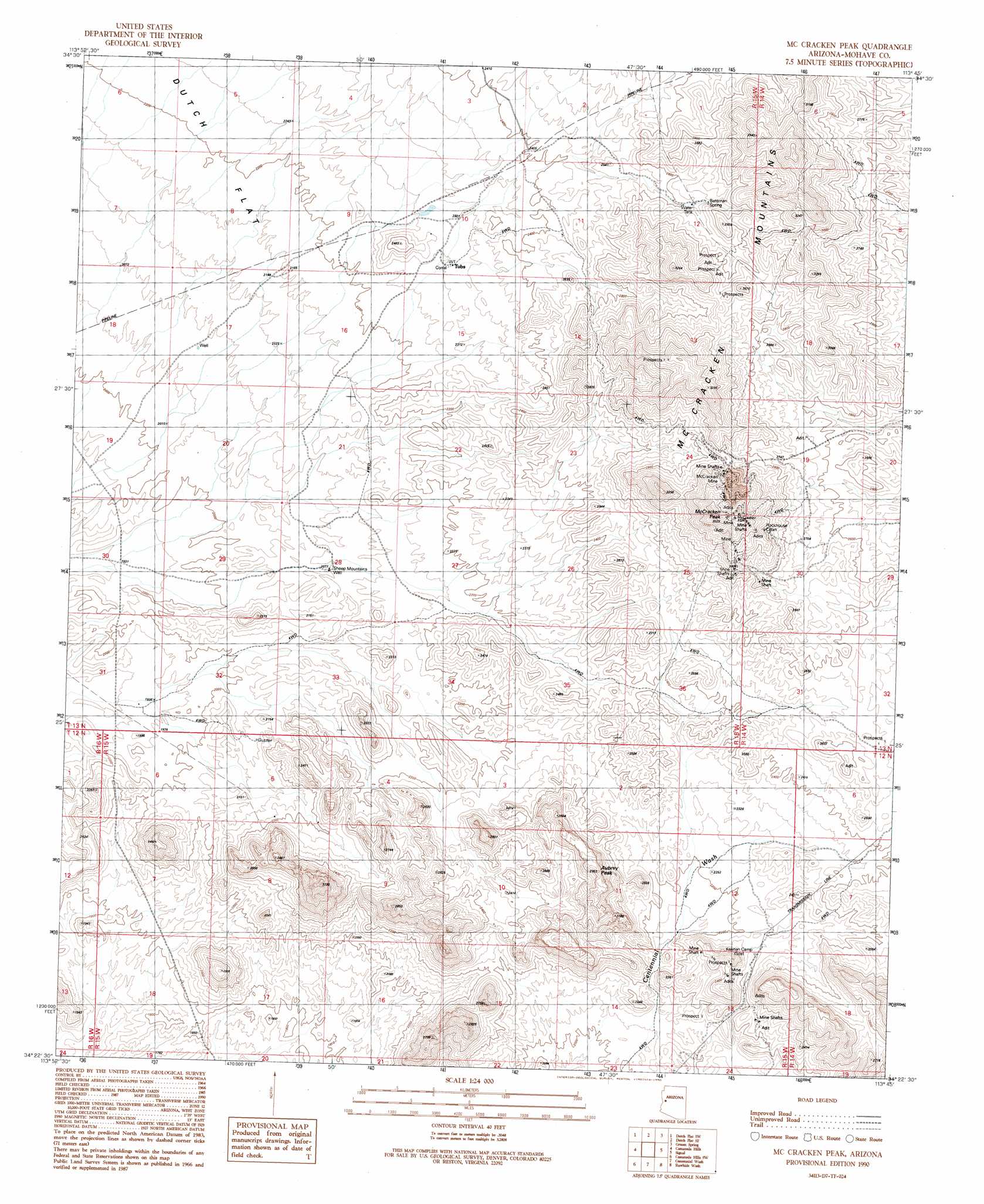
Mccracken Peak Topo Map Arizona
To zoom in, hover over the map of Mccracken Peak
USGS Topo Quad 34113d7 - 1:24,000 scale
| Topo Map Name: | Mccracken Peak |
| USGS Topo Quad ID: | 34113d7 |
| Print Size: | ca. 21 1/4" wide x 27" high |
| Southeast Coordinates: | 34.375° N latitude / 113.75° W longitude |
| Map Center Coordinates: | 34.4375° N latitude / 113.8125° W longitude |
| U.S. State: | AZ |
| Filename: | o34113d7.jpg |
| Download Map JPG Image: | Mccracken Peak topo map 1:24,000 scale |
| Map Type: | Topographic |
| Topo Series: | 7.5´ |
| Map Scale: | 1:24,000 |
| Source of Map Images: | United States Geological Survey (USGS) |
| Alternate Map Versions: |
McCracken Peak AZ 1990, updated 1990 Download PDF Buy paper map McCracken Peak AZ 2011 Download PDF Buy paper map McCracken Peak AZ 2014 Download PDF Buy paper map |
1:24,000 Topo Quads surrounding Mccracken Peak
Buck Mountains Ne |
Dutch Flat Nw |
Beecher Canyon |
Aubrey Peak |
Wikieup |
Buck Mountains Se |
Dutch Flat Sw |
Dutch Flat Se |
Groom Spring |
Greenwood Peak |
Mohave Springs |
Castaneda Hills |
Mccracken Peak |
Signal |
Signal Mountain |
Monkeys Head |
Castaneda Hills Sw |
Centennial Wash |
Rawhide Wash |
Artillery Peak |
Osborne Well |
Planet |
Swansea |
Reid Valley |
Alamo Dam |
> Back to 34113a1 at 1:100,000 scale
> Back to 34112a1 at 1:250,000 scale
> Back to U.S. Topo Maps home
Mccracken Peak topo map: Gazetteer
Mccracken Peak: Mines
McCracken Mine elevation 970m 3182′Mccracken Peak: Springs
Bateman Spring elevation 810m 2657′Mccracken Peak: Summits
Aubrey Peak elevation 783m 2568′McCracken Peak elevation 1074m 3523′
Mccracken Peak: Wells
Sheep Mounts Well elevation 0m 0′Mccracken Peak digital topo map on disk
Buy this Mccracken Peak topo map showing relief, roads, GPS coordinates and other geographical features, as a high-resolution digital map file on DVD: