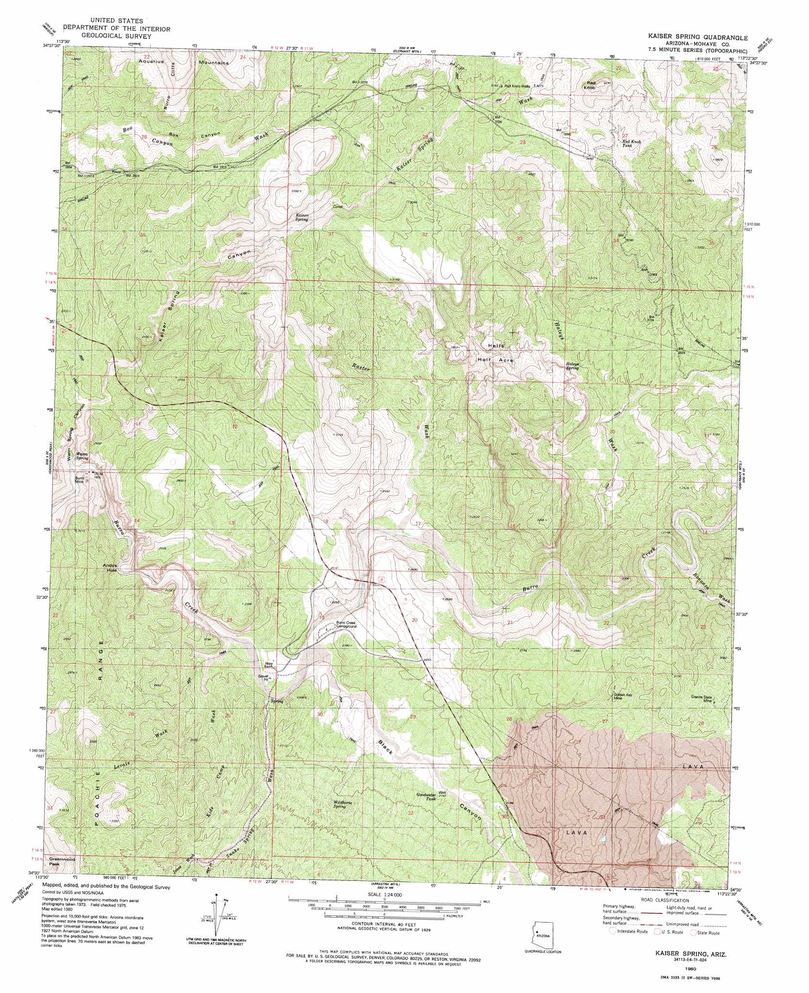
Kaiser Spring Topo Map Arizona
To zoom in, hover over the map of Kaiser Spring
USGS Topo Quad 34113e4 - 1:24,000 scale
| Topo Map Name: | Kaiser Spring |
| USGS Topo Quad ID: | 34113e4 |
| Print Size: | ca. 21 1/4" wide x 27" high |
| Southeast Coordinates: | 34.5° N latitude / 113.375° W longitude |
| Map Center Coordinates: | 34.5625° N latitude / 113.4375° W longitude |
| U.S. State: | AZ |
| Filename: | o34113e4.jpg |
| Download Map JPG Image: | Kaiser Spring topo map 1:24,000 scale |
| Map Type: | Topographic |
| Topo Series: | 7.5´ |
| Map Scale: | 1:24,000 |
| Source of Map Images: | United States Geological Survey (USGS) |
| Alternate Map Versions: |
Kaiser Spring AZ 1980, updated 1980 Download PDF Buy paper map Kaiser Spring AZ 1980, updated 1986 Download PDF Buy paper map Kaiser Spring AZ 2011 Download PDF Buy paper map Kaiser Spring AZ 2014 Download PDF Buy paper map |
1:24,000 Topo Quads surrounding Kaiser Spring
Gunsight Canyon |
Tule Wash |
Cedar Basin |
Pilot Knob |
Burro Mesa |
Aubrey Peak |
Wikieup |
Elephant Mountain |
Negro Ed |
Bozarth Mesa |
Groom Spring |
Greenwood Peak |
Kaiser Spring |
Grayback Mountains |
Bagdad |
Signal |
Signal Mountain |
Arrastra Mountain |
Arrastra Mountain Ne |
Thorn Peak |
Rawhide Wash |
Artillery Peak |
Palmerita Ranch |
Arrastra Mountain Se |
Ives Peak |
> Back to 34113e1 at 1:100,000 scale
> Back to 34112a1 at 1:250,000 scale
> Back to U.S. Topo Maps home
Kaiser Spring topo map: Gazetteer
Kaiser Spring: Areas
Hells Half Acre elevation 726m 2381′Kaiser Spring: Arroyos
Bonanza Wash elevation 651m 2135′Haleys Wash elevation 619m 2030′
Jones Wash elevation 780m 2559′
Kaiser Spring Wash elevation 838m 2749′
Kids Camp Wash elevation 609m 1998′
Levais Wash elevation 563m 1847′
Kaiser Spring: Bends
Andys Hole elevation 544m 1784′Kaiser Spring: Mines
Burro Mine elevation 632m 2073′Golden Key Mine elevation 865m 2837′
Granite State Mine elevation 876m 2874′
Kaiser Spring: Reservoirs
Goodwater Tank elevation 659m 2162′Red Knob Tank elevation 1033m 3389′
Kaiser Spring: Springs
Haleys Spring elevation 739m 2424′Kaiser Spring elevation 830m 2723′
Warm Spring elevation 549m 1801′
Wildhorse Spring elevation 695m 2280′
Kaiser Spring: Streams
Snake Spring Wash elevation 574m 1883′Kaiser Spring: Summits
Red Knob elevation 1178m 3864′Kaiser Spring: Valleys
Black Canyon elevation 616m 2020′Kaiser Spring Canyon elevation 537m 1761′
Raster Wash elevation 595m 1952′
Warm Spring Canyon elevation 536m 1758′
Kaiser Spring: Wells
Red Knob Wells elevation 1001m 3284′Kaiser Spring digital topo map on disk
Buy this Kaiser Spring topo map showing relief, roads, GPS coordinates and other geographical features, as a high-resolution digital map file on DVD: