Dutch Flat Sw Topo Map Arizona
To zoom in, hover over the map of Dutch Flat Sw
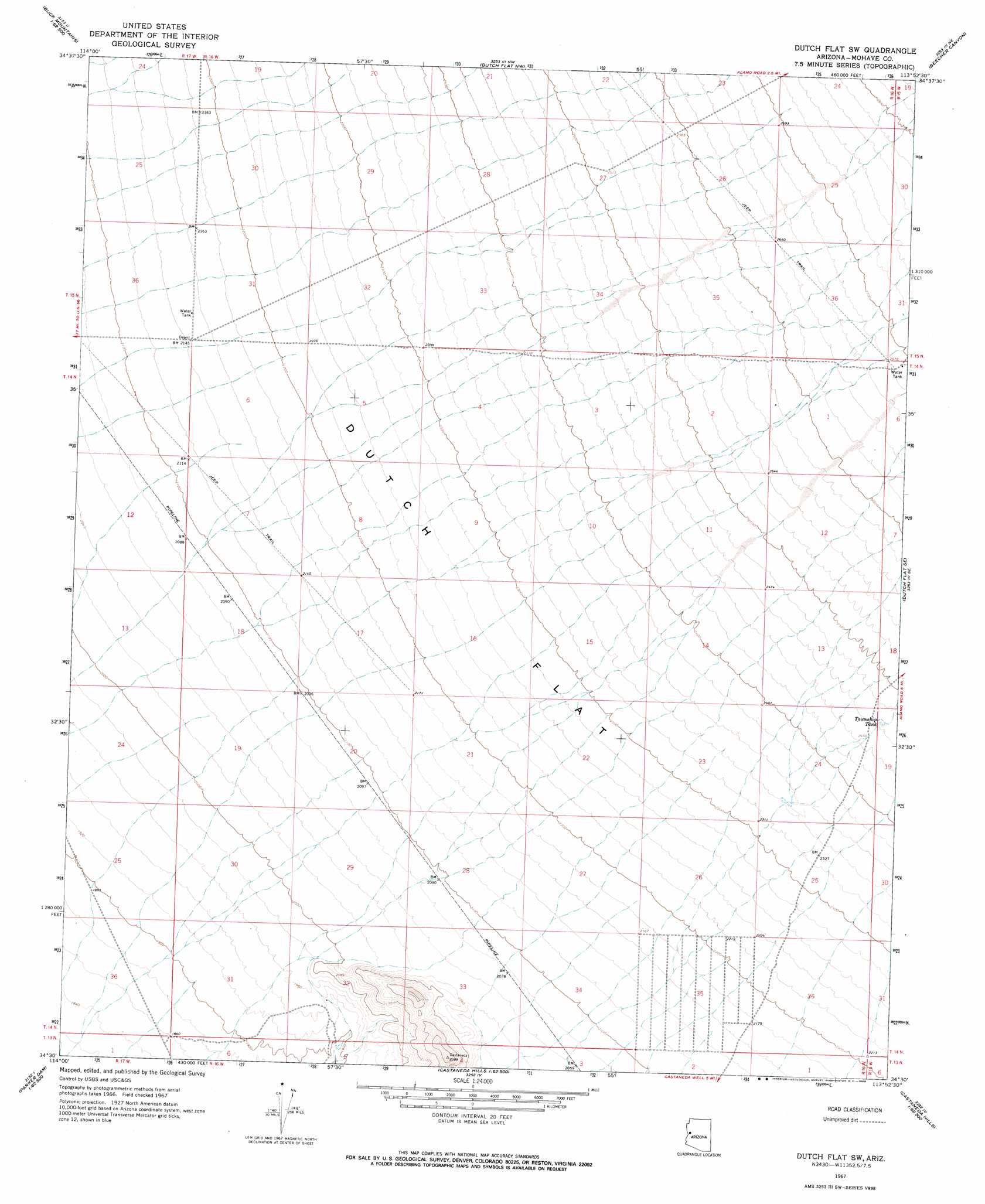
USGS Topo Quad 34113e8 - 1:24,000 scale
| Topo Map Name: | Dutch Flat Sw |
| USGS Topo Quad ID: | 34113e8 |
| Print Size: | ca. 21 1/4" wide x 27" high |
| Southeast Coordinates: | 34.5° N latitude / 113.875° W longitude |
| Map Center Coordinates: | 34.5625° N latitude / 113.9375° W longitude |
| U.S. State: | AZ |
| Filename: | o34113e8.jpg |
| Download Map JPG Image: | Dutch Flat Sw topo map 1:24,000 scale |
| Map Type: | Topographic |
| Topo Series: | 7.5´ |
| Map Scale: | 1:24,000 |
| Source of Map Images: | United States Geological Survey (USGS) |
| Alternate Map Versions: |
Dutch Flat SW AZ 1967, updated 1969 Download PDF Buy paper map Dutch Flat SW AZ 2011 Download PDF Buy paper map Dutch Flat SW AZ 2014 Download PDF Buy paper map |
1:24,000 Topo Quads surrounding Dutch Flat Sw
Yucca |
Yucca Se |
Creamery Canyon |
Diamond Joe Peak |
Gunsight Canyon |
Buck Mountains |
Buck Mountains Ne |
Dutch Flat Nw |
Beecher Canyon |
Aubrey Peak |
Crossman Peak |
Buck Mountains Se |
Dutch Flat Sw |
Dutch Flat Se |
Groom Spring |
Standard Wash |
Mohave Springs |
Castaneda Hills |
Mccracken Peak |
Signal |
Gene Wash |
Monkeys Head |
Castaneda Hills Sw |
Centennial Wash |
Rawhide Wash |
> Back to 34113e1 at 1:100,000 scale
> Back to 34112a1 at 1:250,000 scale
> Back to U.S. Topo Maps home
Dutch Flat Sw digital topo map on disk
Buy this Dutch Flat Sw topo map showing relief, roads, GPS coordinates and other geographical features, as a high-resolution digital map file on DVD: