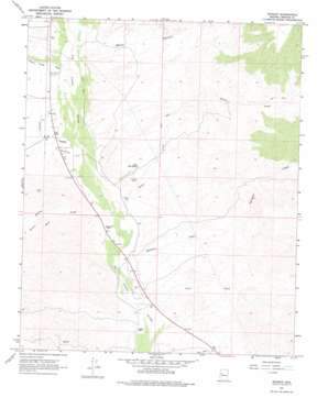
Wikieup Topo Map Arizona
To zoom in, hover over the map of Wikieup
USGS Topo Quad 34113f5 - 1:24,000 scale
| Topo Map Name: | Wikieup |
| USGS Topo Quad ID: | 34113f5 |
| Print Size: | ca. 21 1/4" wide x 27" high |
| Southeast Coordinates: | 34.625° N latitude / 113.5° W longitude |
| Map Center Coordinates: | 34.6875° N latitude / 113.5625° W longitude |
| U.S. State: | AZ |
| Filename: | o34113f5.jpg |
| Download Map JPG Image: | Wikieup topo map 1:24,000 scale |
| Map Type: | Topographic |
| Topo Series: | 7.5´ |
| Map Scale: | 1:24,000 |
| Source of Map Images: | United States Geological Survey (USGS) |
| Alternate Map Versions: |
Wikieup AZ 1967, updated 1970 Download PDF Buy paper map Wikieup AZ 1967, updated 1977 Download PDF Buy paper map Wikieup AZ 2011 Download PDF Buy paper map Wikieup AZ 2014 Download PDF Buy paper map |
1:24,000 Topo Quads surrounding Wikieup
> Back to 34113e1 at 1:100,000 scale
> Back to 34112a1 at 1:250,000 scale
> Back to U.S. Topo Maps home
Wikieup topo map: Gazetteer
Wikieup: Populated Places
Wikieup elevation 606m 1988′Wikieup: Post Offices
Wikieup Post Office elevation 600m 1968′Wikieup: Springs
Cofer Hot Spring elevation 632m 2073′Wikieup: Streams
Bitter Creek elevation 565m 1853′Bronco Creek elevation 566m 1856′
Bronco Wash elevation 642m 2106′
Gray Wash elevation 545m 1788′
Natural Corrals Wash elevation 609m 1998′
Sycamore Creek elevation 548m 1797′
Wikieup: Valleys
Boner Canyon elevation 615m 2017′Wikieup digital topo map on disk
Buy this Wikieup topo map showing relief, roads, GPS coordinates and other geographical features, as a high-resolution digital map file on DVD:


