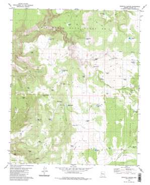
Scratch Canyon Topo Map Arizona
To zoom in, hover over the map of Scratch Canyon
USGS Topo Quad 34113g1 - 1:24,000 scale
| Topo Map Name: | Scratch Canyon |
| USGS Topo Quad ID: | 34113g1 |
| Print Size: | ca. 21 1/4" wide x 27" high |
| Southeast Coordinates: | 34.75° N latitude / 113° W longitude |
| Map Center Coordinates: | 34.8125° N latitude / 113.0625° W longitude |
| U.S. State: | AZ |
| Filename: | o34113g1.jpg |
| Download Map JPG Image: | Scratch Canyon topo map 1:24,000 scale |
| Map Type: | Topographic |
| Topo Series: | 7.5´ |
| Map Scale: | 1:24,000 |
| Source of Map Images: | United States Geological Survey (USGS) |
| Alternate Map Versions: |
Scratch Canyon AZ 1980, updated 1980 Download PDF Buy paper map Scratch Canyon AZ 1980, updated 1980 Download PDF Buy paper map Scratch Canyon AZ 2012 Download PDF Buy paper map Scratch Canyon AZ 2014 Download PDF Buy paper map |
| FStopo: | US Forest Service topo Scratch Canyon is available: Download FStopo PDF Download FStopo TIF |
1:24,000 Topo Quads surrounding Scratch Canyon
> Back to 34113e1 at 1:100,000 scale
> Back to 34112a1 at 1:250,000 scale
> Back to U.S. Topo Maps home
Scratch Canyon topo map: Gazetteer
Scratch Canyon: Basins
Hole in the Ground elevation 1579m 5180′Scratch Canyon: Cliffs
Windy Ridge elevation 1769m 5803′Scratch Canyon: Dams
Pine Creek Dam elevation 1751m 5744′White House Dam elevation 1900m 6233′
Scratch Canyon: Reservoirs
Antelope Tank elevation 1762m 5780′Antelope Tank elevation 1829m 6000′
Bar Thirty Seven Tank elevation 1779m 5836′
Bobbie Tank elevation 1751m 5744′
Bull Tank elevation 1543m 5062′
Burro Creek Tank elevation 1655m 5429′
Christie Tank elevation 1735m 5692′
Conger Tank elevation 1594m 5229′
Coyote Tank elevation 1770m 5807′
Halfway House Tank elevation 1709m 5606′
Harman Tank elevation 1727m 5666′
Harper Tank elevation 1686m 5531′
Hidden Tank elevation 1627m 5337′
Hosea Tank elevation 1722m 5649′
Lane Tank elevation 1739m 5705′
Leppi Tank elevation 1608m 5275′
Lone Pine Tank elevation 1726m 5662′
Long Canyon Tank elevation 1740m 5708′
Lower Crossing elevation 1669m 5475′
Mexican-Nest Tank elevation 1697m 5567′
Mikes Tank elevation 1717m 5633′
Miller Tank elevation 1716m 5629′
Ring Cone Tank elevation 1577m 5173′
Roadside Tank elevation 1756m 5761′
Robbins Tank elevation 1786m 5859′
Rose Tank elevation 1678m 5505′
Seven Up Pasture Tank elevation 1796m 5892′
Thirty Day Tank elevation 1714m 5623′
Upper Crossing elevation 1704m 5590′
Vennie Tank elevation 1653m 5423′
Whistle Tank elevation 1631m 5351′
Wiggins Tank elevation 1535m 5036′
Wildhorse Tank elevation 1900m 6233′
Winter Camp Tank elevation 1704m 5590′
Yellow Hammer Tank elevation 1683m 5521′
Scratch Canyon: Springs
Conger Spring elevation 1406m 4612′Scratch Canyon: Streams
Pine Creek elevation 1357m 4452′Scratch Canyon: Summits
Black Butte elevation 1834m 6017′Little Shirttail Mesa elevation 1689m 5541′
Scratch Canyon: Valleys
Deep Canyon elevation 1439m 4721′Scratch Canyon digital topo map on disk
Buy this Scratch Canyon topo map showing relief, roads, GPS coordinates and other geographical features, as a high-resolution digital map file on DVD:


