Diamond Joe Peak Topo Map Arizona
To zoom in, hover over the map of Diamond Joe Peak
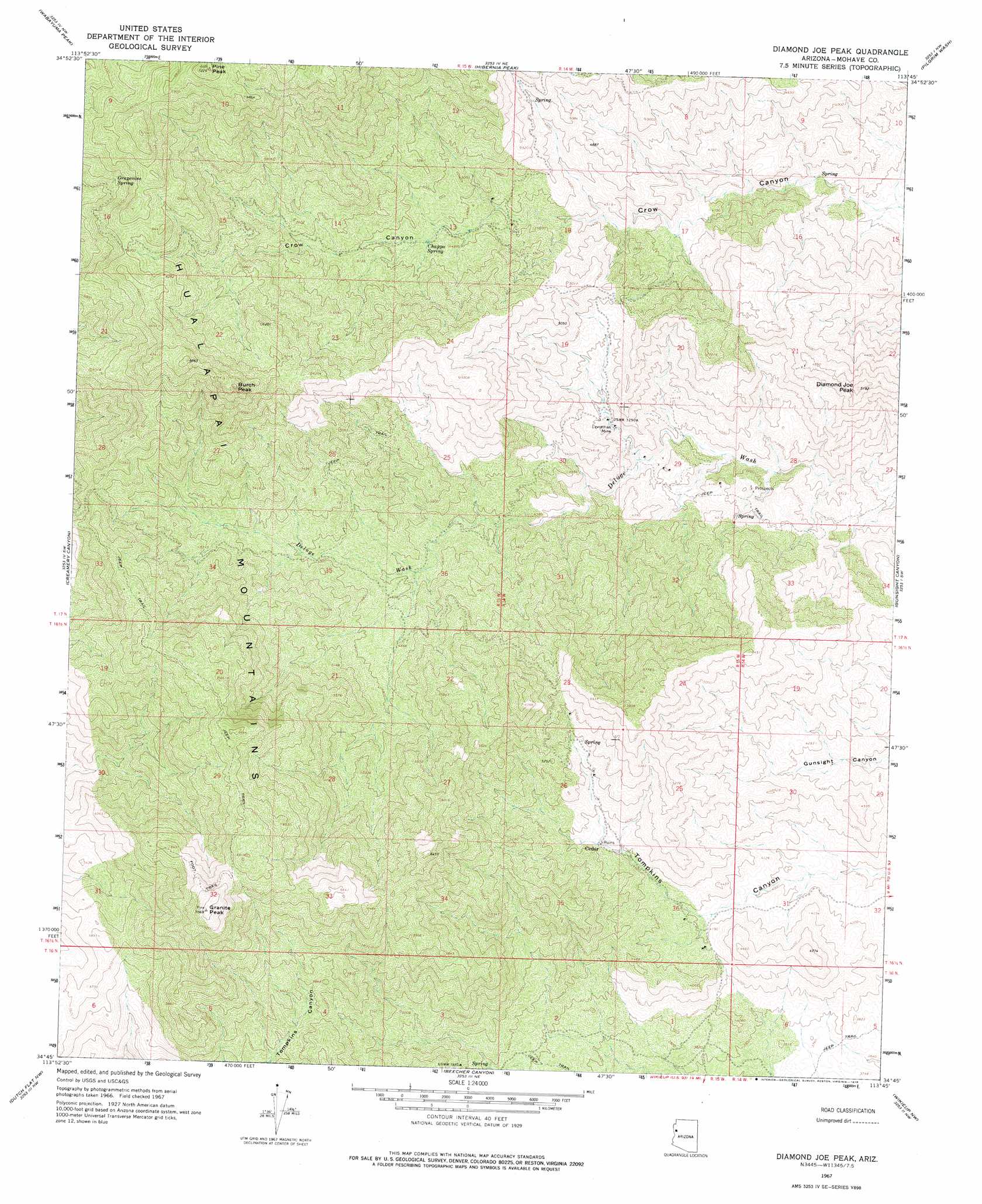
USGS Topo Quad 34113g7 - 1:24,000 scale
| Topo Map Name: | Diamond Joe Peak |
| USGS Topo Quad ID: | 34113g7 |
| Print Size: | ca. 21 1/4" wide x 27" high |
| Southeast Coordinates: | 34.75° N latitude / 113.75° W longitude |
| Map Center Coordinates: | 34.8125° N latitude / 113.8125° W longitude |
| U.S. State: | AZ |
| Filename: | o34113g7.jpg |
| Download Map JPG Image: | Diamond Joe Peak topo map 1:24,000 scale |
| Map Type: | Topographic |
| Topo Series: | 7.5´ |
| Map Scale: | 1:24,000 |
| Source of Map Images: | United States Geological Survey (USGS) |
| Alternate Map Versions: |
Diamond Joe Peak AZ 1967, updated 1969 Download PDF Buy paper map Diamond Joe Peak AZ 1967, updated 1978 Download PDF Buy paper map Diamond Joe Peak AZ 2011 Download PDF Buy paper map Diamond Joe Peak AZ 2014 Download PDF Buy paper map |
1:24,000 Topo Quads surrounding Diamond Joe Peak
Kingman Se |
Hualapai Peak |
Dean Peak |
Bottleneck Wash |
Austin Peak |
Yucca Ne |
Wabayuma Peak |
Hibernia Peak |
Pilgrim Wash |
Tom Brown Canyon |
Yucca Se |
Creamery Canyon |
Diamond Joe Peak |
Gunsight Canyon |
Tule Wash |
Buck Mountains Ne |
Dutch Flat Nw |
Beecher Canyon |
Aubrey Peak |
Wikieup |
Buck Mountains Se |
Dutch Flat Sw |
Dutch Flat Se |
Groom Spring |
Greenwood Peak |
> Back to 34113e1 at 1:100,000 scale
> Back to 34112a1 at 1:250,000 scale
> Back to U.S. Topo Maps home
Diamond Joe Peak topo map: Gazetteer
Diamond Joe Peak: Mines
Leviathan Mine elevation 1240m 4068′Diamond Joe Peak: Populated Places
Cedar elevation 1359m 4458′Diamond Joe Peak: Springs
Chappo Spring elevation 1482m 4862′Grapevine Spring elevation 1830m 6003′
Lower Cypress Spring elevation 1364m 4475′
Diamond Joe Peak: Summits
Burch Peak elevation 2076m 6811′Diamond Joe Peak elevation 1561m 5121′
Granite Peak elevation 2153m 7063′
Pine Peak elevation 2199m 7214′
Diamond Joe Peak digital topo map on disk
Buy this Diamond Joe Peak topo map showing relief, roads, GPS coordinates and other geographical features, as a high-resolution digital map file on DVD: