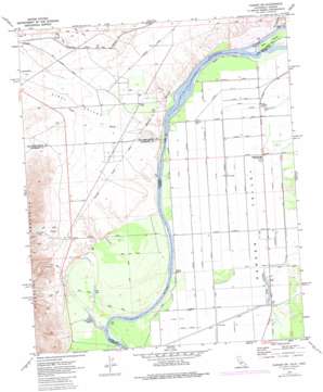
Parker Sw Topo Map California
To zoom in, hover over the map of Parker Sw
USGS Topo Quad 34114a4 - 1:24,000 scale
| Topo Map Name: | Parker Sw |
| USGS Topo Quad ID: | 34114a4 |
| Print Size: | ca. 21 1/4" wide x 27" high |
| Southeast Coordinates: | 34° N latitude / 114.375° W longitude |
| Map Center Coordinates: | 34.0625° N latitude / 114.4375° W longitude |
| U.S. States: | CA, AZ |
| Filename: | o34114a4.jpg |
| Download Map JPG Image: | Parker Sw topo map 1:24,000 scale |
| Map Type: | Topographic |
| Topo Series: | 7.5´ |
| Map Scale: | 1:24,000 |
| Source of Map Images: | United States Geological Survey (USGS) |
| Alternate Map Versions: |
Parker SW CA 1970, updated 1973 Download PDF Buy paper map Parker SW CA 1970, updated 1977 Download PDF Buy paper map Parker SW CA 1970, updated 1986 Download PDF Buy paper map Parker SW CA 2012 Download PDF Buy paper map Parker SW CA 2015 Download PDF Buy paper map |
1:24,000 Topo Quads surrounding Parker Sw
> Back to 34114a1 at 1:100,000 scale
> Back to 34114a1 at 1:250,000 scale
> Back to U.S. Topo Maps home
Parker Sw topo map: Gazetteer
Parker Sw: Bends
Gravel Hill Bend elevation 103m 337′Parker Sw: Canals
Lateral Nineteen R elevation 106m 347′Lateral Nineteen R-37 elevation 104m 341′
Lateral Nineteen R-37-24 elevation 103m 337′
Lateral Number Seventy-nine elevation 101m 331′
Lateral Twenty-seven R-25 elevation 104m 341′
Parker Sw: Guts
Twelvemile Slough elevation 102m 334′Parker Sw: Islands
Deer Island elevation 107m 351′Parker Sw: Lakes
Alligator Slough (historical) elevation 98m 321′Lost Lake elevation 97m 318′
Parker Sw: Streams
Vidal Wash elevation 103m 337′Parker Sw: Valleys
Vidal Valley elevation 107m 351′Parker Sw digital topo map on disk
Buy this Parker Sw topo map showing relief, roads, GPS coordinates and other geographical features, as a high-resolution digital map file on DVD:


