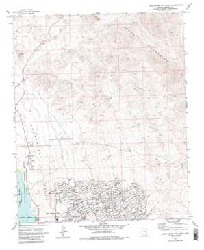
Lake Havasu City North Topo Map Arizona
To zoom in, hover over the map of Lake Havasu City North
USGS Topo Quad 34114e3 - 1:24,000 scale
| Topo Map Name: | Lake Havasu City North |
| USGS Topo Quad ID: | 34114e3 |
| Print Size: | ca. 21 1/4" wide x 27" high |
| Southeast Coordinates: | 34.5° N latitude / 114.25° W longitude |
| Map Center Coordinates: | 34.5625° N latitude / 114.3125° W longitude |
| U.S. State: | AZ |
| Filename: | o34114e3.jpg |
| Download Map JPG Image: | Lake Havasu City North topo map 1:24,000 scale |
| Map Type: | Topographic |
| Topo Series: | 7.5´ |
| Map Scale: | 1:24,000 |
| Source of Map Images: | United States Geological Survey (USGS) |
| Alternate Map Versions: |
Lake Havasu City North AZ 1970, updated 1973 Download PDF Buy paper map Lake Havasu City North AZ 1970, updated 1981 Download PDF Buy paper map Lake Havasu City North AZ 1970, updated 1987 Download PDF Buy paper map Lake Havasu City North AZ 1970, updated 1987 Download PDF Buy paper map Lake Havasu City North AZ 2011 Download PDF Buy paper map Lake Havasu City North AZ 2014 Download PDF Buy paper map |
1:24,000 Topo Quads surrounding Lake Havasu City North
> Back to 34114e1 at 1:100,000 scale
> Back to 34114a1 at 1:250,000 scale
> Back to U.S. Topo Maps home
Lake Havasu City North topo map: Gazetteer
Lake Havasu City North: Airports
Lake Havasu City Airport elevation 228m 748′Lake Havasu City North: Mines
Wing Mine elevation 549m 1801′Lake Havasu City North: Populated Places
Desert Hills elevation 167m 547′Jops Landing elevation 184m 603′
Lake Havasu City North: Streams
Atlantic Drain elevation 263m 862′Avalon Drain elevation 220m 721′
Falls Springs Wash elevation 534m 1751′
Havasupai Wash elevation 139m 456′
Hillside Drain elevation 196m 643′
Kiowa Drain elevation 137m 449′
Neptune Wash elevation 138m 452′
Palmtree Wash elevation 314m 1030′
Sage Drain elevation 0m 0′
San Juan Drain elevation 0m 0′
Sandwood Drain elevation 0m 0′
Lake Havasu City North digital topo map on disk
Buy this Lake Havasu City North topo map showing relief, roads, GPS coordinates and other geographical features, as a high-resolution digital map file on DVD:


