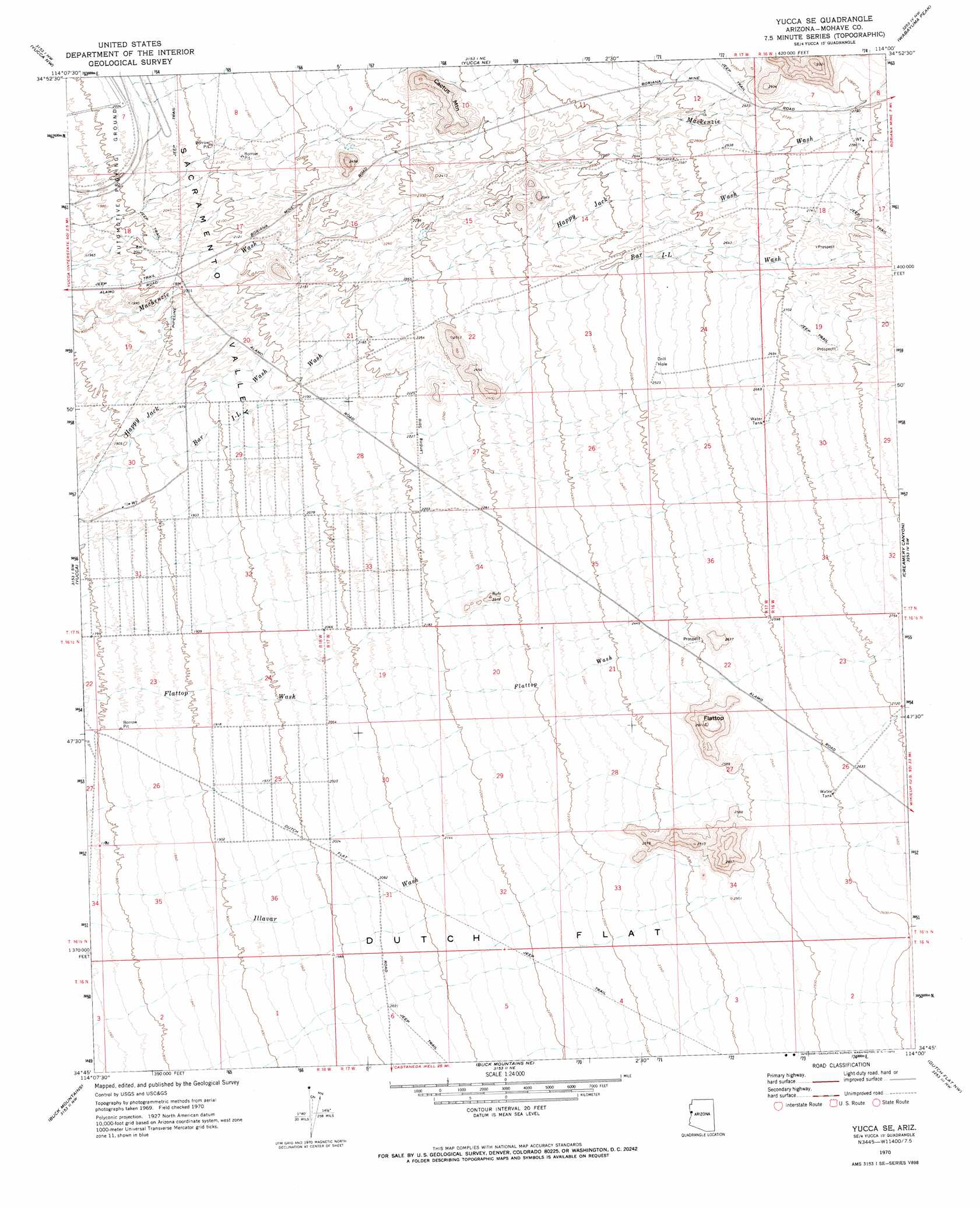
Yucca Se Topo Map Arizona
To zoom in, hover over the map of Yucca Se
USGS Topo Quad 34114g1 - 1:24,000 scale
| Topo Map Name: | Yucca Se |
| USGS Topo Quad ID: | 34114g1 |
| Print Size: | ca. 21 1/4" wide x 27" high |
| Southeast Coordinates: | 34.75° N latitude / 114° W longitude |
| Map Center Coordinates: | 34.8125° N latitude / 114.0625° W longitude |
| U.S. State: | AZ |
| Filename: | o34114g1.jpg |
| Download Map JPG Image: | Yucca Se topo map 1:24,000 scale |
| Map Type: | Topographic |
| Topo Series: | 7.5´ |
| Map Scale: | 1:24,000 |
| Source of Map Images: | United States Geological Survey (USGS) |
| Alternate Map Versions: |
Yucca SE AZ 1970, updated 1973 Download PDF Buy paper map Yucca SE AZ 2011 Download PDF Buy paper map Yucca SE AZ 2014 Download PDF Buy paper map |
1:24,000 Topo Quads surrounding Yucca Se
Mount Nutt |
Kingman Sw |
Kingman Se |
Hualapai Peak |
Dean Peak |
Warm Springs |
Yucca Nw |
Yucca Ne |
Wabayuma Peak |
Hibernia Peak |
Warm Springs Se |
Yucca |
Yucca Se |
Creamery Canyon |
Diamond Joe Peak |
Franconia |
Buck Mountains |
Buck Mountains Ne |
Dutch Flat Nw |
Beecher Canyon |
Lake Havasu City North |
Crossman Peak |
Buck Mountains Se |
Dutch Flat Sw |
Dutch Flat Se |
> Back to 34114e1 at 1:100,000 scale
> Back to 34114a1 at 1:250,000 scale
> Back to U.S. Topo Maps home
Yucca Se topo map: Gazetteer
Yucca Se: Reservoirs
Flat Top Tank elevation 828m 2716′Number Five Trough elevation 744m 2440′
Number Four Trough elevation 811m 2660′
Number Three Trough elevation 818m 2683′
Number Two Trough elevation 829m 2719′
Yucca Se: Springs
End Spring elevation 791m 2595′Yucca Se: Streams
Bar I-L Wash elevation 556m 1824′Yucca Se: Summits
Cactus Mountain elevation 788m 2585′Flattop elevation 887m 2910′
Yucca Se digital topo map on disk
Buy this Yucca Se topo map showing relief, roads, GPS coordinates and other geographical features, as a high-resolution digital map file on DVD: