Warm Springs Se Topo Map Arizona
To zoom in, hover over the map of Warm Springs Se
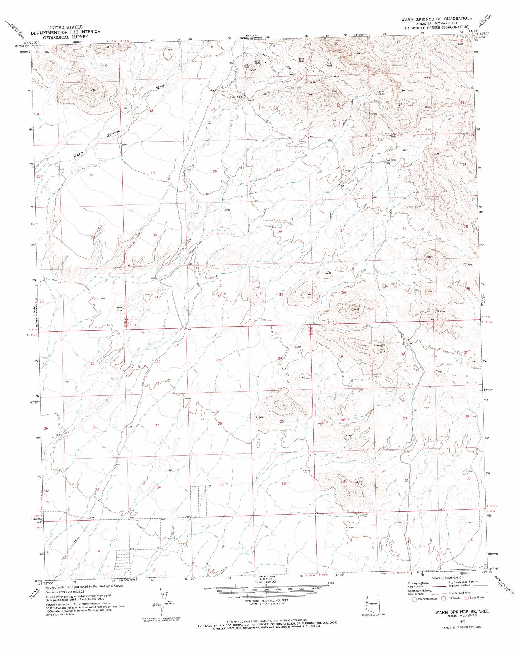
USGS Topo Quad 34114g3 - 1:24,000 scale
| Topo Map Name: | Warm Springs Se |
| USGS Topo Quad ID: | 34114g3 |
| Print Size: | ca. 21 1/4" wide x 27" high |
| Southeast Coordinates: | 34.75° N latitude / 114.25° W longitude |
| Map Center Coordinates: | 34.8125° N latitude / 114.3125° W longitude |
| U.S. State: | AZ |
| Filename: | o34114g3.jpg |
| Download Map JPG Image: | Warm Springs Se topo map 1:24,000 scale |
| Map Type: | Topographic |
| Topo Series: | 7.5´ |
| Map Scale: | 1:24,000 |
| Source of Map Images: | United States Geological Survey (USGS) |
| Alternate Map Versions: |
Warm Springs SE AZ 1970, updated 1973 Download PDF Buy paper map Warm Springs SE AZ 2011 Download PDF Buy paper map Warm Springs SE AZ 2014 Download PDF Buy paper map |
1:24,000 Topo Quads surrounding Warm Springs Se
Davis Dam Se |
Oatman |
Mount Nutt |
Kingman Sw |
Kingman Se |
Needles Ne |
Boundary Cone |
Warm Springs |
Yucca Nw |
Yucca Ne |
Needles |
Warm Springs Sw |
Warm Springs Se |
Yucca |
Yucca Se |
Whale Mountain |
Topock |
Franconia |
Buck Mountains |
Buck Mountains Ne |
Chemehuevi Peak |
Castle Rock |
Lake Havasu City North |
Crossman Peak |
Buck Mountains Se |
> Back to 34114e1 at 1:100,000 scale
> Back to 34114a1 at 1:250,000 scale
> Back to U.S. Topo Maps home
No gazetteer data is available for the Warm Springs Se topo map sheet.
Warm Springs Se digital topo map on disk
Buy this Warm Springs Se topo map showing relief, roads, GPS coordinates and other geographical features, as a high-resolution digital map file on DVD: