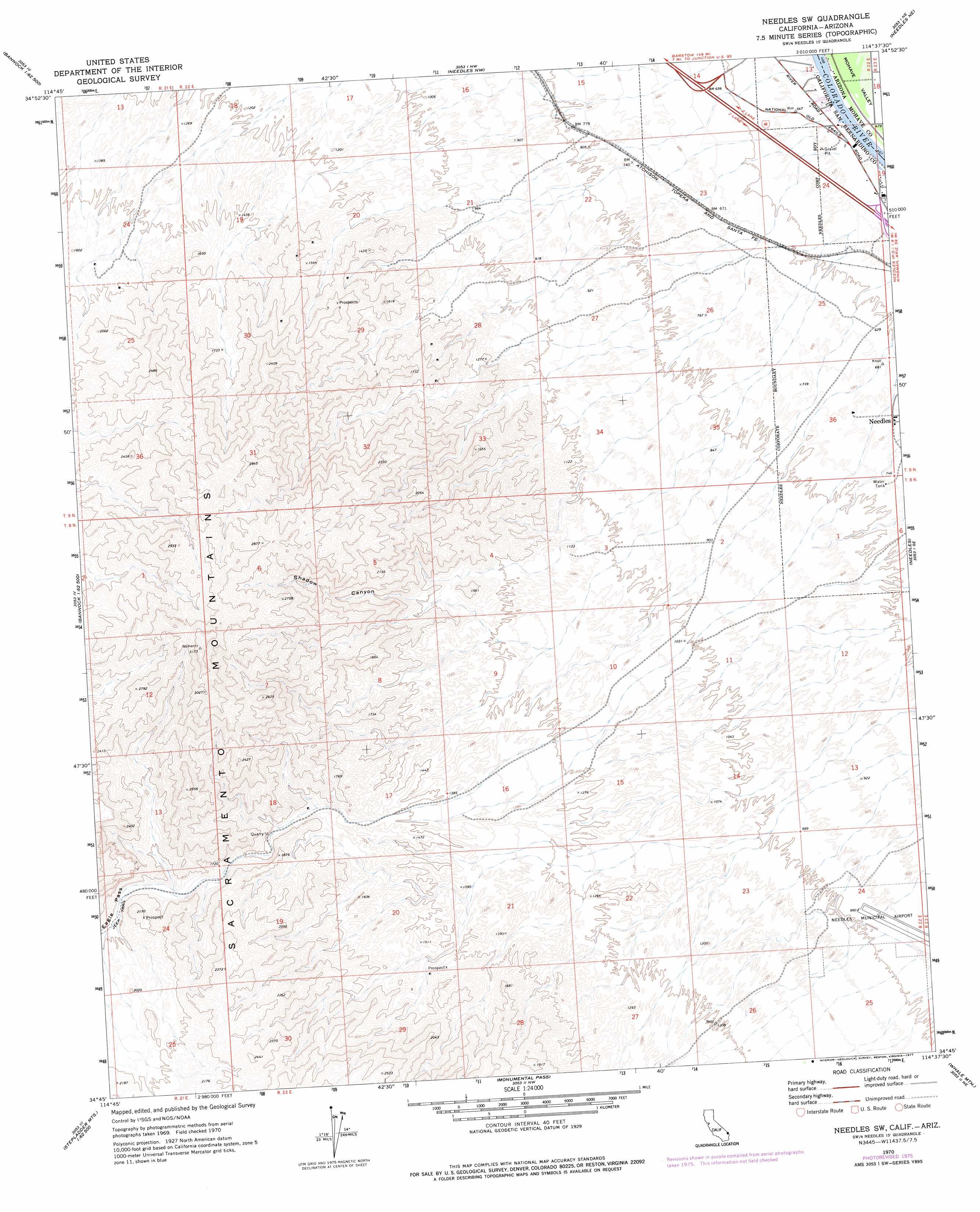
Needles Sw Topo Map California
To zoom in, hover over the map of Needles Sw
USGS Topo Quad 34114g6 - 1:24,000 scale
| Topo Map Name: | Needles Sw |
| USGS Topo Quad ID: | 34114g6 |
| Print Size: | ca. 21 1/4" wide x 27" high |
| Southeast Coordinates: | 34.75° N latitude / 114.625° W longitude |
| Map Center Coordinates: | 34.8125° N latitude / 114.6875° W longitude |
| U.S. States: | CA, AZ |
| Filename: | o34114g6.jpg |
| Download Map JPG Image: | Needles Sw topo map 1:24,000 scale |
| Map Type: | Topographic |
| Topo Series: | 7.5´ |
| Map Scale: | 1:24,000 |
| Source of Map Images: | United States Geological Survey (USGS) |
| Alternate Map Versions: |
Needles SW CA 1970, updated 1973 Download PDF Buy paper map Needles SW CA 1970, updated 1977 Download PDF Buy paper map Needles SW CA 2012 Download PDF Buy paper map Needles SW CA 2015 Download PDF Buy paper map |
1:24,000 Topo Quads surrounding Needles Sw
Homer Mountain |
East Of Homer Mountain |
Mount Manchester |
Davis Dam Se |
Oatman |
Homer |
Bannock |
Needles Nw |
Needles Ne |
Boundary Cone |
West Of Flattop Mountain |
Flattop Mountain |
Needles Sw |
Needles |
Warm Springs Sw |
Stepladder Mountains Nw |
Stepladder Mountains Ne |
Monumental Pass |
Whale Mountain |
Topock |
Stepladder Mountains Sw |
Stepladder Mountains |
Snaggletooth |
Chemehuevi Peak |
Castle Rock |
> Back to 34114e1 at 1:100,000 scale
> Back to 34114a1 at 1:250,000 scale
> Back to U.S. Topo Maps home
Needles Sw topo map: Gazetteer
Needles Sw: Gaps
Eagle Pass elevation 546m 1791′Needles Sw: Valleys
Shadow Canyon elevation 432m 1417′Needles Sw digital topo map on disk
Buy this Needles Sw topo map showing relief, roads, GPS coordinates and other geographical features, as a high-resolution digital map file on DVD: