Bannock Topo Map California
To zoom in, hover over the map of Bannock
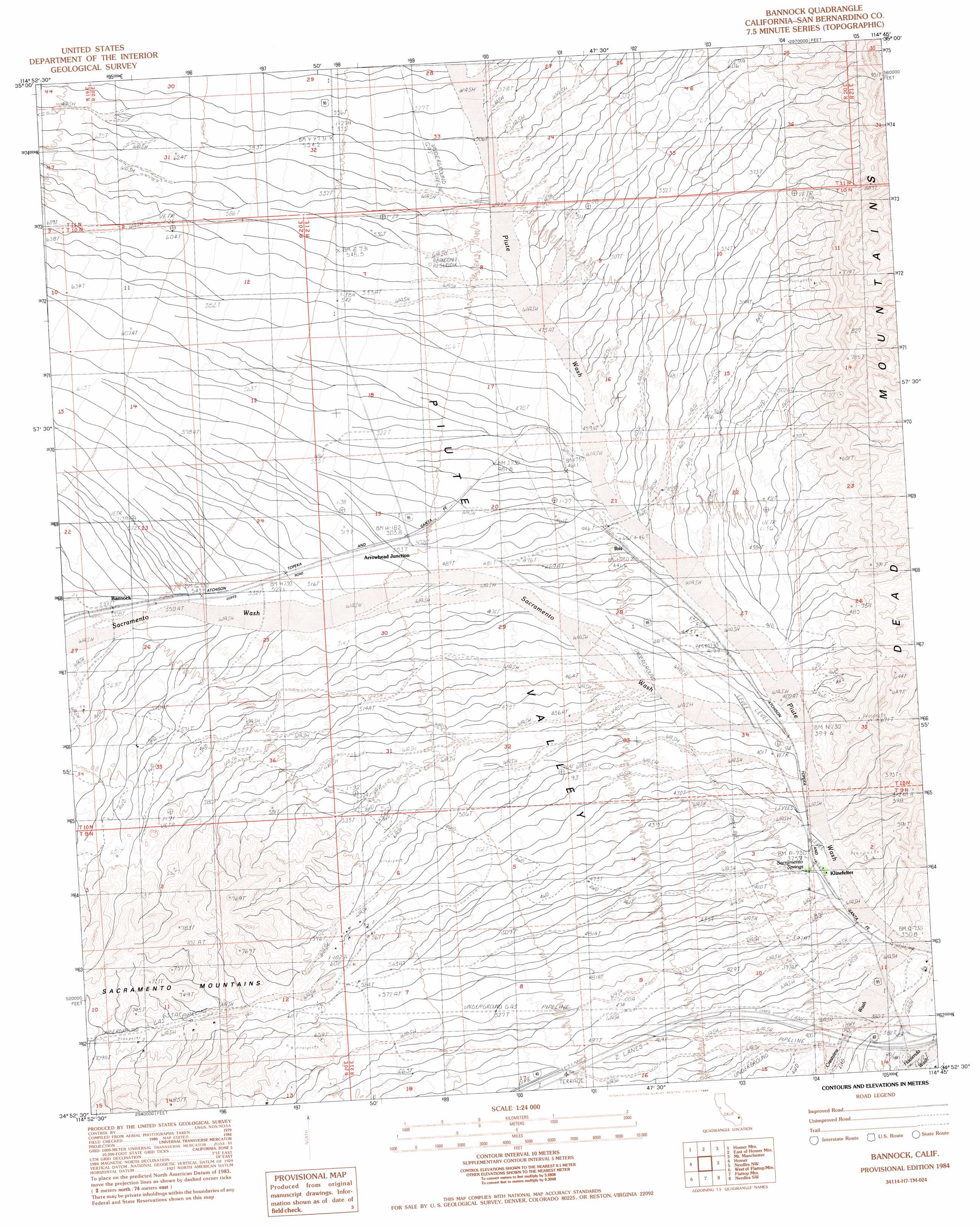
USGS Topo Quad 34114h7 - 1:24,000 scale
| Topo Map Name: | Bannock |
| USGS Topo Quad ID: | 34114h7 |
| Print Size: | ca. 21 1/4" wide x 27" high |
| Southeast Coordinates: | 34.875° N latitude / 114.75° W longitude |
| Map Center Coordinates: | 34.9375° N latitude / 114.8125° W longitude |
| U.S. State: | CA |
| Filename: | o34114h7.jpg |
| Download Map JPG Image: | Bannock topo map 1:24,000 scale |
| Map Type: | Topographic |
| Topo Series: | 7.5´ |
| Map Scale: | 1:24,000 |
| Source of Map Images: | United States Geological Survey (USGS) |
| Alternate Map Versions: |
Bannock CA 1984, updated 1984 Download PDF Buy paper map Bannock CA 2012 Download PDF Buy paper map Bannock CA 2015 Download PDF Buy paper map |
1:24,000 Topo Quads surrounding Bannock
East Of Grotto Hills |
West Of Juniper Mine |
Juniper Mine |
Bridge Canyon |
Davis Dam |
Signal Hill |
Homer Mountain |
East Of Homer Mountain |
Mount Manchester |
Davis Dam Se |
Goffs |
Homer |
Bannock |
Needles Nw |
Needles Ne |
Fenner Spring |
West Of Flattop Mountain |
Flattop Mountain |
Needles Sw |
Needles |
Little Piute Mountains |
Stepladder Mountains Nw |
Stepladder Mountains Ne |
Monumental Pass |
Whale Mountain |
> Back to 34114e1 at 1:100,000 scale
> Back to 34114a1 at 1:250,000 scale
> Back to U.S. Topo Maps home
Bannock topo map: Gazetteer
Bannock: Populated Places
Arrowhead Junction elevation 504m 1653′Bannock elevation 552m 1811′
Ibis elevation 445m 1459′
Klinefelter elevation 376m 1233′
Bannock: Springs
Sacramento Springs elevation 379m 1243′Bannock: Streams
Crestview Wash elevation 351m 1151′Bannock digital topo map on disk
Buy this Bannock topo map showing relief, roads, GPS coordinates and other geographical features, as a high-resolution digital map file on DVD: