Humbug Mountain Topo Map California
To zoom in, hover over the map of Humbug Mountain
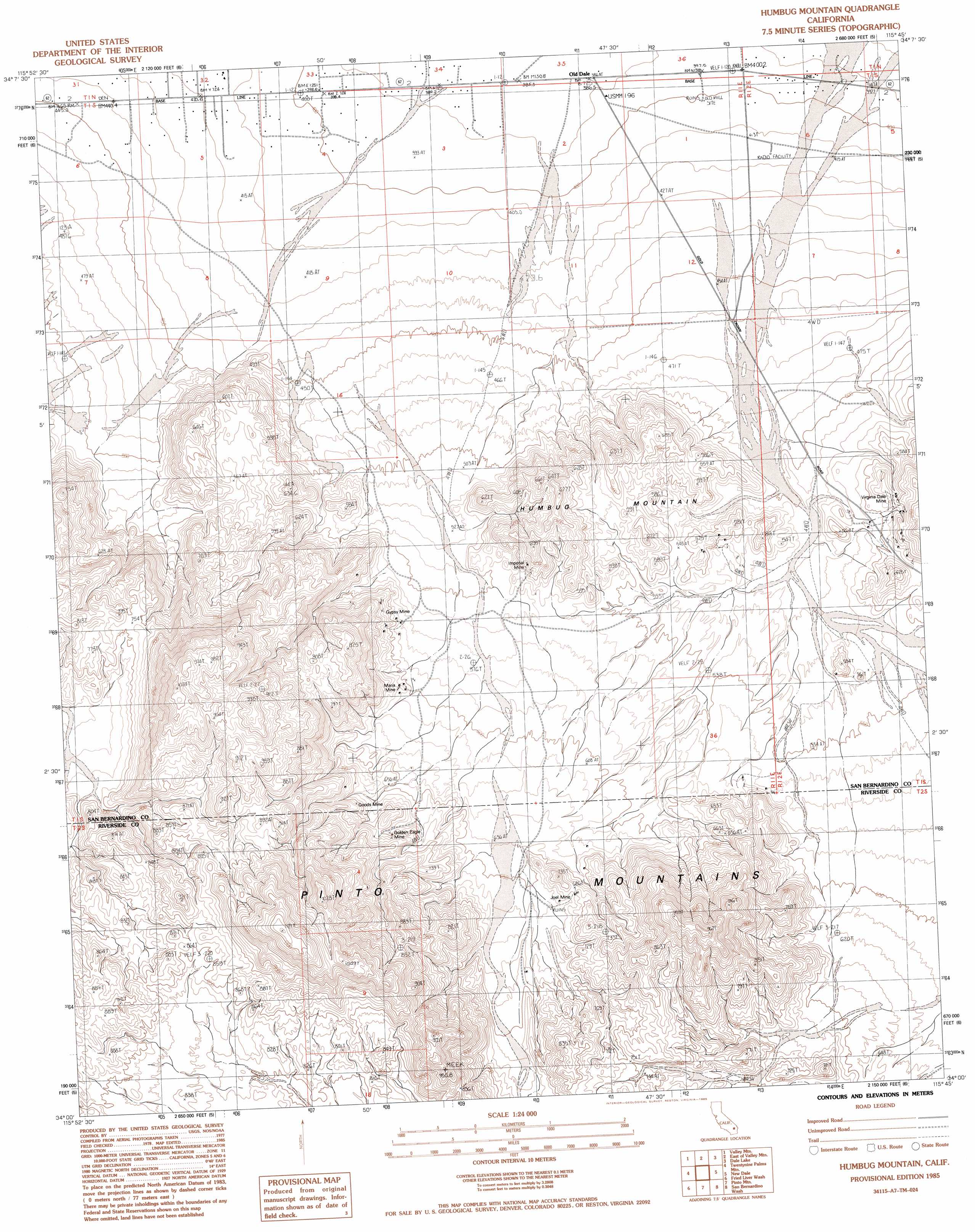
USGS Topo Quad 34115a7 - 1:24,000 scale
| Topo Map Name: | Humbug Mountain |
| USGS Topo Quad ID: | 34115a7 |
| Print Size: | ca. 21 1/4" wide x 27" high |
| Southeast Coordinates: | 34° N latitude / 115.75° W longitude |
| Map Center Coordinates: | 34.0625° N latitude / 115.8125° W longitude |
| U.S. State: | CA |
| Filename: | o34115a7.jpg |
| Download Map JPG Image: | Humbug Mountain topo map 1:24,000 scale |
| Map Type: | Topographic |
| Topo Series: | 7.5´ |
| Map Scale: | 1:24,000 |
| Source of Map Images: | United States Geological Survey (USGS) |
| Alternate Map Versions: |
Humbug Mountain CA 1985, updated 1985 Download PDF Buy paper map Humbug Mountain CA 2012 Download PDF Buy paper map Humbug Mountain CA 2015 Download PDF Buy paper map |
1:24,000 Topo Quads surrounding Humbug Mountain
Deadman Lake Se |
Lead Mountain Sw |
Cleghorn Lakes |
Bristol Lake Sw |
Calumet Mountains |
Twentynine Palms |
Valley Mountain |
East Of Valley Mountain |
Dale Lake |
East Of Dale Lake |
Queen Mountain |
Twentynine Palms Mountain |
Humbug Mountain |
New Dale |
Clarks Pass |
Malapai Hill |
Fried Liver Wash |
Pinto Mountain |
San Bernardino Wash |
Placer Canyon |
Rockhouse Canyon |
Washington Wash |
Porcupine Wash |
Conejo Well |
Buzzard Spring |
> Back to 34115a1 at 1:100,000 scale
> Back to 34114a1 at 1:250,000 scale
> Back to U.S. Topo Maps home
Humbug Mountain topo map: Gazetteer
Humbug Mountain: Mines
Golden Eagle Mine elevation 699m 2293′Goods Mine elevation 711m 2332′
Gypsy Mine elevation 608m 1994′
Imperial Mine elevation 605m 1984′
Joel Mine elevation 669m 2194′
Maria Mine elevation 621m 2037′
Virginia Dale Mine elevation 581m 1906′
Humbug Mountain: Populated Places
Old Dale elevation 387m 1269′Humbug Mountain: Ranges
Pinto Mountains elevation 953m 3126′Humbug Mountain: Summits
Humbug Mountain elevation 614m 2014′Humbug Mountain digital topo map on disk
Buy this Humbug Mountain topo map showing relief, roads, GPS coordinates and other geographical features, as a high-resolution digital map file on DVD: