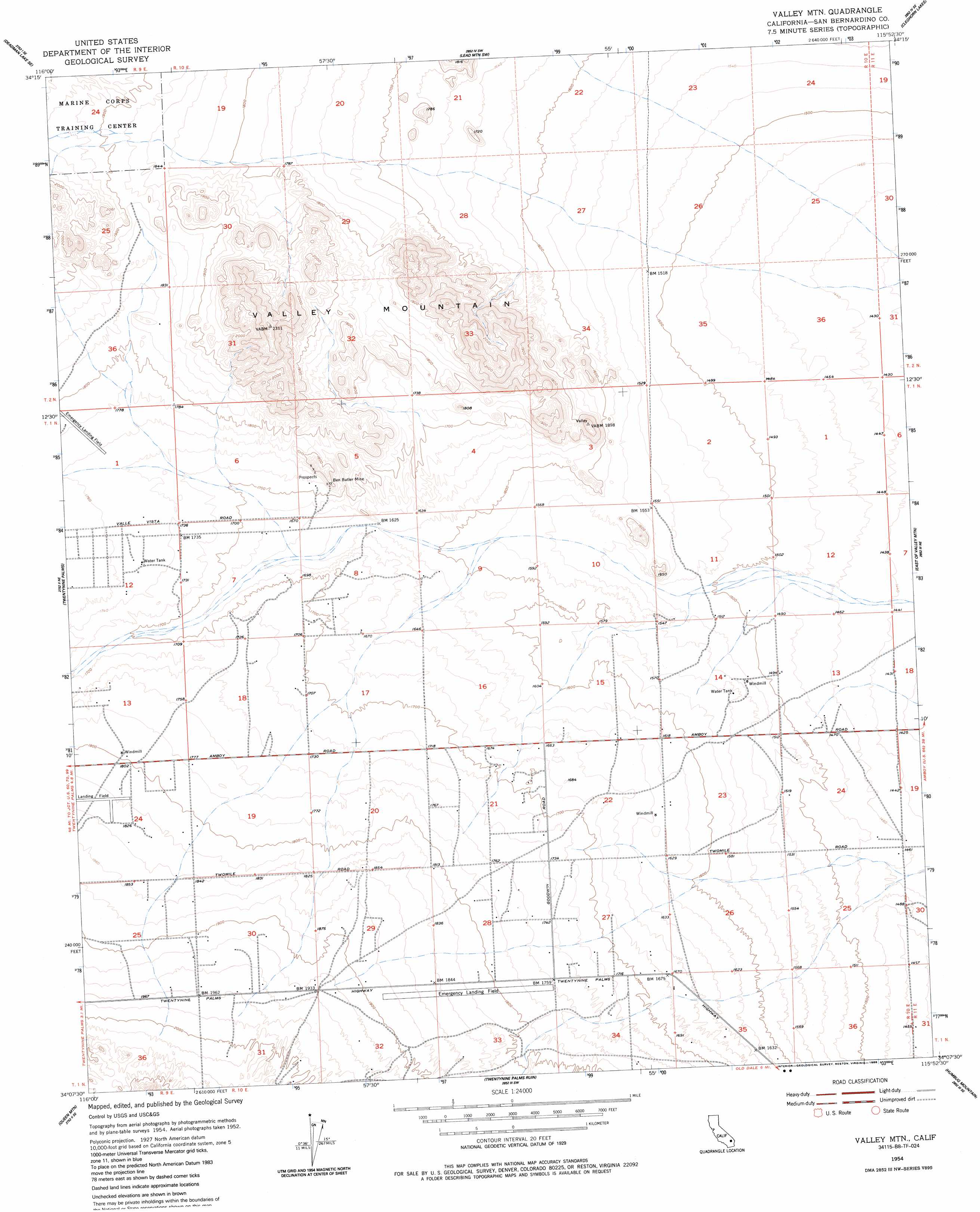
Valley Mountain Topo Map California
To zoom in, hover over the map of Valley Mountain
USGS Topo Quad 34115b8 - 1:24,000 scale
| Topo Map Name: | Valley Mountain |
| USGS Topo Quad ID: | 34115b8 |
| Print Size: | ca. 21 1/4" wide x 27" high |
| Southeast Coordinates: | 34.125° N latitude / 115.875° W longitude |
| Map Center Coordinates: | 34.1875° N latitude / 115.9375° W longitude |
| U.S. State: | CA |
| Filename: | o34115b8.jpg |
| Download Map JPG Image: | Valley Mountain topo map 1:24,000 scale |
| Map Type: | Topographic |
| Topo Series: | 7.5´ |
| Map Scale: | 1:24,000 |
| Source of Map Images: | United States Geological Survey (USGS) |
| Alternate Map Versions: |
Valley Mtn CA 1954, updated 1955 Download PDF Buy paper map Valley Mtn CA 1954, updated 1958 Download PDF Buy paper map Valley Mtn CA 1954, updated 1986 Download PDF Buy paper map Valley Mountain CA 2012 Download PDF Buy paper map Valley Mountain CA 2015 Download PDF Buy paper map |
1:24,000 Topo Quads surrounding Valley Mountain
Deadman Lake Nw |
Deadman Lake Ne |
Lead Mountain |
Lead Mountain Ne |
Bristol Lake Nw |
Deadman Lake Sw |
Deadman Lake Se |
Lead Mountain Sw |
Cleghorn Lakes |
Bristol Lake Sw |
Sunfair |
Twentynine Palms |
Valley Mountain |
East Of Valley Mountain |
Dale Lake |
Indian Cove |
Queen Mountain |
Twentynine Palms Mountain |
Humbug Mountain |
New Dale |
Keys View |
Malapai Hill |
Fried Liver Wash |
Pinto Mountain |
San Bernardino Wash |
> Back to 34115a1 at 1:100,000 scale
> Back to 34114a1 at 1:250,000 scale
> Back to U.S. Topo Maps home
Valley Mountain topo map: Gazetteer
Valley Mountain: Airports
Crosswinds Airport elevation 560m 1837′Dick Dale Skyranch elevation 542m 1778′
Twentynine Palms Airport elevation 563m 1847′
Valley Mountain: Mines
Ben Butler Mine elevation 548m 1797′Valley Mountain: Summits
Valley Mountain elevation 685m 2247′Valley Mountain digital topo map on disk
Buy this Valley Mountain topo map showing relief, roads, GPS coordinates and other geographical features, as a high-resolution digital map file on DVD: