Van Winkle Wash Topo Map California
To zoom in, hover over the map of Van Winkle Wash
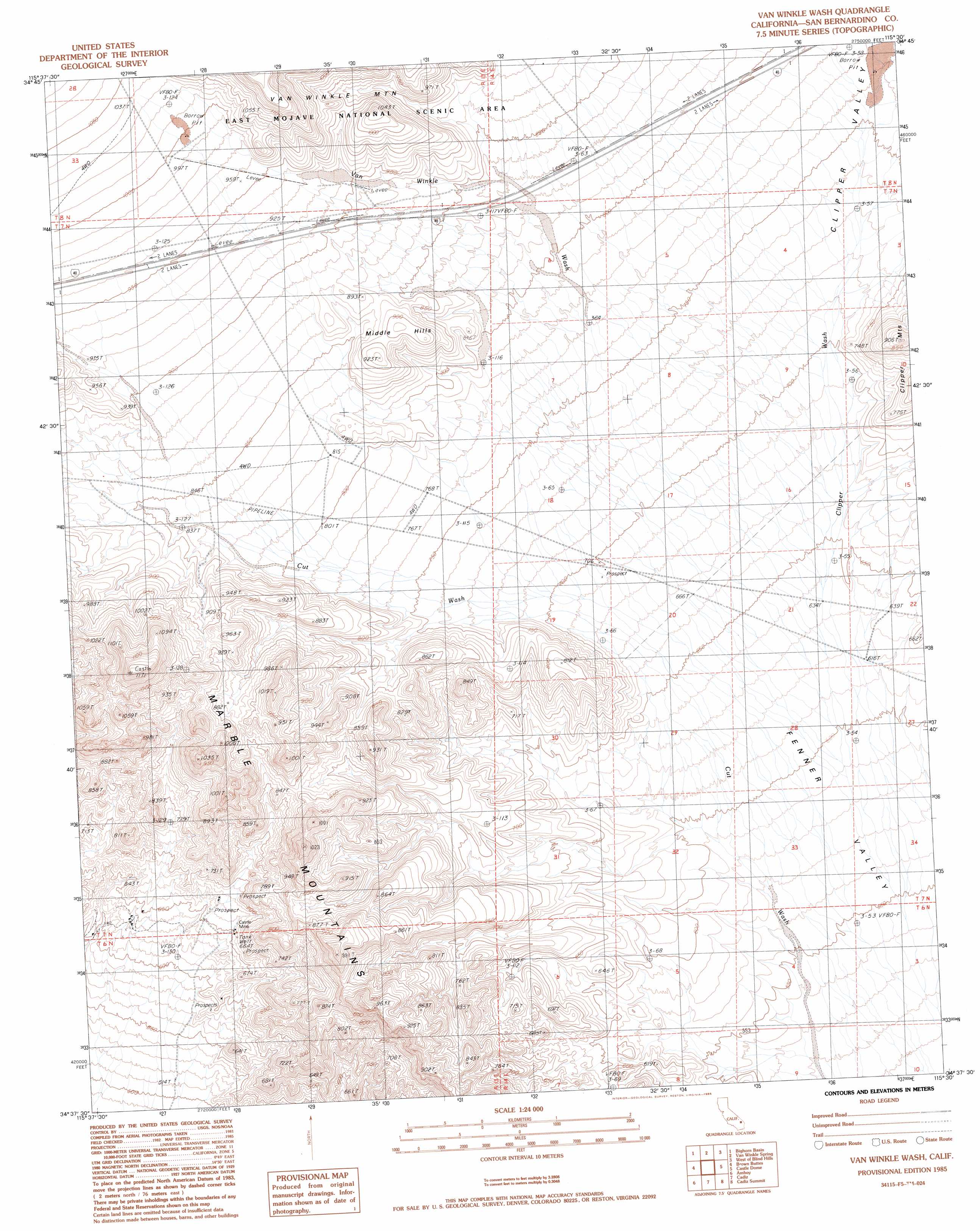
USGS Topo Quad 34115f5 - 1:24,000 scale
| Topo Map Name: | Van Winkle Wash |
| USGS Topo Quad ID: | 34115f5 |
| Print Size: | ca. 21 1/4" wide x 27" high |
| Southeast Coordinates: | 34.625° N latitude / 115.5° W longitude |
| Map Center Coordinates: | 34.6875° N latitude / 115.5625° W longitude |
| U.S. State: | CA |
| Filename: | o34115f5.jpg |
| Download Map JPG Image: | Van Winkle Wash topo map 1:24,000 scale |
| Map Type: | Topographic |
| Topo Series: | 7.5´ |
| Map Scale: | 1:24,000 |
| Source of Map Images: | United States Geological Survey (USGS) |
| Alternate Map Versions: |
Van Winkle Wash CA 1985, updated 1985 Download PDF Buy paper map Van Winkle Wash CA 2012 Download PDF Buy paper map Van Winkle Wash CA 2015 Download PDF Buy paper map |
1:24,000 Topo Quads surrounding Van Winkle Wash
Glasgow |
Kelso Dunes |
Fountain Peak |
Colton Well |
Desert Spring |
Budweiser Wash |
Bighorn Basin |
Van Winkle Spring |
West Of Blind Hills |
Blind Hills |
East Of Siberia |
Brown Buttes |
Van Winkle Wash |
Castle Dome |
Danby |
Amboy Crater |
Amboy |
Cadiz |
Cadiz Summit |
Skeleton Pass |
Lead Mountain Ne |
Bristol Lake Nw |
Calumet Mine |
Cadiz Lake Nw |
Cadiz Lake Ne |
> Back to 34115e1 at 1:100,000 scale
> Back to 34114a1 at 1:250,000 scale
> Back to U.S. Topo Maps home
Van Winkle Wash topo map: Gazetteer
Van Winkle Wash: Mines
Castle Mine elevation 690m 2263′Van Winkle Wash: Ranges
Middle Hills elevation 911m 2988′Van Winkle Wash: Streams
Clipper Wash elevation 611m 2004′Van Winkle Wash elevation 674m 2211′
Van Winkle Wash digital topo map on disk
Buy this Van Winkle Wash topo map showing relief, roads, GPS coordinates and other geographical features, as a high-resolution digital map file on DVD: