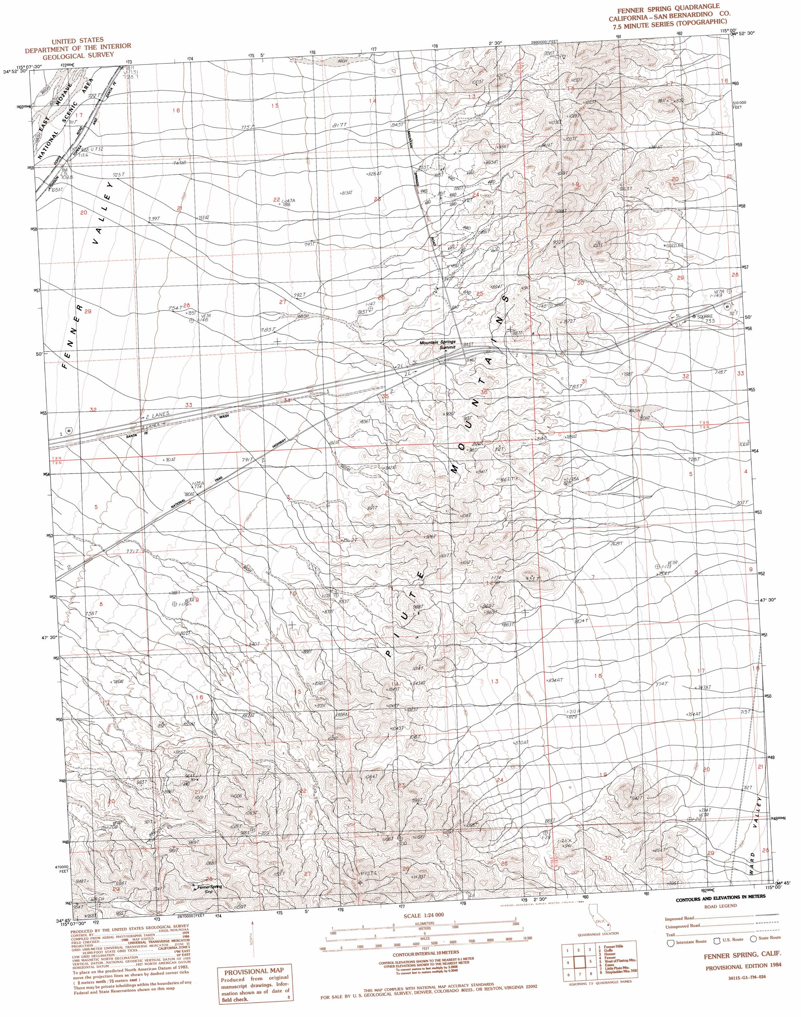
Fenner Spring Topo Map California
To zoom in, hover over the map of Fenner Spring
USGS Topo Quad 34115g1 - 1:24,000 scale
| Topo Map Name: | Fenner Spring |
| USGS Topo Quad ID: | 34115g1 |
| Print Size: | ca. 21 1/4" wide x 27" high |
| Southeast Coordinates: | 34.75° N latitude / 115° W longitude |
| Map Center Coordinates: | 34.8125° N latitude / 115.0625° W longitude |
| U.S. State: | CA |
| Filename: | o34115g1.jpg |
| Download Map JPG Image: | Fenner Spring topo map 1:24,000 scale |
| Map Type: | Topographic |
| Topo Series: | 7.5´ |
| Map Scale: | 1:24,000 |
| Source of Map Images: | United States Geological Survey (USGS) |
| Alternate Map Versions: |
Fenner Spring CA 1984, updated 1984 Download PDF Buy paper map Fenner Spring CA 2012 Download PDF Buy paper map Fenner Spring CA 2015 Download PDF Buy paper map |
1:24,000 Topo Quads surrounding Fenner Spring
Woods Mountains |
Hackberry Mountain |
Signal Hill |
Homer Mountain |
East Of Homer Mountain |
Desert Spring |
Fenner Hills |
Goffs |
Homer |
Bannock |
Blind Hills |
Fenner |
Fenner Spring |
West Of Flattop Mountain |
Flattop Mountain |
Danby |
Essex |
Little Piute Mountains |
Stepladder Mountains Nw |
Stepladder Mountains Ne |
Skeleton Pass |
Old Woman Statue |
Painted Rock Wash |
Stepladder Mountains Sw |
Stepladder Mountains |
> Back to 34115e1 at 1:100,000 scale
> Back to 34114a1 at 1:250,000 scale
> Back to U.S. Topo Maps home
Fenner Spring topo map: Gazetteer
Fenner Spring: Gaps
Mountain Springs Summit elevation 840m 2755′Fenner Spring: Ranges
Piute Mountains elevation 964m 3162′Fenner Spring: Springs
Fenner Spring elevation 965m 3166′Fenner Spring digital topo map on disk
Buy this Fenner Spring topo map showing relief, roads, GPS coordinates and other geographical features, as a high-resolution digital map file on DVD: