Goffs Topo Map California
To zoom in, hover over the map of Goffs
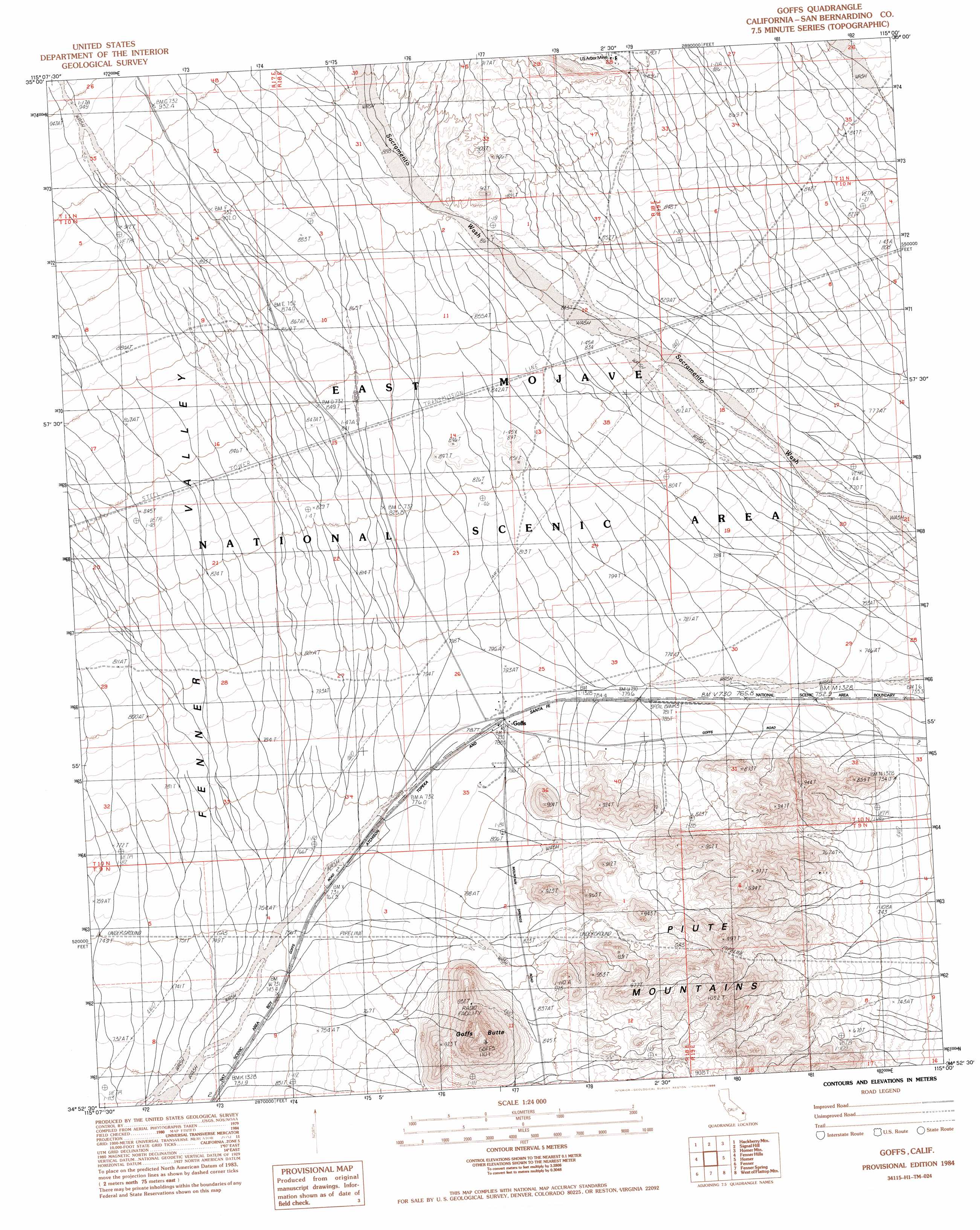
USGS Topo Quad 34115h1 - 1:24,000 scale
| Topo Map Name: | Goffs |
| USGS Topo Quad ID: | 34115h1 |
| Print Size: | ca. 21 1/4" wide x 27" high |
| Southeast Coordinates: | 34.875° N latitude / 115° W longitude |
| Map Center Coordinates: | 34.9375° N latitude / 115.0625° W longitude |
| U.S. State: | CA |
| Filename: | o34115h1.jpg |
| Download Map JPG Image: | Goffs topo map 1:24,000 scale |
| Map Type: | Topographic |
| Topo Series: | 7.5´ |
| Map Scale: | 1:24,000 |
| Source of Map Images: | United States Geological Survey (USGS) |
| Alternate Map Versions: |
Goffs CA 1984, updated 1984 Download PDF Buy paper map Goffs CA 1984, updated 1986 Download PDF Buy paper map Goffs CA 2012 Download PDF Buy paper map Goffs CA 2015 Download PDF Buy paper map |
1:24,000 Topo Quads surrounding Goffs
Pinto Valley |
Grotto Hills |
East Of Grotto Hills |
West Of Juniper Mine |
Juniper Mine |
Woods Mountains |
Hackberry Mountain |
Signal Hill |
Homer Mountain |
East Of Homer Mountain |
Desert Spring |
Fenner Hills |
Goffs |
Homer |
Bannock |
Blind Hills |
Fenner |
Fenner Spring |
West Of Flattop Mountain |
Flattop Mountain |
Danby |
Essex |
Little Piute Mountains |
Stepladder Mountains Nw |
Stepladder Mountains Ne |
> Back to 34115e1 at 1:100,000 scale
> Back to 34114a1 at 1:250,000 scale
> Back to U.S. Topo Maps home
Goffs topo map: Gazetteer
Goffs: Mines
United States Arbor Mine elevation 912m 2992′Goffs: Populated Places
Goffs elevation 791m 2595′Goffs: Summits
Goffs Butte elevation 1099m 3605′Goffs digital topo map on disk
Buy this Goffs topo map showing relief, roads, GPS coordinates and other geographical features, as a high-resolution digital map file on DVD: