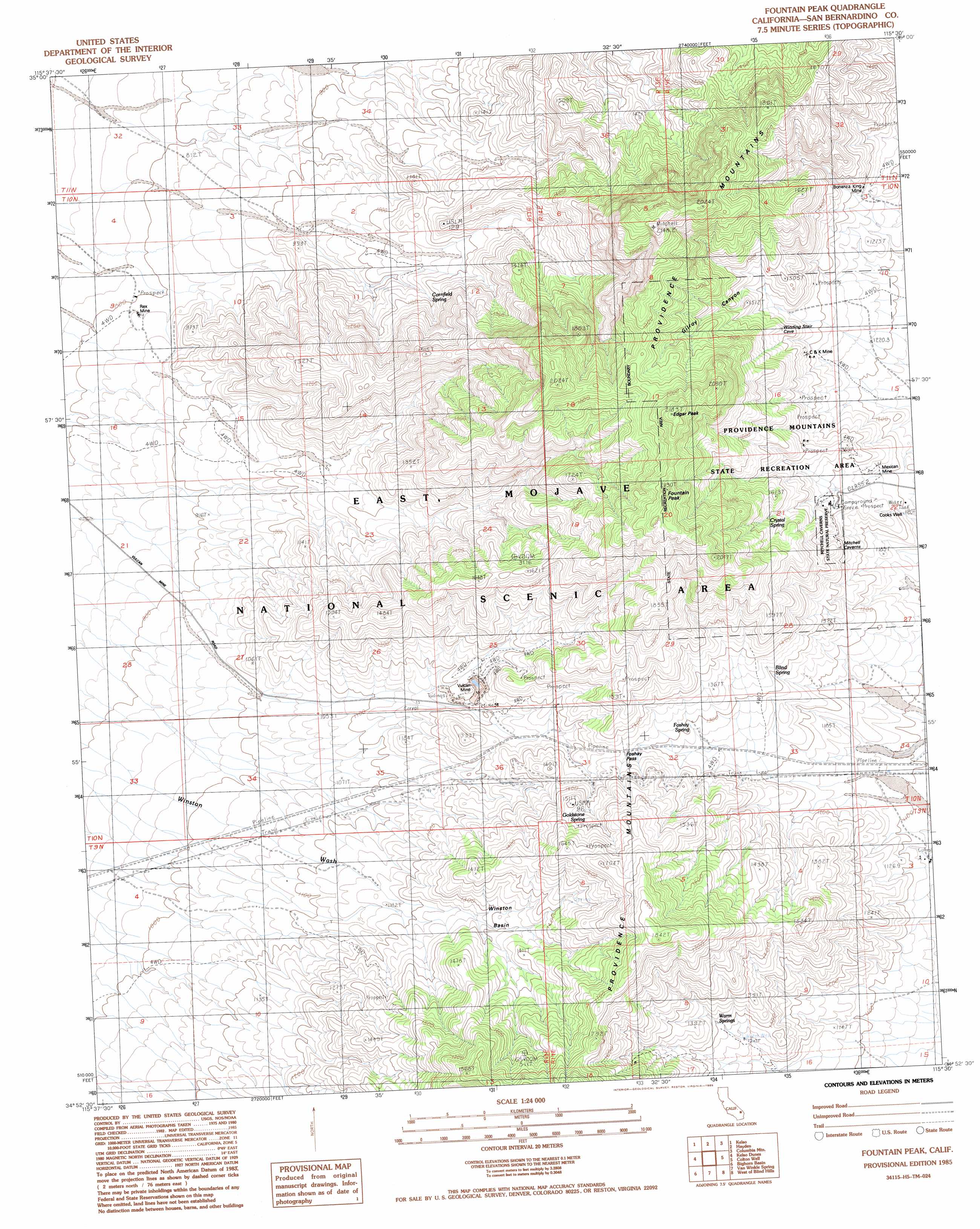
Fountain Peak Topo Map California
To zoom in, hover over the map of Fountain Peak
USGS Topo Quad 34115h5 - 1:24,000 scale
| Topo Map Name: | Fountain Peak |
| USGS Topo Quad ID: | 34115h5 |
| Print Size: | ca. 21 1/4" wide x 27" high |
| Southeast Coordinates: | 34.875° N latitude / 115.5° W longitude |
| Map Center Coordinates: | 34.9375° N latitude / 115.5625° W longitude |
| U.S. State: | CA |
| Filename: | o34115h5.jpg |
| Download Map JPG Image: | Fountain Peak topo map 1:24,000 scale |
| Map Type: | Topographic |
| Topo Series: | 7.5´ |
| Map Scale: | 1:24,000 |
| Source of Map Images: | United States Geological Survey (USGS) |
| Alternate Map Versions: |
Fountain Peak CA 1985, updated 1985 Download PDF Buy paper map Fountain Peak CA 2012 Download PDF Buy paper map Fountain Peak CA 2015 Download PDF Buy paper map |
1:24,000 Topo Quads surrounding Fountain Peak
Indian Spring |
Marl Mountains |
Cima |
Mid Hills |
Pinto Valley |
Old Dad Mountain |
Kelso |
Hayden |
Columbia Mountain |
Woods Mountains |
Glasgow |
Kelso Dunes |
Fountain Peak |
Colton Well |
Desert Spring |
Budweiser Wash |
Bighorn Basin |
Van Winkle Spring |
West Of Blind Hills |
Blind Hills |
East Of Siberia |
Brown Buttes |
Van Winkle Wash |
Castle Dome |
Danby |
> Back to 34115e1 at 1:100,000 scale
> Back to 34114a1 at 1:250,000 scale
> Back to U.S. Topo Maps home
Fountain Peak topo map: Gazetteer
Fountain Peak: Basins
Winston Basin elevation 1302m 4271′Fountain Peak: Gaps
Foshay Pass elevation 1340m 4396′Fountain Peak: Mines
Bonanza King Mine elevation 1318m 4324′C and K Mine elevation 1301m 4268′
Mexican Mine elevation 1248m 4094′
Rex Mine elevation 805m 2641′
Vulcan Mine elevation 1201m 3940′
Fountain Peak: Parks
Mitchell Caverns State Park elevation 1376m 4514′Providence Mountains State Recreation Area elevation 1244m 4081′
Fountain Peak: Springs
Blind Spring elevation 1289m 4229′Cornfield Spring elevation 1066m 3497′
Crystal Spring elevation 1499m 4917′
Foshay Spring elevation 1283m 4209′
Goldstone Spring elevation 1418m 4652′
Warm Springs elevation 1297m 4255′
Fountain Peak: Summits
Edgar Peak elevation 2183m 7162′Fountain Peak elevation 2126m 6975′
Fountain Peak: Valleys
Gilroy Canyon elevation 1305m 4281′Fountain Peak: Wells
Cooks Well elevation 1181m 3874′Fountain Peak digital topo map on disk
Buy this Fountain Peak topo map showing relief, roads, GPS coordinates and other geographical features, as a high-resolution digital map file on DVD: