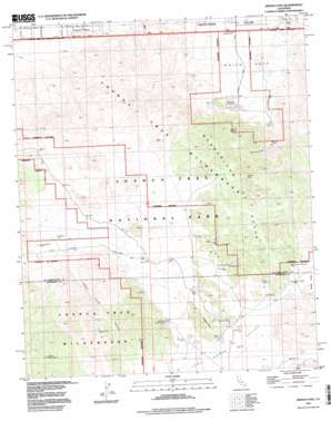
Indian Cove Topo Map California
To zoom in, hover over the map of Indian Cove
USGS Topo Quad 34116a2 - 1:24,000 scale
| Topo Map Name: | Indian Cove |
| USGS Topo Quad ID: | 34116a2 |
| Print Size: | ca. 21 1/4" wide x 27" high |
| Southeast Coordinates: | 34° N latitude / 116.125° W longitude |
| Map Center Coordinates: | 34.0625° N latitude / 116.1875° W longitude |
| U.S. State: | CA |
| Filename: | o34116a2.jpg |
| Download Map JPG Image: | Indian Cove topo map 1:24,000 scale |
| Map Type: | Topographic |
| Topo Series: | 7.5´ |
| Map Scale: | 1:24,000 |
| Source of Map Images: | United States Geological Survey (USGS) |
| Alternate Map Versions: |
Indian Cove CA 1972, updated 1975 Download PDF Buy paper map Indian Cove CA 1972, updated 1994 Download PDF Buy paper map Indian Cove CA 1995, updated 1998 Download PDF Buy paper map Indian Cove CA 1995, updated 1998 Download PDF Buy paper map Indian Cove CA 2012 Download PDF Buy paper map Indian Cove CA 2015 Download PDF Buy paper map |
1:24,000 Topo Quads surrounding Indian Cove
> Back to 34116a1 at 1:100,000 scale
> Back to 34116a1 at 1:250,000 scale
> Back to U.S. Topo Maps home
Indian Cove topo map: Gazetteer
Indian Cove: Areas
Wonderland of Rocks elevation 1353m 4438′Indian Cove: Arroyos
Wonderland Ranch Wash elevation 1037m 3402′Indian Cove: Basins
Willow Hole elevation 1241m 4071′Indian Cove: Dams
Barker Dam elevation 1303m 4274′Cow Camp Dam elevation 1278m 4192′
Indian Cove: Mines
Lang Mine elevation 1455m 4773′Indian Cove: Pillars
Samuelsons Rock elevation 1147m 3763′Indian Cove: Populated Places
Panorama Heights elevation 814m 2670′Indian Cove: Springs
Johnson Spring elevation 1050m 3444′Sneakeye Spring elevation 1060m 3477′
Indian Cove: Summits
Quail Mountain elevation 1772m 5813′Indian Cove: Trails
Ryan Mountain Trail elevation 1362m 4468′Indian Cove: Valleys
Hidden Valley elevation 1237m 4058′Indian Cove elevation 823m 2700′
Johnny Lang Canyon elevation 1170m 3838′
Lost Horse Valley elevation 1254m 4114′
Queen Valley elevation 1307m 4288′
Rattlesnake Canyon elevation 930m 3051′
Indian Cove: Wells
Desert Queen Well elevation 1311m 4301′Indian Cove digital topo map on disk
Buy this Indian Cove topo map showing relief, roads, GPS coordinates and other geographical features, as a high-resolution digital map file on DVD:


