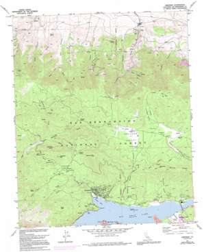
Fawnskin Topo Map California
To zoom in, hover over the map of Fawnskin
USGS Topo Quad 34116c8 - 1:24,000 scale
| Topo Map Name: | Fawnskin |
| USGS Topo Quad ID: | 34116c8 |
| Print Size: | ca. 21 1/4" wide x 27" high |
| Southeast Coordinates: | 34.25° N latitude / 116.875° W longitude |
| Map Center Coordinates: | 34.3125° N latitude / 116.9375° W longitude |
| U.S. State: | CA |
| Filename: | o34116c8.jpg |
| Download Map JPG Image: | Fawnskin topo map 1:24,000 scale |
| Map Type: | Topographic |
| Topo Series: | 7.5´ |
| Map Scale: | 1:24,000 |
| Source of Map Images: | United States Geological Survey (USGS) |
| Alternate Map Versions: |
Fawnskin CA 1971, updated 1975 Download PDF Buy paper map Fawnskin CA 1971, updated 1991 Download PDF Buy paper map Fawnskin CA 1971, updated 1999 Download PDF Buy paper map Fawnskin CA 1996, updated 1999 Download PDF Buy paper map Fawnskin CA 2012 Download PDF Buy paper map Fawnskin CA 2015 Download PDF Buy paper map |
| FStopo: | US Forest Service topo Fawnskin is available: Download FStopo PDF Download FStopo TIF |
1:24,000 Topo Quads surrounding Fawnskin
> Back to 34116a1 at 1:100,000 scale
> Back to 34116a1 at 1:250,000 scale
> Back to U.S. Topo Maps home
Fawnskin topo map: Gazetteer
Fawnskin: Basins
Fawnskin Valley elevation 2186m 7171′Fawnskin: Bays
Grout Bay elevation 2057m 6748′Shelter Cove elevation 2057m 6748′
Fawnskin: Capes
Eagle Point elevation 2068m 6784′Gilner Point elevation 2062m 6765′
Juniper Point elevation 2061m 6761′
Juniper Point elevation 2062m 6765′
Lagonita Point elevation 2056m 6745′
Windy Point elevation 2061m 6761′
Fawnskin: Flats
Hanna Flat elevation 2146m 7040′John Bull Flat elevation 2455m 8054′
Fawnskin: Mines
Arctic Canyon Pit elevation 1489m 4885′Greenlead Mine elevation 2238m 7342′
Harvey K Mine elevation 2292m 7519′
Wright Mine elevation 2069m 6788′
Fawnskin: Parks
Grout Bay Recreation Area elevation 2076m 6811′North Shore Recreation Area elevation 2086m 6843′
Fawnskin: Populated Places
Fawnskin elevation 2081m 6827′Minnelusa elevation 2114m 6935′
Fawnskin: Post Offices
Fawnskin Post Office elevation 2061m 6761′Fawnskin: Ridges
Bertha Ridge elevation 2421m 7942′Fawnskin: Springs
Delamar Spring elevation 2288m 7506′Furnace Spring elevation 1373m 4504′
Harry Spring elevation 2116m 6942′
Hitchcock Spring elevation 2206m 7237′
Little Bear Spring elevation 2106m 6909′
Quail Spring elevation 1472m 4829′
Fawnskin: Streams
Crystal Creek elevation 1216m 3989′Greenlead Creek elevation 1995m 6545′
Grout Creek elevation 2058m 6751′
Rathbun Creek elevation 2057m 6748′
Fawnskin: Summits
Bertha Peak elevation 2499m 8198′Delamar Mountain elevation 2553m 8375′
Grays Peak elevation 2414m 7919′
Hanna Rocks elevation 2356m 7729′
Little Bear Peak elevation 2321m 7614′
Fawnskin: Valleys
Arctic Canyon elevation 1392m 4566′Bousic Canyon elevation 1260m 4133′
Dry Canyon elevation 1376m 4514′
East Fork Dry Canyon elevation 1636m 5367′
Furnace Canyon elevation 1342m 4402′
Holcomb Valley elevation 2193m 7194′
Minnelusa Canyon elevation 2057m 6748′
Poligue Canyon elevation 2057m 6748′
Upper Holcomb Valley elevation 2232m 7322′
West Fork Dry Canyon elevation 1636m 5367′
Wild Rose Canyon elevation 1579m 5180′
Fawnskin digital topo map on disk
Buy this Fawnskin topo map showing relief, roads, GPS coordinates and other geographical features, as a high-resolution digital map file on DVD:


