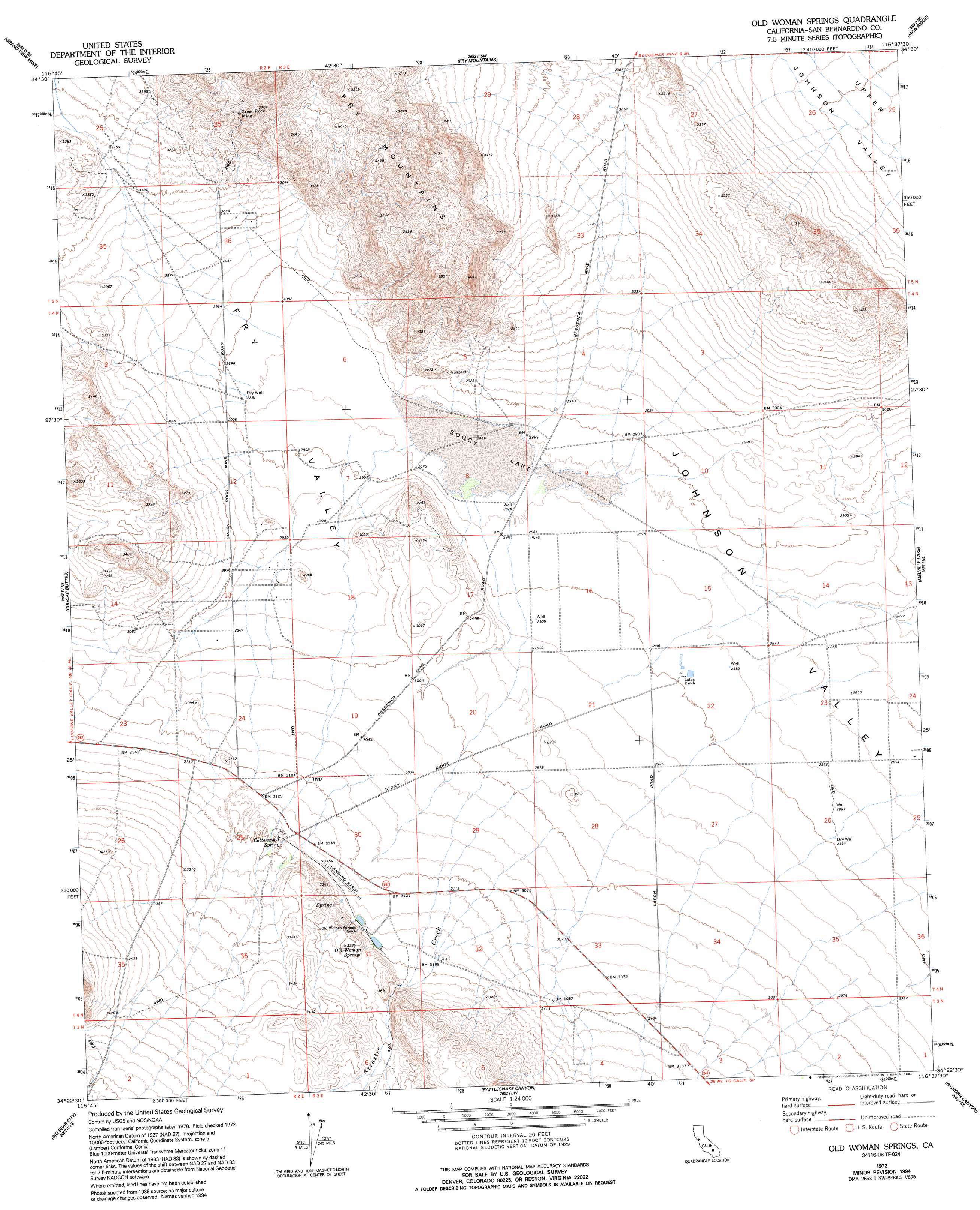
Old Woman Springs Topo Map California
To zoom in, hover over the map of Old Woman Springs
USGS Topo Quad 34116d6 - 1:24,000 scale
| Topo Map Name: | Old Woman Springs |
| USGS Topo Quad ID: | 34116d6 |
| Print Size: | ca. 21 1/4" wide x 27" high |
| Southeast Coordinates: | 34.375° N latitude / 116.625° W longitude |
| Map Center Coordinates: | 34.4375° N latitude / 116.6875° W longitude |
| U.S. State: | CA |
| Filename: | o34116d6.jpg |
| Download Map JPG Image: | Old Woman Springs topo map 1:24,000 scale |
| Map Type: | Topographic |
| Topo Series: | 7.5´ |
| Map Scale: | 1:24,000 |
| Source of Map Images: | United States Geological Survey (USGS) |
| Alternate Map Versions: |
Old Woman Springs CA 1972, updated 1975 Download PDF Buy paper map Old Woman Springs CA 1972, updated 1994 Download PDF Buy paper map Old Woman Springs CA 1999, updated 2002 Download PDF Buy paper map Old Woman Springs CA 2012 Download PDF Buy paper map Old Woman Springs CA 2015 Download PDF Buy paper map |
1:24,000 Topo Quads surrounding Old Woman Springs
West Ord Mountain |
Ord Mountain |
Camp Rock Mine |
Silver Bell Mine |
Sunshine Peak |
White Horse Mountain |
Grand View Mine |
Fry Mountains |
Iron Ridge |
Galway Lake |
Lucerne Valley |
Cougar Buttes |
Old Woman Springs |
Melville Lake |
Emerson Lake |
Fawnskin |
Big Bear City |
Rattlesnake Canyon |
Bighorn Canyon |
Landers |
Big Bear Lake |
Moonridge |
Onyx Peak |
Rimrock |
Yucca Valley North |
> Back to 34116a1 at 1:100,000 scale
> Back to 34116a1 at 1:250,000 scale
> Back to U.S. Topo Maps home
Old Woman Springs topo map: Gazetteer
Old Woman Springs: Basins
Fry Valley elevation 880m 2887′Old Woman Springs: Flats
Soggy Lake elevation 875m 2870′Old Woman Springs: Mines
Green Rock Mine elevation 1082m 3549′Old Woman Springs: Springs
Cottonwood Spring elevation 968m 3175′Old Woman Spring elevation 991m 3251′
Old Woman Springs: Streams
Arrastre Creek elevation 909m 2982′Old Woman Springs digital topo map on disk
Buy this Old Woman Springs topo map showing relief, roads, GPS coordinates and other geographical features, as a high-resolution digital map file on DVD: