Galway Lake Topo Map California
To zoom in, hover over the map of Galway Lake
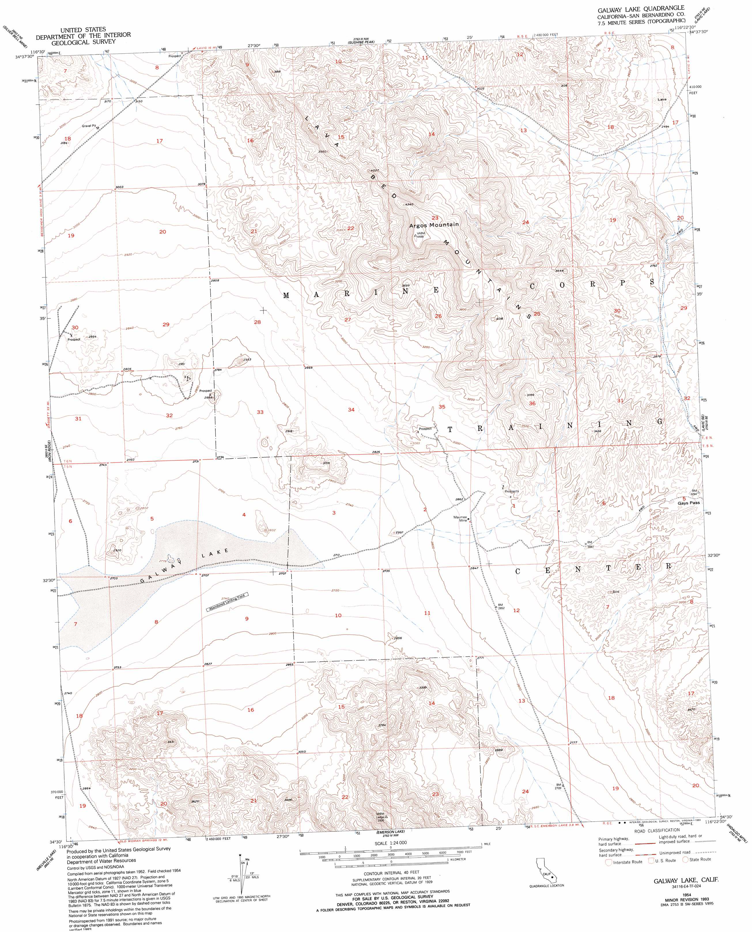
USGS Topo Quad 34116e4 - 1:24,000 scale
| Topo Map Name: | Galway Lake |
| USGS Topo Quad ID: | 34116e4 |
| Print Size: | ca. 21 1/4" wide x 27" high |
| Southeast Coordinates: | 34.5° N latitude / 116.375° W longitude |
| Map Center Coordinates: | 34.5625° N latitude / 116.4375° W longitude |
| U.S. State: | CA |
| Filename: | o34116e4.jpg |
| Download Map JPG Image: | Galway Lake topo map 1:24,000 scale |
| Map Type: | Topographic |
| Topo Series: | 7.5´ |
| Map Scale: | 1:24,000 |
| Source of Map Images: | United States Geological Survey (USGS) |
| Alternate Map Versions: |
Galway Lake CA 1954, updated 1955 Download PDF Buy paper map Galway Lake CA 1954, updated 1965 Download PDF Buy paper map Galway Lake CA 1954, updated 1986 Download PDF Buy paper map Galway Lake CA 1954, updated 1993 Download PDF Buy paper map Galway Lake CA 2012 Download PDF Buy paper map Galway Lake CA 2015 Download PDF Buy paper map |
1:24,000 Topo Quads surrounding Galway Lake
Newberry Springs |
Troy Lake |
Hector |
Sleeping Beauty |
Broadwell Lake |
Camp Rock Mine |
Silver Bell Mine |
Sunshine Peak |
Lavic Lake |
Ludlow |
Fry Mountains |
Iron Ridge |
Galway Lake |
Lavic Se |
Morgans Well |
Old Woman Springs |
Melville Lake |
Emerson Lake |
Hidalgo Mountain |
Deadman Lake Nw |
Rattlesnake Canyon |
Bighorn Canyon |
Landers |
Goat Mountain |
Deadman Lake Sw |
> Back to 34116e1 at 1:100,000 scale
> Back to 34116a1 at 1:250,000 scale
> Back to U.S. Topo Maps home
Galway Lake topo map: Gazetteer
Galway Lake: Flats
Galway Lake elevation 843m 2765′Galway Lake: Gaps
Gays Pass elevation 1008m 3307′Galway Lake: Mines
Maumee Mine elevation 873m 2864′Galway Lake: Summits
Argos Mountain elevation 1365m 4478′Galway Lake digital topo map on disk
Buy this Galway Lake topo map showing relief, roads, GPS coordinates and other geographical features, as a high-resolution digital map file on DVD: