Troy Lake Topo Map California
To zoom in, hover over the map of Troy Lake
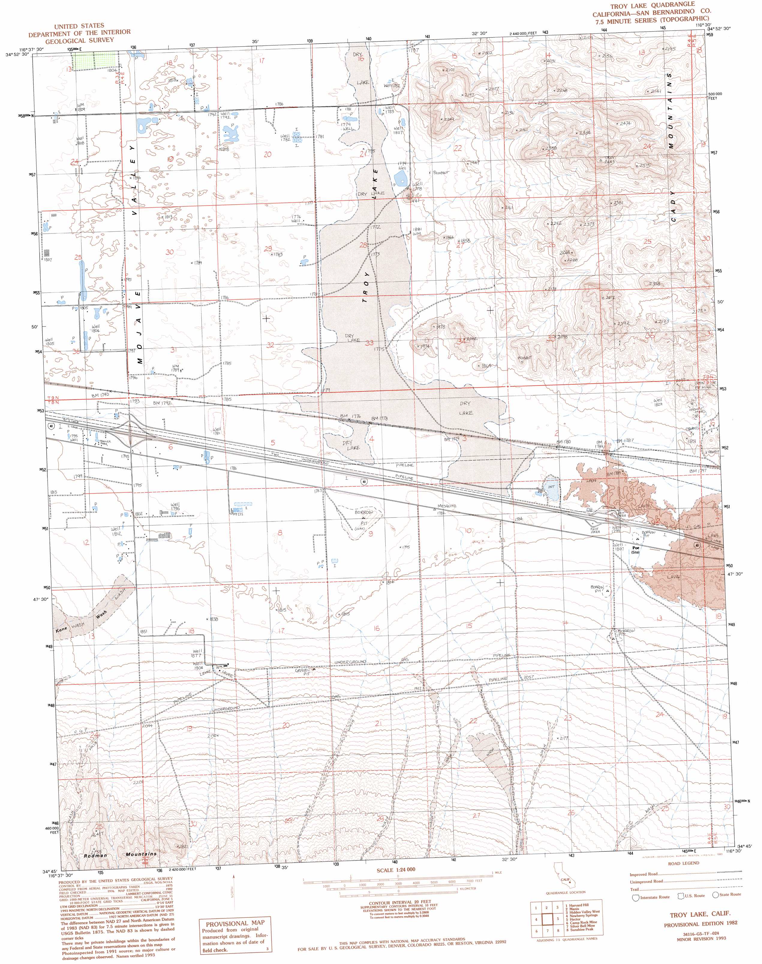
USGS Topo Quad 34116g5 - 1:24,000 scale
| Topo Map Name: | Troy Lake |
| USGS Topo Quad ID: | 34116g5 |
| Print Size: | ca. 21 1/4" wide x 27" high |
| Southeast Coordinates: | 34.75° N latitude / 116.5° W longitude |
| Map Center Coordinates: | 34.8125° N latitude / 116.5625° W longitude |
| U.S. State: | CA |
| Filename: | o34116g5.jpg |
| Download Map JPG Image: | Troy Lake topo map 1:24,000 scale |
| Map Type: | Topographic |
| Topo Series: | 7.5´ |
| Map Scale: | 1:24,000 |
| Source of Map Images: | United States Geological Survey (USGS) |
| Alternate Map Versions: |
Troy Lake CA 1982, updated 1982 Download PDF Buy paper map Troy Lake CA 1982, updated 1993 Download PDF Buy paper map Troy Lake CA 2012 Download PDF Buy paper map Troy Lake CA 2015 Download PDF Buy paper map |
1:24,000 Topo Quads surrounding Troy Lake
Coyote Lake |
Alvord Mountain West |
Alvord Mountain East |
Dunn |
Cave Mountain |
Yermo |
Harvard Hill |
Manix |
Hidden Valley West |
Hidden Valley East |
Minneola |
Newberry Springs |
Troy Lake |
Hector |
Sleeping Beauty |
Ord Mountain |
Camp Rock Mine |
Silver Bell Mine |
Sunshine Peak |
Lavic Lake |
Grand View Mine |
Fry Mountains |
Iron Ridge |
Galway Lake |
Lavic Se |
> Back to 34116e1 at 1:100,000 scale
> Back to 34116a1 at 1:250,000 scale
> Back to U.S. Topo Maps home
Troy Lake topo map: Gazetteer
Troy Lake: Flats
Troy Lake elevation 543m 1781′Troy Lake: Populated Places
Poe (historical) elevation 552m 1811′Troy Lake: Streams
Kane Wash elevation 548m 1797′Troy Lake digital topo map on disk
Buy this Troy Lake topo map showing relief, roads, GPS coordinates and other geographical features, as a high-resolution digital map file on DVD: