Manix Topo Map California
To zoom in, hover over the map of Manix
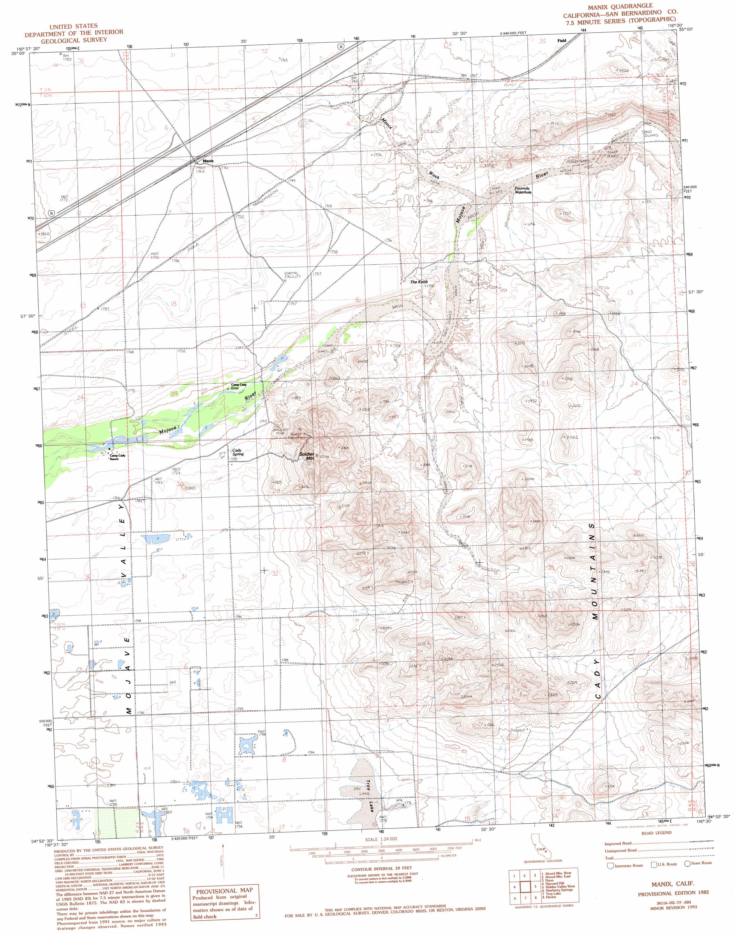
USGS Topo Quad 34116h5 - 1:24,000 scale
| Topo Map Name: | Manix |
| USGS Topo Quad ID: | 34116h5 |
| Print Size: | ca. 21 1/4" wide x 27" high |
| Southeast Coordinates: | 34.875° N latitude / 116.5° W longitude |
| Map Center Coordinates: | 34.9375° N latitude / 116.5625° W longitude |
| U.S. State: | CA |
| Filename: | o34116h5.jpg |
| Download Map JPG Image: | Manix topo map 1:24,000 scale |
| Map Type: | Topographic |
| Topo Series: | 7.5´ |
| Map Scale: | 1:24,000 |
| Source of Map Images: | United States Geological Survey (USGS) |
| Alternate Map Versions: |
Manix CA 1982, updated 1982 Download PDF Buy paper map Manix CA 1982, updated 1993 Download PDF Buy paper map Manix CA 1982, updated 1993 Download PDF Buy paper map Manix CA 1982, updated 1993 Download PDF Buy paper map Manix CA 2012 Download PDF Buy paper map Manix CA 2015 Download PDF Buy paper map |
1:24,000 Topo Quads surrounding Manix
Paradise Range |
Langford Well |
East Of Langford Well |
Bitter Spring |
Cronise Lakes |
Coyote Lake |
Alvord Mountain West |
Alvord Mountain East |
Dunn |
Cave Mountain |
Yermo |
Harvard Hill |
Manix |
Hidden Valley West |
Hidden Valley East |
Minneola |
Newberry Springs |
Troy Lake |
Hector |
Sleeping Beauty |
Ord Mountain |
Camp Rock Mine |
Silver Bell Mine |
Sunshine Peak |
Lavic Lake |
> Back to 34116e1 at 1:100,000 scale
> Back to 34116a1 at 1:250,000 scale
> Back to U.S. Topo Maps home
Manix topo map: Gazetteer
Manix: Populated Places
Manix elevation 537m 1761′Manix: Reservoirs
Fourmile Waterhole elevation 491m 1610′Manix: Springs
Cady Spring elevation 527m 1729′Manix: Streams
Manix Wash elevation 494m 1620′Manix: Summits
The Knob elevation 532m 1745′Manix digital topo map on disk
Buy this Manix topo map showing relief, roads, GPS coordinates and other geographical features, as a high-resolution digital map file on DVD: