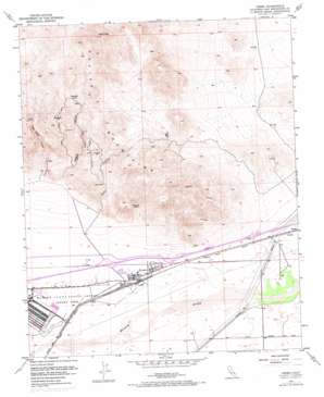
Yermo Topo Map California
To zoom in, hover over the map of Yermo
USGS Topo Quad 34116h7 - 1:24,000 scale
| Topo Map Name: | Yermo |
| USGS Topo Quad ID: | 34116h7 |
| Print Size: | ca. 21 1/4" wide x 27" high |
| Southeast Coordinates: | 34.875° N latitude / 116.75° W longitude |
| Map Center Coordinates: | 34.9375° N latitude / 116.8125° W longitude |
| U.S. State: | CA |
| Filename: | o34116h7.jpg |
| Download Map JPG Image: | Yermo topo map 1:24,000 scale |
| Map Type: | Topographic |
| Topo Series: | 7.5´ |
| Map Scale: | 1:24,000 |
| Source of Map Images: | United States Geological Survey (USGS) |
| Alternate Map Versions: |
Yermo CA 1953, updated 1954 Download PDF Buy paper map Yermo CA 1953, updated 1960 Download PDF Buy paper map Yermo CA 1953, updated 1971 Download PDF Buy paper map Yermo CA 2012 Download PDF Buy paper map Yermo CA 2015 Download PDF Buy paper map |
1:24,000 Topo Quads surrounding Yermo
> Back to 34116e1 at 1:100,000 scale
> Back to 34116a1 at 1:250,000 scale
> Back to U.S. Topo Maps home
Yermo topo map: Gazetteer
Yermo: Arches
Kramer Arch elevation 786m 2578′Yermo: Gaps
Tin Can Alley elevation 794m 2604′Yermo: Mines
Saint Louis Mine elevation 886m 2906′Yermo: Parks
Hurst Park elevation 591m 1938′Smith Park elevation 588m 1929′
Yarrow Ravine Rattlesnake Habitat Area elevation 689m 2260′
Yermo: Pillars
Camp Rock elevation 762m 2500′Chimney Rock elevation 736m 2414′
Yermo: Populated Places
Bismarck (historical) elevation 934m 3064′Calico elevation 696m 2283′
Yermo elevation 588m 1929′
Yermo: Ranges
Calico Mountains elevation 1062m 3484′Yermo: Springs
Sweetwater Spring elevation 930m 3051′Yermo: Summits
Calico Peak elevation 1370m 4494′Yermo: Valleys
Mule Canyon elevation 662m 2171′Odessa Canyon elevation 665m 2181′
Sunrise Canyon elevation 675m 2214′
Wall Street Canyon elevation 652m 2139′
Yermo digital topo map on disk
Buy this Yermo topo map showing relief, roads, GPS coordinates and other geographical features, as a high-resolution digital map file on DVD:


