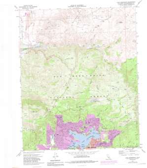
Lake Arrowhead Topo Map California
To zoom in, hover over the map of Lake Arrowhead
USGS Topo Quad 34117c2 - 1:24,000 scale
| Topo Map Name: | Lake Arrowhead |
| USGS Topo Quad ID: | 34117c2 |
| Print Size: | ca. 21 1/4" wide x 27" high |
| Southeast Coordinates: | 34.25° N latitude / 117.125° W longitude |
| Map Center Coordinates: | 34.3125° N latitude / 117.1875° W longitude |
| U.S. State: | CA |
| Filename: | o34117c2.jpg |
| Download Map JPG Image: | Lake Arrowhead topo map 1:24,000 scale |
| Map Type: | Topographic |
| Topo Series: | 7.5´ |
| Map Scale: | 1:24,000 |
| Source of Map Images: | United States Geological Survey (USGS) |
| Alternate Map Versions: |
Lake Arrowhead CA 1971, updated 1975 Download PDF Buy paper map Lake Arrowhead CA 1971, updated 1981 Download PDF Buy paper map Lake Arrowhead CA 1971, updated 1988 Download PDF Buy paper map Lake Arrowhead CA 1996, updated 1999 Download PDF Buy paper map Lake Arrowhead CA 2012 Download PDF Buy paper map Lake Arrowhead CA 2015 Download PDF Buy paper map |
| FStopo: | US Forest Service topo Lake Arrowhead is available: Download FStopo PDF Download FStopo TIF |
1:24,000 Topo Quads surrounding Lake Arrowhead
> Back to 34117a1 at 1:100,000 scale
> Back to 34116a1 at 1:250,000 scale
> Back to U.S. Topo Maps home
Lake Arrowhead topo map: Gazetteer
Lake Arrowhead: Airports
Lake Arrowhead Airport elevation 1400m 4593′Mountains Community Hospital Heliport elevation 1624m 5328′
Lake Arrowhead: Basins
Grass Valley elevation 1569m 5147′Lake Arrowhead: Bays
Blue Jay Bay elevation 1560m 5118′Emerald Bay elevation 1560m 5118′
Meadow Bay elevation 1560m 5118′
North Bay elevation 1560m 5118′
Orchard Bay elevation 1560m 5118′
Paradise Bay elevation 1560m 5118′
Rainbow Bay elevation 1560m 5118′
Shelter Cove elevation 1560m 5118′
Tavern Bay elevation 1560m 5118′
Village Bay elevation 1558m 5111′
Winter Harbor Cove elevation 1560m 5118′
Yacht Club Bay elevation 1560m 5118′
Lake Arrowhead: Capes
Eagle Point elevation 1577m 5173′Long Point elevation 1575m 5167′
Palisades Point elevation 1579m 5180′
Rainbow Point elevation 1560m 5118′
Totem Pole Point elevation 1560m 5118′
Village Point elevation 1560m 5118′
Lake Arrowhead: Dams
Grass Valley 805-002 Dam elevation 1565m 5134′Lake Arrowhead 805 Dam elevation 1562m 5124′
Mojave Dam elevation 959m 3146′
New Lake Arrowhead 1803-002 Dam elevation 1555m 5101′
Lake Arrowhead: Flats
Ash Meadows elevation 1616m 5301′Bacon Flats elevation 1441m 4727′
Burnt Flats elevation 1343m 4406′
Rouse Meadow elevation 1494m 4901′
Saddle Flats elevation 1531m 5022′
Stove Flats elevation 1415m 4642′
Lake Arrowhead: Islands
Lone Pine Island elevation 1560m 5118′Lake Arrowhead: Parks
Deer Lodge Park elevation 1563m 5127′Lake Arrowhead: Populated Places
Arrowhead Equestrian Estates elevation 913m 2995′Cedar Glen elevation 1647m 5403′
North Shore elevation 1560m 5118′
Lake Arrowhead: Post Offices
Cedar Glen Post Office elevation 1595m 5232′Cedar Glen Post Office (historical) elevation 1647m 5403′
Lake Arrowhead: Reservoirs
Grass Valley Lake elevation 1565m 5134′Lake Arrowhead elevation 1562m 5124′
Mojave River Forks Reservoir elevation 959m 3146′
Papoose Lake elevation 1555m 5101′
Lake Arrowhead: Ridges
Tunnel Two Ridge elevation 1719m 5639′Lake Arrowhead: Springs
Hot Spring elevation 1084m 3556′Warm Spring elevation 1099m 3605′
Lake Arrowhead: Streams
Burnt Mill Creek elevation 1561m 5121′Cedar Creek elevation 1510m 4954′
Coxey Creek elevation 1209m 3966′
Deep Creek elevation 912m 2992′
Fern Creek elevation 1490m 4888′
Holcomb Creek elevation 1331m 4366′
Hooks Creek elevation 1425m 4675′
Kinley Creek elevation 1037m 3402′
Little Bear Creek elevation 1399m 4589′
Orchard Creek elevation 1561m 5121′
Shake Creek elevation 1475m 4839′
West Fork Mojave River elevation 910m 2985′
Willow Creek elevation 1130m 3707′
Lake Arrowhead: Summits
Luna Mountain elevation 1817m 5961′Mount Marie Louise elevation 1675m 5495′
Round Mountain elevation 1604m 5262′
The Pinnacles elevation 1716m 5629′
Lake Arrowhead: Trails
Willow Creek Jeep Trail elevation 1345m 4412′Lake Arrowhead: Valleys
Lion Canyon elevation 1180m 3871′Luna Canyon elevation 1121m 3677′
Maloney Canyon elevation 1245m 4084′
Lake Arrowhead digital topo map on disk
Buy this Lake Arrowhead topo map showing relief, roads, GPS coordinates and other geographical features, as a high-resolution digital map file on DVD:


