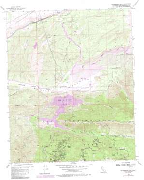
Silverwood Lake Topo Map California
To zoom in, hover over the map of Silverwood Lake
USGS Topo Quad 34117c3 - 1:24,000 scale
| Topo Map Name: | Silverwood Lake |
| USGS Topo Quad ID: | 34117c3 |
| Print Size: | ca. 21 1/4" wide x 27" high |
| Southeast Coordinates: | 34.25° N latitude / 117.25° W longitude |
| Map Center Coordinates: | 34.3125° N latitude / 117.3125° W longitude |
| U.S. State: | CA |
| Filename: | o34117c3.jpg |
| Download Map JPG Image: | Silverwood Lake topo map 1:24,000 scale |
| Map Type: | Topographic |
| Topo Series: | 7.5´ |
| Map Scale: | 1:24,000 |
| Source of Map Images: | United States Geological Survey (USGS) |
| Alternate Map Versions: |
Cedar Springs CA 1956, updated 1957 Download PDF Buy paper map Cedar Springs CA 1956, updated 1961 Download PDF Buy paper map Cedar Springs CA 1956, updated 1961 Download PDF Buy paper map Cedar Springs CA 1956, updated 1969 Download PDF Buy paper map Silverwood Lake CA 1956, updated 1975 Download PDF Buy paper map Silverwood Lake CA 1956, updated 1987 Download PDF Buy paper map Silverwood Lake CA 1956, updated 1988 Download PDF Buy paper map Silverwood Lake CA 1973, updated 1980 Download PDF Buy paper map Silverwood Lake CA 1996, updated 1999 Download PDF Buy paper map Silverwood Lake CA 2012 Download PDF Buy paper map Silverwood Lake CA 2015 Download PDF Buy paper map |
| FStopo: | US Forest Service topo Silverwood Lake is available: Download FStopo PDF Download FStopo TIF |
1:24,000 Topo Quads surrounding Silverwood Lake
> Back to 34117a1 at 1:100,000 scale
> Back to 34116a1 at 1:250,000 scale
> Back to U.S. Topo Maps home
Silverwood Lake topo map: Gazetteer
Silverwood Lake: Airports
Lugo Substation Heliport elevation 1141m 3743′Silverwood Lake: Basins
Pillars of God elevation 1428m 4685′Silverwood Lake: Capes
Breezy Point elevation 1501m 4924′Jamajab Point elevation 1038m 3405′
Silverwood Lake: Dams
Cedar Spring Dam elevation 969m 3179′Silverwood Lake: Flats
Seeley Flat elevation 1342m 4402′Silverwood Lake: Parks
Silverwood Lake State Recreation Area elevation 1029m 3375′Silverwood Lake: Populated Places
Cedar Springs (historical) elevation 1029m 3375′Cedarpines Park elevation 1443m 4734′
Lugo elevation 1043m 3421′
Silverwood Lake: Reservoirs
Silverwood Lake elevation 969m 3179′Silverwood Lake: Streams
Burnt Mill Creek elevation 1039m 3408′Dart Creek elevation 1289m 4229′
East Fork West Fork Trinity River elevation 1033m 3389′
Grass Valley Creek elevation 927m 3041′
Houston Creek elevation 1126m 3694′
Seeley Creek elevation 1062m 3484′
Silverwood Lake: Summits
Lynx Point elevation 1051m 3448′Pilot Rock elevation 1601m 5252′
Silverwood Lake: Trails
Miller Canyon Trail elevation 1225m 4019′Pilot Rock Truck Trail elevation 1524m 5000′
Silverwood Lake: Valleys
Burnt Mill Canyon elevation 1049m 3441′Horsethief Canyon elevation 952m 3123′
Little Horsethief Canyon elevation 998m 3274′
Miller Canyon elevation 1029m 3375′
Sawpit Canyon elevation 1032m 3385′
Summit Valley elevation 929m 3047′
Telephone Canyon elevation 1056m 3464′
Silverwood Lake digital topo map on disk
Buy this Silverwood Lake topo map showing relief, roads, GPS coordinates and other geographical features, as a high-resolution digital map file on DVD:


