Apple Valley South Topo Map California
To zoom in, hover over the map of Apple Valley South
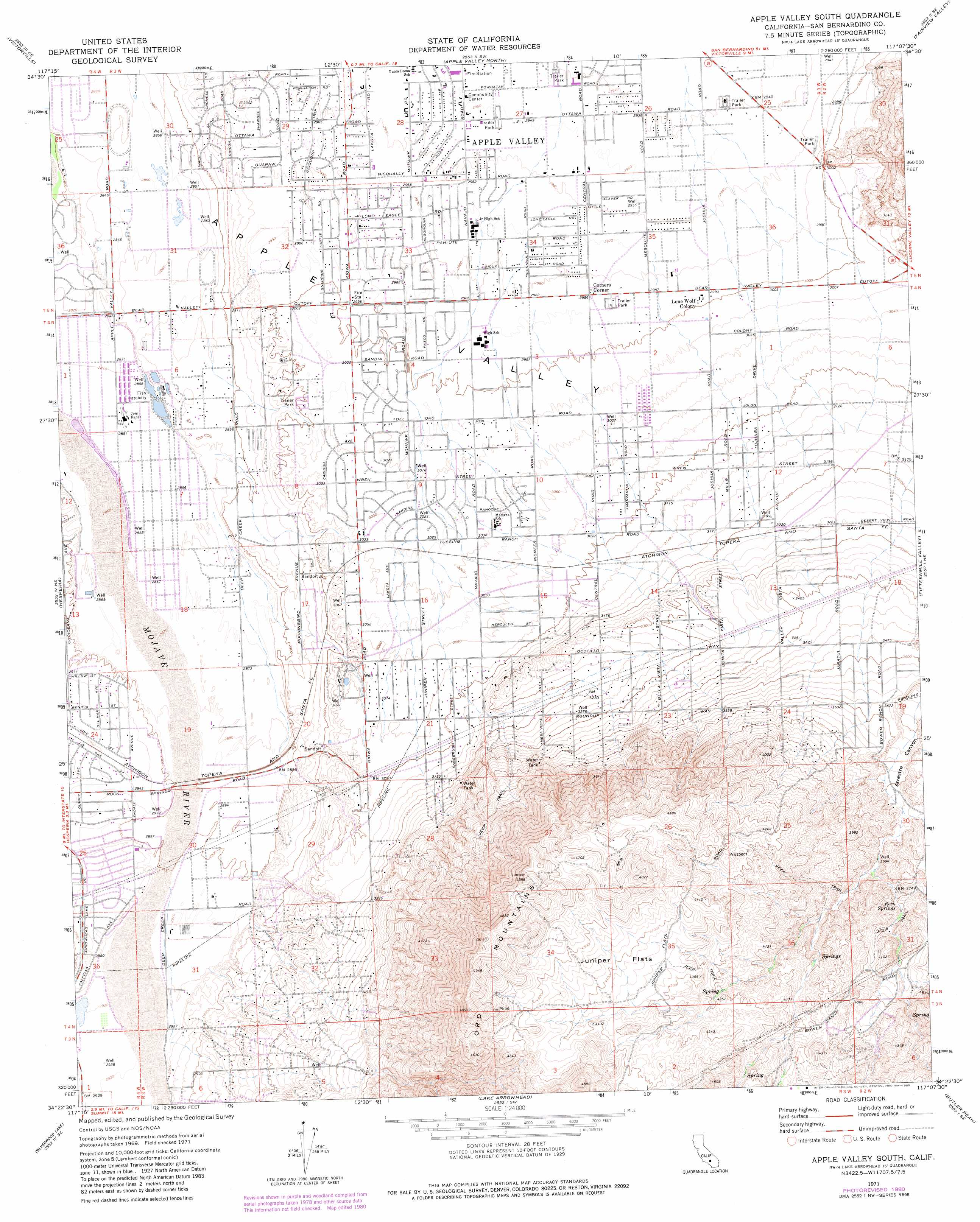
USGS Topo Quad 34117d2 - 1:24,000 scale
| Topo Map Name: | Apple Valley South |
| USGS Topo Quad ID: | 34117d2 |
| Print Size: | ca. 21 1/4" wide x 27" high |
| Southeast Coordinates: | 34.375° N latitude / 117.125° W longitude |
| Map Center Coordinates: | 34.4375° N latitude / 117.1875° W longitude |
| U.S. State: | CA |
| Filename: | o34117d2.jpg |
| Download Map JPG Image: | Apple Valley South topo map 1:24,000 scale |
| Map Type: | Topographic |
| Topo Series: | 7.5´ |
| Map Scale: | 1:24,000 |
| Source of Map Images: | United States Geological Survey (USGS) |
| Alternate Map Versions: |
Apple Valley South CA 1971, updated 1975 Download PDF Buy paper map Apple Valley South CA 1971, updated 1975 Download PDF Buy paper map Apple Valley South CA 1971, updated 1980 Download PDF Buy paper map Apple Valley South CA 1971, updated 1980 Download PDF Buy paper map Apple Valley South CA 1971, updated 1985 Download PDF Buy paper map Apple Valley South CA 1971, updated 1985 Download PDF Buy paper map Apple Valley South CA 1971, updated 1985 Download PDF Buy paper map Apple Valley South CA 2012 Download PDF Buy paper map Apple Valley South CA 2015 Download PDF Buy paper map |
1:24,000 Topo Quads surrounding Apple Valley South
Victorville Nw |
Helendale |
Turtle Valley |
Stoddard Well |
West Ord Mountain |
Adelanto |
Victorville |
Apple Valley North |
Fairview Valley |
White Horse Mountain |
Baldy Mesa |
Hesperia |
Apple Valley South |
Fifteenmile Valley |
Lucerne Valley |
Cajon |
Silverwood Lake |
Lake Arrowhead |
Butler Peak |
Fawnskin |
Devore |
San Bernardino North |
Harrison Mountain |
Keller Peak |
Big Bear Lake |
> Back to 34117a1 at 1:100,000 scale
> Back to 34116a1 at 1:250,000 scale
> Back to U.S. Topo Maps home
Apple Valley South topo map: Gazetteer
Apple Valley South: Flats
Juniper Flats elevation 1341m 4399′Apple Valley South: Parks
Bass Sports Center elevation 911m 2988′Hesperia Lake Park elevation 891m 2923′
Horsemans Center Park elevation 930m 3051′
Loma Park elevation 900m 2952′
Mendel park elevation 928m 3044′
Apple Valley South: Populated Places
Apple Valley Highlands elevation 965m 3166′Cotners Corner elevation 911m 2988′
Lone Wolf Colony elevation 915m 3001′
Mariana Ranchos elevation 940m 3083′
Ranchos del Oro elevation 941m 3087′
Sunset Hills elevation 909m 2982′
Apple Valley South: Reservoirs
Jess Lakes elevation 871m 2857′Apple Valley South: Springs
Rock Springs elevation 1153m 3782′Apple Valley South: Valleys
Antelope Valley elevation 884m 2900′Apple Valley South digital topo map on disk
Buy this Apple Valley South topo map showing relief, roads, GPS coordinates and other geographical features, as a high-resolution digital map file on DVD: