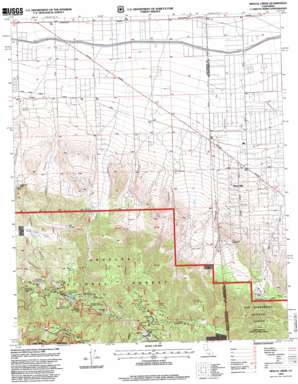
Mescal Creek Topo Map California
To zoom in, hover over the map of Mescal Creek
USGS Topo Quad 34117d6 - 1:24,000 scale
| Topo Map Name: | Mescal Creek |
| USGS Topo Quad ID: | 34117d6 |
| Print Size: | ca. 21 1/4" wide x 27" high |
| Southeast Coordinates: | 34.375° N latitude / 117.625° W longitude |
| Map Center Coordinates: | 34.4375° N latitude / 117.6875° W longitude |
| U.S. State: | CA |
| Filename: | o34117d6.jpg |
| Download Map JPG Image: | Mescal Creek topo map 1:24,000 scale |
| Map Type: | Topographic |
| Topo Series: | 7.5´ |
| Map Scale: | 1:24,000 |
| Source of Map Images: | United States Geological Survey (USGS) |
| Alternate Map Versions: |
Mescal Creek CA 1956, updated 1961 Download PDF Buy paper map Mescal Creek CA 1956, updated 1968 Download PDF Buy paper map Mescal Creek CA 1956, updated 1978 Download PDF Buy paper map Mescal Creek CA 1956, updated 1988 Download PDF Buy paper map Mescal Creek CA 1995, updated 1999 Download PDF Buy paper map Mescal Creek CA 2012 Download PDF Buy paper map Mescal Creek CA 2015 Download PDF Buy paper map |
1:24,000 Topo Quads surrounding Mescal Creek
> Back to 34117a1 at 1:100,000 scale
> Back to 34116a1 at 1:250,000 scale
> Back to U.S. Topo Maps home
Mescal Creek topo map: Gazetteer
Mescal Creek: Flats
Appletree Flat elevation 1914m 6279′Ball Flat elevation 1863m 6112′
Big John Flat elevation 1637m 5370′
Jackson Flat elevation 2304m 7559′
McClellean Flat elevation 2166m 7106′
Mescal Creek: Lakes
Jackson Lake elevation 1872m 6141′Mescal Creek: Populated Places
Big Pines elevation 2094m 6870′Piñon Hills elevation 1272m 4173′
Pinon Hills Estates elevation 1109m 3638′
Mescal Creek: Post Offices
Pinon Hills Post Office elevation 1247m 4091′Mescal Creek: Summits
Table Mountain elevation 2285m 7496′Mescal Creek: Valleys
Boneyard Canyon elevation 1259m 4130′Cedar Canyon elevation 1738m 5702′
Graham Canyon elevation 1157m 3795′
Grassy Hollow elevation 2231m 7319′
Jesus Canyon elevation 1195m 3920′
Puzzle Canyon elevation 1219m 3999′
Mescal Creek digital topo map on disk
Buy this Mescal Creek topo map showing relief, roads, GPS coordinates and other geographical features, as a high-resolution digital map file on DVD:


