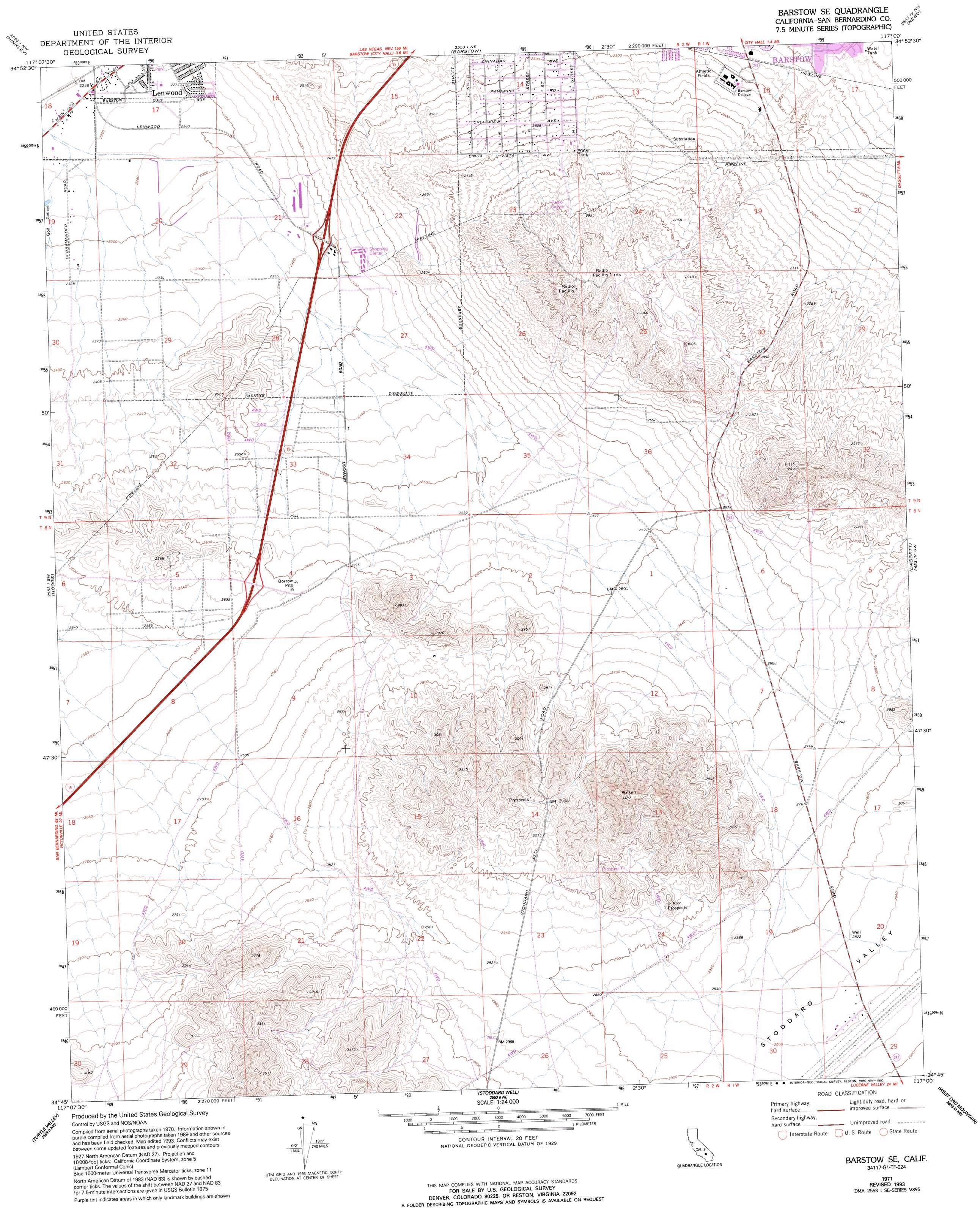
Barstow Se Topo Map California
To zoom in, hover over the map of Barstow Se
USGS Topo Quad 34117g1 - 1:24,000 scale
| Topo Map Name: | Barstow Se |
| USGS Topo Quad ID: | 34117g1 |
| Print Size: | ca. 21 1/4" wide x 27" high |
| Southeast Coordinates: | 34.75° N latitude / 117° W longitude |
| Map Center Coordinates: | 34.8125° N latitude / 117.0625° W longitude |
| U.S. State: | CA |
| Filename: | o34117g1.jpg |
| Download Map JPG Image: | Barstow Se topo map 1:24,000 scale |
| Map Type: | Topographic |
| Topo Series: | 7.5´ |
| Map Scale: | 1:24,000 |
| Source of Map Images: | United States Geological Survey (USGS) |
| Alternate Map Versions: |
Barstow SE CA 1971, updated 1973 Download PDF Buy paper map Barstow SE CA 1971, updated 1993 Download PDF Buy paper map Barstow SE CA 2012 Download PDF Buy paper map Barstow SE CA 2015 Download PDF Buy paper map |
1:24,000 Topo Quads surrounding Barstow Se
Lockhart |
Water Valley |
Mud Hills |
Lane Mountain |
Coyote Lake |
Twelve Gauge Lake |
Hinkley |
Barstow |
Nebo |
Yermo |
Wild Crossing |
Hodge |
Barstow Se |
Daggett |
Minneola |
Helendale |
Turtle Valley |
Stoddard Well |
West Ord Mountain |
Ord Mountain |
Victorville |
Apple Valley North |
Fairview Valley |
White Horse Mountain |
Grand View Mine |
> Back to 34117e1 at 1:100,000 scale
> Back to 34116a1 at 1:250,000 scale
> Back to U.S. Topo Maps home
Barstow Se topo map: Gazetteer
Barstow Se: Parks
Lenwood Park elevation 691m 2267′Barstow Se: Populated Places
Barstow Heights elevation 780m 2559′Barstow Se: Valleys
Stoddard Valley elevation 844m 2769′Barstow Se digital topo map on disk
Buy this Barstow Se topo map showing relief, roads, GPS coordinates and other geographical features, as a high-resolution digital map file on DVD: