Rogers Lake South Topo Map California
To zoom in, hover over the map of Rogers Lake South
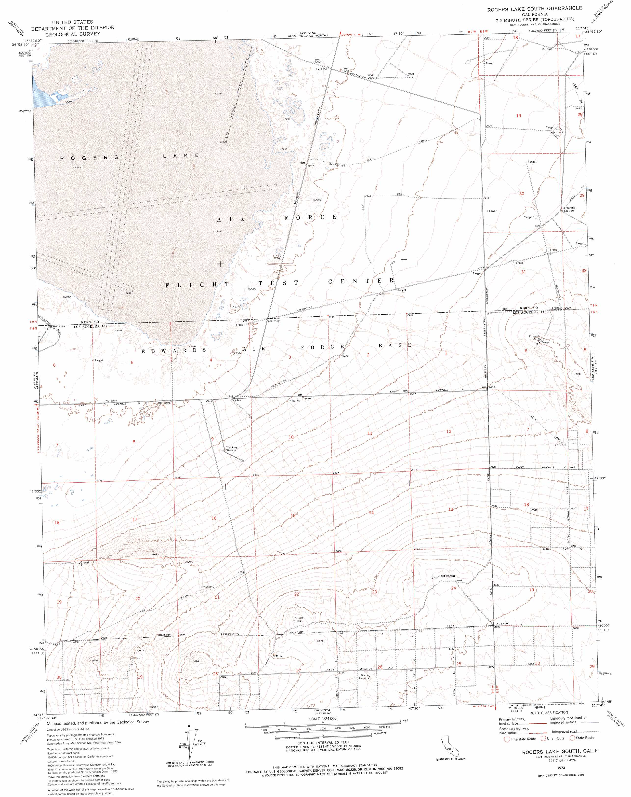
USGS Topo Quad 34117g7 - 1:24,000 scale
| Topo Map Name: | Rogers Lake South |
| USGS Topo Quad ID: | 34117g7 |
| Print Size: | ca. 21 1/4" wide x 27" high |
| Southeast Coordinates: | 34.75° N latitude / 117.75° W longitude |
| Map Center Coordinates: | 34.8125° N latitude / 117.8125° W longitude |
| U.S. State: | CA |
| Filename: | o34117g7.jpg |
| Download Map JPG Image: | Rogers Lake South topo map 1:24,000 scale |
| Map Type: | Topographic |
| Topo Series: | 7.5´ |
| Map Scale: | 1:24,000 |
| Source of Map Images: | United States Geological Survey (USGS) |
| Alternate Map Versions: |
Mt. Mesa CA 1947, updated 1947 Download PDF Buy paper map Mt. Mesa CA 1947, updated 1964 Download PDF Buy paper map Rogers Lake South CA 1973, updated 1976 Download PDF Buy paper map Rogers Lake South CA 1973, updated 1986 Download PDF Buy paper map Rogers Lake South CA 1992, updated 1992 Download PDF Buy paper map Rogers Lake South CA 1992, updated 1992 Download PDF Buy paper map Rogers Lake South CA 2012 Download PDF Buy paper map Rogers Lake South CA 2015 Download PDF Buy paper map |
1:24,000 Topo Quads surrounding Rogers Lake South
Sanborn |
California City South |
North Edwards |
Boron |
Saddleback Mountain |
Bissell |
Edwards |
Rogers Lake North |
Leuhman Ridge |
Kramer Junction |
Rosamond Lake |
Redman |
Rogers Lake South |
Jackrabbit Hill |
Red Buttes |
Lancaster East |
Alpine Butte |
Hi Vista |
Adobe Mountain |
Shadow Mountains |
Palmdale |
Littlerock |
Lovejoy Buttes |
El Mirage |
Shadow Mountains Se |
> Back to 34117e1 at 1:100,000 scale
> Back to 34116a1 at 1:250,000 scale
> Back to U.S. Topo Maps home
Rogers Lake South digital topo map on disk
Buy this Rogers Lake South topo map showing relief, roads, GPS coordinates and other geographical features, as a high-resolution digital map file on DVD: