Kramer Junction Topo Map California
To zoom in, hover over the map of Kramer Junction
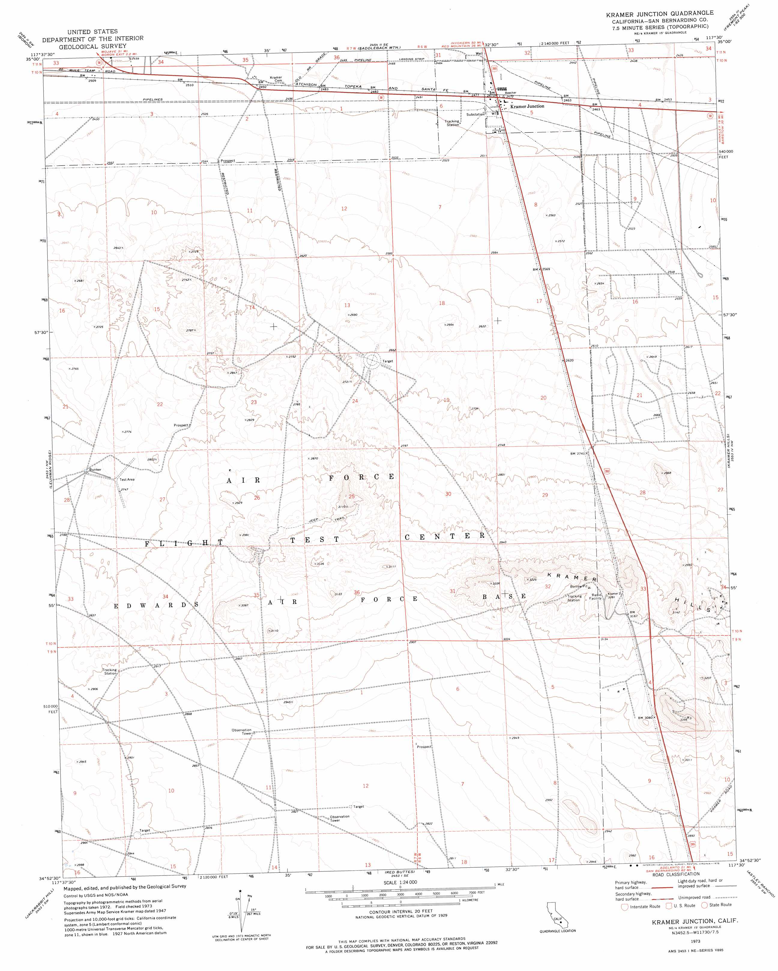
USGS Topo Quad 34117h5 - 1:24,000 scale
| Topo Map Name: | Kramer Junction |
| USGS Topo Quad ID: | 34117h5 |
| Print Size: | ca. 21 1/4" wide x 27" high |
| Southeast Coordinates: | 34.875° N latitude / 117.5° W longitude |
| Map Center Coordinates: | 34.9375° N latitude / 117.5625° W longitude |
| U.S. State: | CA |
| Filename: | o34117h5.jpg |
| Download Map JPG Image: | Kramer Junction topo map 1:24,000 scale |
| Map Type: | Topographic |
| Topo Series: | 7.5´ |
| Map Scale: | 1:24,000 |
| Source of Map Images: | United States Geological Survey (USGS) |
| Alternate Map Versions: |
Kramer CA 1947, updated 1947 Download PDF Buy paper map Kramer Junction CA 1973, updated 1976 Download PDF Buy paper map Kramer Junction CA 2012 Download PDF Buy paper map Kramer Junction CA 2015 Download PDF Buy paper map |
1:24,000 Topo Quads surrounding Kramer Junction
Galileo Hill |
Boron Nw |
Boron Ne |
Fremont Peak |
Bird Spring |
North Edwards |
Boron |
Saddleback Mountain |
The Buttes |
Lockhart |
Rogers Lake North |
Leuhman Ridge |
Kramer Junction |
Kramer Hills |
Twelve Gauge Lake |
Rogers Lake South |
Jackrabbit Hill |
Red Buttes |
Astley Rancho |
Wild Crossing |
Hi Vista |
Adobe Mountain |
Shadow Mountains |
Victorville Nw |
Helendale |
> Back to 34117e1 at 1:100,000 scale
> Back to 34116a1 at 1:250,000 scale
> Back to U.S. Topo Maps home
Kramer Junction topo map: Gazetteer
Kramer Junction: Populated Places
Kramer elevation 761m 2496′Kramer Junction elevation 755m 2477′
Kramer Junction: Ranges
Kramer Hills elevation 1020m 3346′Kramer Junction digital topo map on disk
Buy this Kramer Junction topo map showing relief, roads, GPS coordinates and other geographical features, as a high-resolution digital map file on DVD: