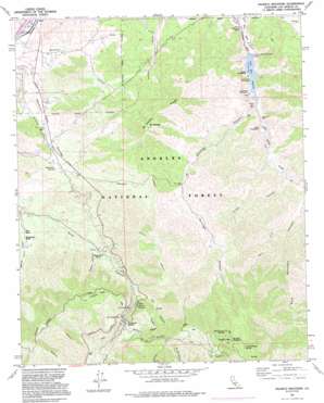
Pacifico Mountain Topo Map California
To zoom in, hover over the map of Pacifico Mountain
USGS Topo Quad 34118d1 - 1:24,000 scale
| Topo Map Name: | Pacifico Mountain |
| USGS Topo Quad ID: | 34118d1 |
| Print Size: | ca. 21 1/4" wide x 27" high |
| Southeast Coordinates: | 34.375° N latitude / 118° W longitude |
| Map Center Coordinates: | 34.4375° N latitude / 118.0625° W longitude |
| U.S. State: | CA |
| Filename: | o34118d1.jpg |
| Download Map JPG Image: | Pacifico Mountain topo map 1:24,000 scale |
| Map Type: | Topographic |
| Topo Series: | 7.5´ |
| Map Scale: | 1:24,000 |
| Source of Map Images: | United States Geological Survey (USGS) |
| Alternate Map Versions: |
Pacifico Mountain CA 1959, updated 1960 Download PDF Buy paper map Pacifico Mountain CA 1959, updated 1960 Download PDF Buy paper map Pacifico Mountain CA 1959, updated 1975 Download PDF Buy paper map Pacifico Mountain CA 1959, updated 1985 Download PDF Buy paper map Pacifico Mountain CA 1991, updated 1995 Download PDF Buy paper map Pacifico Mountain CA 1995, updated 1999 Download PDF Buy paper map Pacifico Mountain CA 2012 Download PDF Buy paper map Pacifico Mountain CA 2015 Download PDF Buy paper map |
1:24,000 Topo Quads surrounding Pacifico Mountain
> Back to 34118a1 at 1:100,000 scale
> Back to 34118a1 at 1:250,000 scale
> Back to U.S. Topo Maps home
Pacifico Mountain topo map: Gazetteer
Pacifico Mountain: Airports
Vincent Substation Heliport elevation 997m 3270′Pacifico Mountain: Dams
Little Rock-Palmdale Dam elevation 982m 3221′Pacifico Mountain: Gaps
Mill Creek Summit elevation 1493m 4898′Pacifico Mountain: Mines
Gold Queen Mine elevation 1420m 4658′Pacifico Mountain: Reservoirs
Little Rock Reservoir elevation 982m 3221′Pacifico Mountain: Ridges
Mount Emma Ridge elevation 1511m 4957′Roundtop Ridge elevation 1911m 6269′
Pacifico Mountain: Springs
Aliso Spring elevation 1450m 4757′Fountainhead Spring elevation 2011m 6597′
Kentucky Springs elevation 1112m 3648′
Sheep Camp Spring elevation 1943m 6374′
Pacifico Mountain: Streams
Little Rock Creek elevation 996m 3267′Pacifico Mountain: Summits
Mount Emma elevation 1606m 5269′Pacifico Mountain elevation 2165m 7103′
Pacifico Mountain: Valleys
Cabin Canyon elevation 1173m 3848′Kitter Canyon elevation 1059m 3474′
Santiago Canyon elevation 997m 3270′
Tie Canyon elevation 1344m 4409′
West Fork Bare Mountain Canyon elevation 1194m 3917′
Pacifico Mountain digital topo map on disk
Buy this Pacifico Mountain topo map showing relief, roads, GPS coordinates and other geographical features, as a high-resolution digital map file on DVD:


