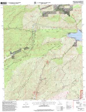
Green Valley Topo Map California
To zoom in, hover over the map of Green Valley
USGS Topo Quad 34118e4 - 1:24,000 scale
| Topo Map Name: | Green Valley |
| USGS Topo Quad ID: | 34118e4 |
| Print Size: | ca. 21 1/4" wide x 27" high |
| Southeast Coordinates: | 34.5° N latitude / 118.375° W longitude |
| Map Center Coordinates: | 34.5625° N latitude / 118.4375° W longitude |
| U.S. State: | CA |
| Filename: | o34118e4.jpg |
| Download Map JPG Image: | Green Valley topo map 1:24,000 scale |
| Map Type: | Topographic |
| Topo Series: | 7.5´ |
| Map Scale: | 1:24,000 |
| Source of Map Images: | United States Geological Survey (USGS) |
| Alternate Map Versions: |
Green Valley CA 1958, updated 1959 Download PDF Buy paper map Green Valley CA 1958, updated 1964 Download PDF Buy paper map Green Valley CA 1958, updated 1975 Download PDF Buy paper map Green Valley CA 1995, updated 1999 Download PDF Buy paper map Green Valley CA 2012 Download PDF Buy paper map Green Valley CA 2015 Download PDF Buy paper map |
| FStopo: | US Forest Service topo Green Valley is available: Download FStopo PDF Download FStopo TIF |
1:24,000 Topo Quads surrounding Green Valley
> Back to 34118e1 at 1:100,000 scale
> Back to 34118a1 at 1:250,000 scale
> Back to U.S. Topo Maps home
Green Valley topo map: Gazetteer
Green Valley: Airports
Camp 14 Heliport elevation 573m 1879′Green Valley: Dams
Bouquet Canyon 6-031 Dam elevation 915m 3001′Bouquet Canyon Dam elevation 915m 3001′
Green Valley: Mines
California Mine elevation 1072m 3517′Silver King Mine elevation 746m 2447′
Green Valley: Populated Places
Green Valley elevation 895m 2936′Las Cantilles elevation 534m 1751′
Green Valley: Reservoirs
Bouquet Reservoir elevation 915m 3001′Green Valley: Ridges
Del Sur Ridge elevation 1087m 3566′Jupiter Mountain elevation 1348m 4422′
Tule Ridge elevation 1335m 4379′
Green Valley: Springs
Aqueduct Spring elevation 742m 2434′Plum Spring elevation 763m 2503′
Whisky Spring elevation 727m 2385′
Green Valley: Summits
Table Rock elevation 745m 2444′Green Valley: Trails
Saugus Del Sur Truck Trail elevation 998m 3274′Green Valley: Tunnels
Aqueduct Tunnel elevation 900m 2952′Green Valley: Valleys
Baird Canyon elevation 565m 1853′Bee Canyon elevation 577m 1893′
Cherry Canyon elevation 654m 2145′
Clearwater Canyon elevation 642m 2106′
Dowd Canyon elevation 875m 2870′
Fall Canyon elevation 694m 2276′
Mystic Canyon elevation 609m 1998′
Rowher Canyon elevation 641m 2103′
South Portal Canyon elevation 779m 2555′
Spunky Canyon elevation 919m 3015′
Green Valley digital topo map on disk
Buy this Green Valley topo map showing relief, roads, GPS coordinates and other geographical features, as a high-resolution digital map file on DVD:


