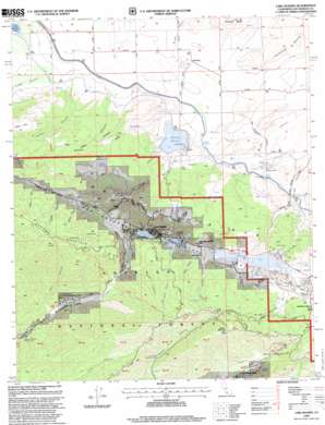
Lake Hughes Topo Map California
To zoom in, hover over the map of Lake Hughes
USGS Topo Quad 34118f4 - 1:24,000 scale
| Topo Map Name: | Lake Hughes |
| USGS Topo Quad ID: | 34118f4 |
| Print Size: | ca. 21 1/4" wide x 27" high |
| Southeast Coordinates: | 34.625° N latitude / 118.375° W longitude |
| Map Center Coordinates: | 34.6875° N latitude / 118.4375° W longitude |
| U.S. State: | CA |
| Filename: | o34118f4.jpg |
| Download Map JPG Image: | Lake Hughes topo map 1:24,000 scale |
| Map Type: | Topographic |
| Topo Series: | 7.5´ |
| Map Scale: | 1:24,000 |
| Source of Map Images: | United States Geological Survey (USGS) |
| Alternate Map Versions: |
Lake Hughes CA 1957, updated 1959 Download PDF Buy paper map Lake Hughes CA 1957, updated 1964 Download PDF Buy paper map Lake Hughes CA 1957, updated 1975 Download PDF Buy paper map Lake Hughes CA 1995, updated 1999 Download PDF Buy paper map Lake Hughes CA 2012 Download PDF Buy paper map Lake Hughes CA 2015 Download PDF Buy paper map |
| FStopo: | US Forest Service topo Lake Hughes is available: Download FStopo PDF Download FStopo TIF |
1:24,000 Topo Quads surrounding Lake Hughes
> Back to 34118e1 at 1:100,000 scale
> Back to 34118a1 at 1:250,000 scale
> Back to U.S. Topo Maps home
Lake Hughes topo map: Gazetteer
Lake Hughes: Canals
Myrick Siphon elevation 878m 2880′Willow Siphon elevation 899m 2949′
Lake Hughes: Dams
Fairmont 6-008 Dam elevation 1124m 3687′Lake Hughes: Flats
Edgewater Park elevation 1022m 3353′Juday Flat elevation 1080m 3543′
Keeler Flats elevation 1282m 4206′
Lake Hughes: Lakes
Elizabeth Lake elevation 997m 3270′Hughes Lake elevation 973m 3192′
Munz Lakes elevation 984m 3228′
Lake Hughes: Populated Places
Andrade Corner elevation 1040m 3412′Fairmont elevation 856m 2808′
Lake Hughes elevation 984m 3228′
Lake Hughes: Reservoirs
Fairmont Reservoir elevation 930m 3051′Kings Canyon Percolation Basin elevation 925m 3034′
Lake Hughes: Springs
Clear Spring elevation 1109m 3638′Craig Spring elevation 1005m 3297′
Indian Spring elevation 883m 2896′
Mud Spring elevation 875m 2870′
Troedel Spring elevation 1181m 3874′
Lake Hughes: Summits
Fairmont Butte elevation 954m 3129′Grass Mountain elevation 1408m 4619′
Lake Hughes: Trails
Burns Truck Trail elevation 1116m 3661′Juday Truck Trail elevation 1247m 4091′
Lake Hughes Truck Trail elevation 1187m 3894′
Myrick Cutoff elevation 1164m 3818′
Sawmill Liebre Firebreak Trail elevation 1380m 4527′
Lake Hughes: Tunnels
Elizabeth Tunnel elevation 1097m 3599′South Portal Elizabeth Tunnel elevation 906m 2972′
Lake Hughes: Valleys
Abrams Canyon elevation 1000m 3280′Bleich Canyon elevation 916m 3005′
Burns Canyon elevation 1047m 3435′
Deer Canyon elevation 867m 2844′
Forsythe Canyon elevation 1082m 3549′
Hiatt Canyon elevation 935m 3067′
Kings Canyon elevation 926m 3038′
Lucky Canyon elevation 1009m 3310′
Munz Canyon elevation 1015m 3330′
Orr Spring Canyon elevation 1051m 3448′
Pine Canyon elevation 989m 3244′
Price Canyon elevation 924m 3031′
Spruce Draw elevation 1089m 3572′
Steiner Canyon elevation 1095m 3592′
Lake Hughes digital topo map on disk
Buy this Lake Hughes topo map showing relief, roads, GPS coordinates and other geographical features, as a high-resolution digital map file on DVD:


