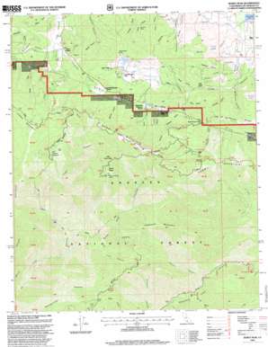
Burnt Peak Topo Map California
To zoom in, hover over the map of Burnt Peak
USGS Topo Quad 34118f5 - 1:24,000 scale
| Topo Map Name: | Burnt Peak |
| USGS Topo Quad ID: | 34118f5 |
| Print Size: | ca. 21 1/4" wide x 27" high |
| Southeast Coordinates: | 34.625° N latitude / 118.5° W longitude |
| Map Center Coordinates: | 34.6875° N latitude / 118.5625° W longitude |
| U.S. State: | CA |
| Filename: | o34118f5.jpg |
| Download Map JPG Image: | Burnt Peak topo map 1:24,000 scale |
| Map Type: | Topographic |
| Topo Series: | 7.5´ |
| Map Scale: | 1:24,000 |
| Source of Map Images: | United States Geological Survey (USGS) |
| Alternate Map Versions: |
Burnt Peak CA 1958, updated 1959 Download PDF Buy paper map Burnt Peak CA 1958, updated 1965 Download PDF Buy paper map Burnt Peak CA 1958, updated 1965 Download PDF Buy paper map Burnt Peak CA 1958, updated 1975 Download PDF Buy paper map Burnt Peak CA 1958, updated 1988 Download PDF Buy paper map Burnt Peak CA 1978 Download PDF Buy paper map Burnt Peak CA 1995, updated 1999 Download PDF Buy paper map Burnt Peak CA 2012 Download PDF Buy paper map Burnt Peak CA 2015 Download PDF Buy paper map |
| FStopo: | US Forest Service topo Burnt Peak is available: Download FStopo PDF Download FStopo TIF |
1:24,000 Topo Quads surrounding Burnt Peak
> Back to 34118e1 at 1:100,000 scale
> Back to 34118a1 at 1:250,000 scale
> Back to U.S. Topo Maps home
Burnt Peak topo map: Gazetteer
Burnt Peak: Basins
The Potholes elevation 1122m 3681′Burnt Peak: Flats
Atmore Meadows elevation 1311m 4301′Bleich Flat elevation 1024m 3359′
Oak Flat elevation 1365m 4478′
Burnt Peak: Gaps
Bushnell Summit elevation 1250m 4101′Burnt Peak: Lakes
Hidden Lake elevation 1199m 3933′Tweedy Lake elevation 1205m 3953′
Burnt Peak: Mines
Big Chief Mine elevation 1099m 3605′Maxwell Mine elevation 1292m 4238′
Burnt Peak: Populated Places
Three Points elevation 1045m 3428′Burnt Peak: Streams
Fish Creek elevation 765m 2509′Burnt Peak: Summits
Burnt Peak elevation 1761m 5777′Little Burnt Peak elevation 1660m 5446′
Sawmill Mountain elevation 1672m 5485′
Sawtooth Mountain elevation 1577m 5173′
Schumacher Point elevation 1199m 3933′
Burnt Peak: Trails
Burnt Peak Trail elevation 1218m 3996′Fish Canyon Trail elevation 925m 3034′
Gillette Mine Trail elevation 1343m 4406′
Burnt Peak: Valleys
Antimony Canyon elevation 1053m 3454′Burnt Peak Canyon elevation 849m 2785′
Deadhorse Canyon elevation 1070m 3510′
Devils Gulch elevation 1235m 4051′
Garden Gulch elevation 1182m 3877′
Heryford Canyon elevation 1201m 3940′
Hideaway Canyon elevation 1155m 3789′
Kimbrough Canyon elevation 1082m 3549′
Lion Canyon elevation 907m 2975′
McCorkle Canyon elevation 1036m 3398′
North Fork Fish Canyon elevation 1277m 4189′
North Long Canyon elevation 955m 3133′
Oakdale Canyon elevation 1042m 3418′
Oakgrove Canyon elevation 1037m 3402′
Pratt Canyon elevation 1043m 3421′
Red Fox Canyon elevation 704m 2309′
Redrock Canyon elevation 1037m 3402′
Sand Canyon elevation 1143m 3750′
Sawmill Canyon elevation 1221m 4005′
Shake Canyon elevation 1212m 3976′
South Long Canyon elevation 979m 3211′
Spring Canyon elevation 1103m 3618′
Turkey Canyon elevation 726m 2381′
Burnt Peak digital topo map on disk
Buy this Burnt Peak topo map showing relief, roads, GPS coordinates and other geographical features, as a high-resolution digital map file on DVD:


